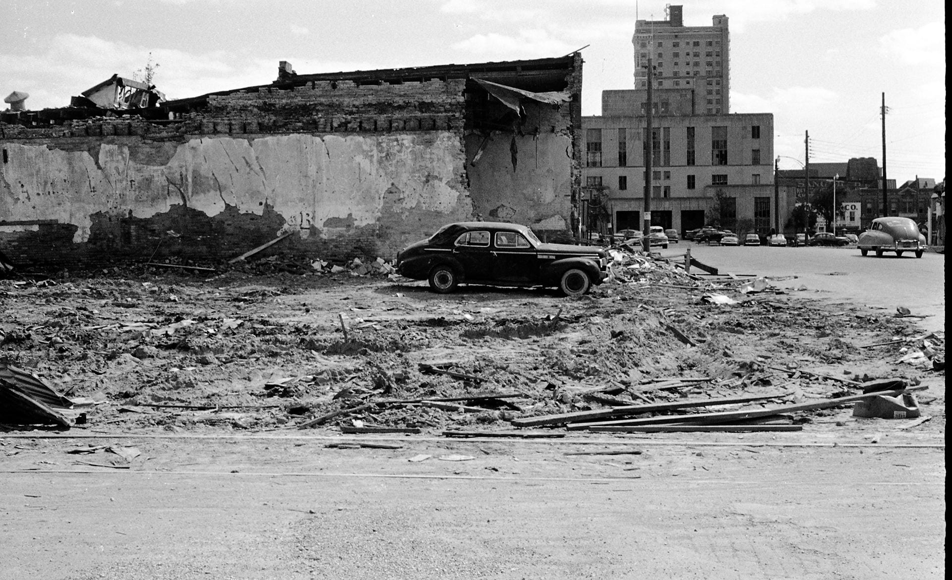
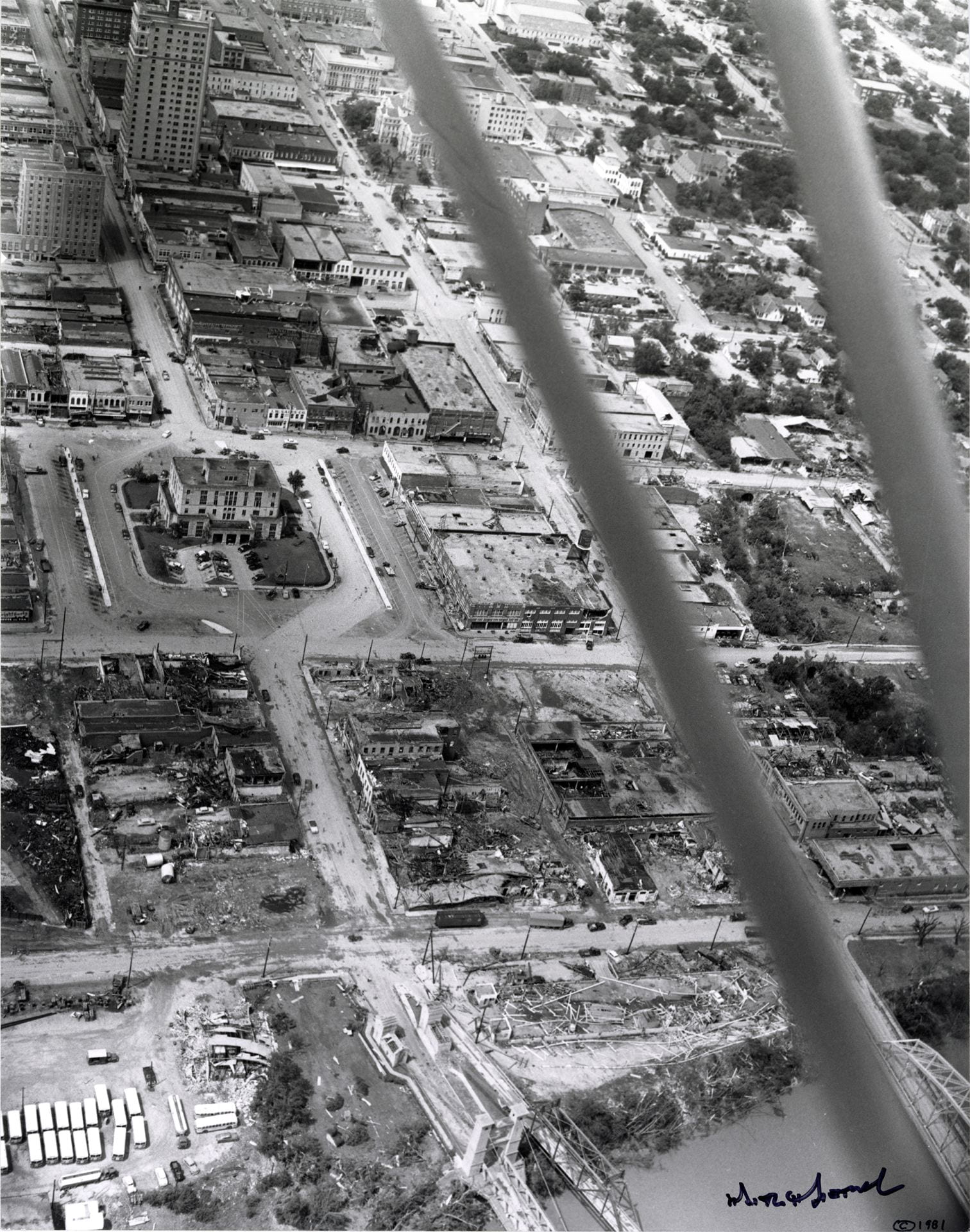
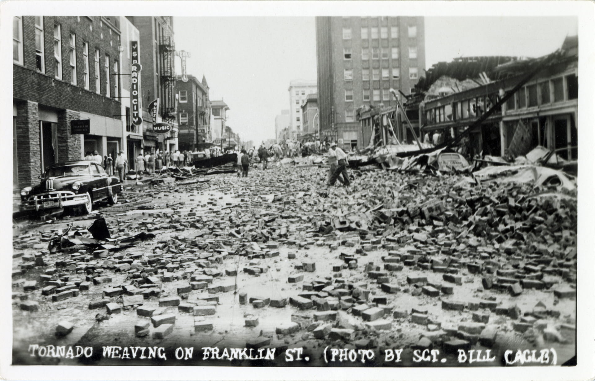
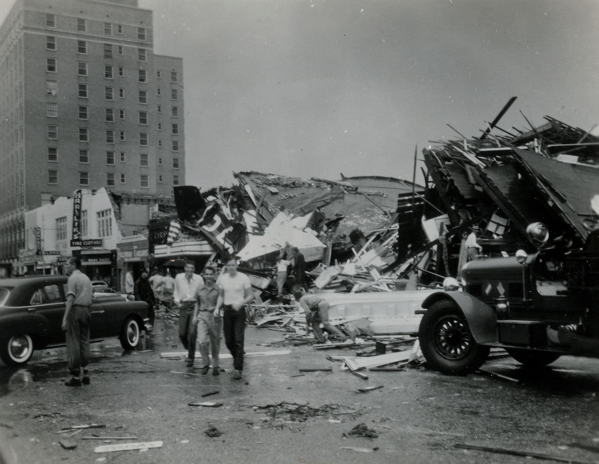
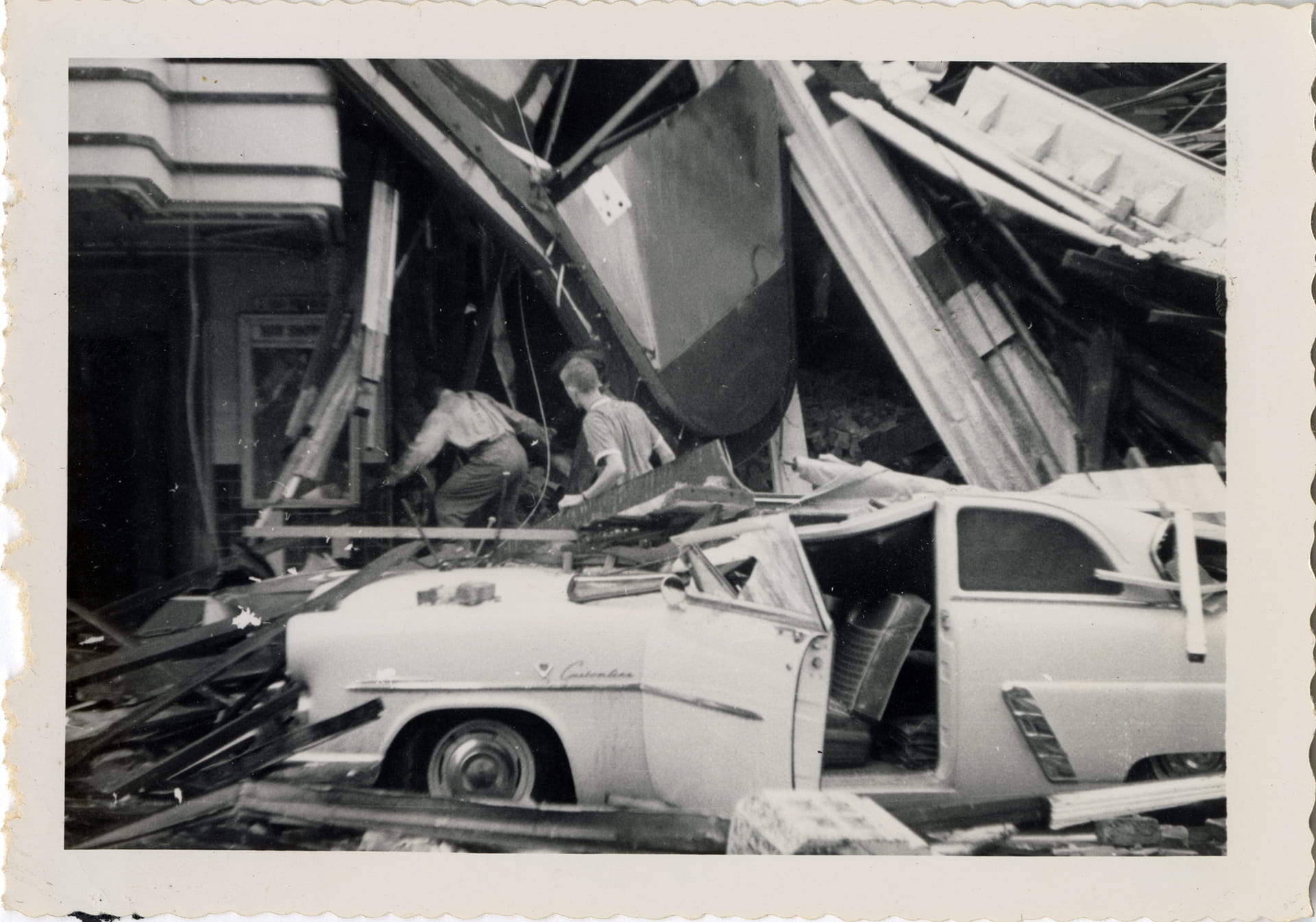
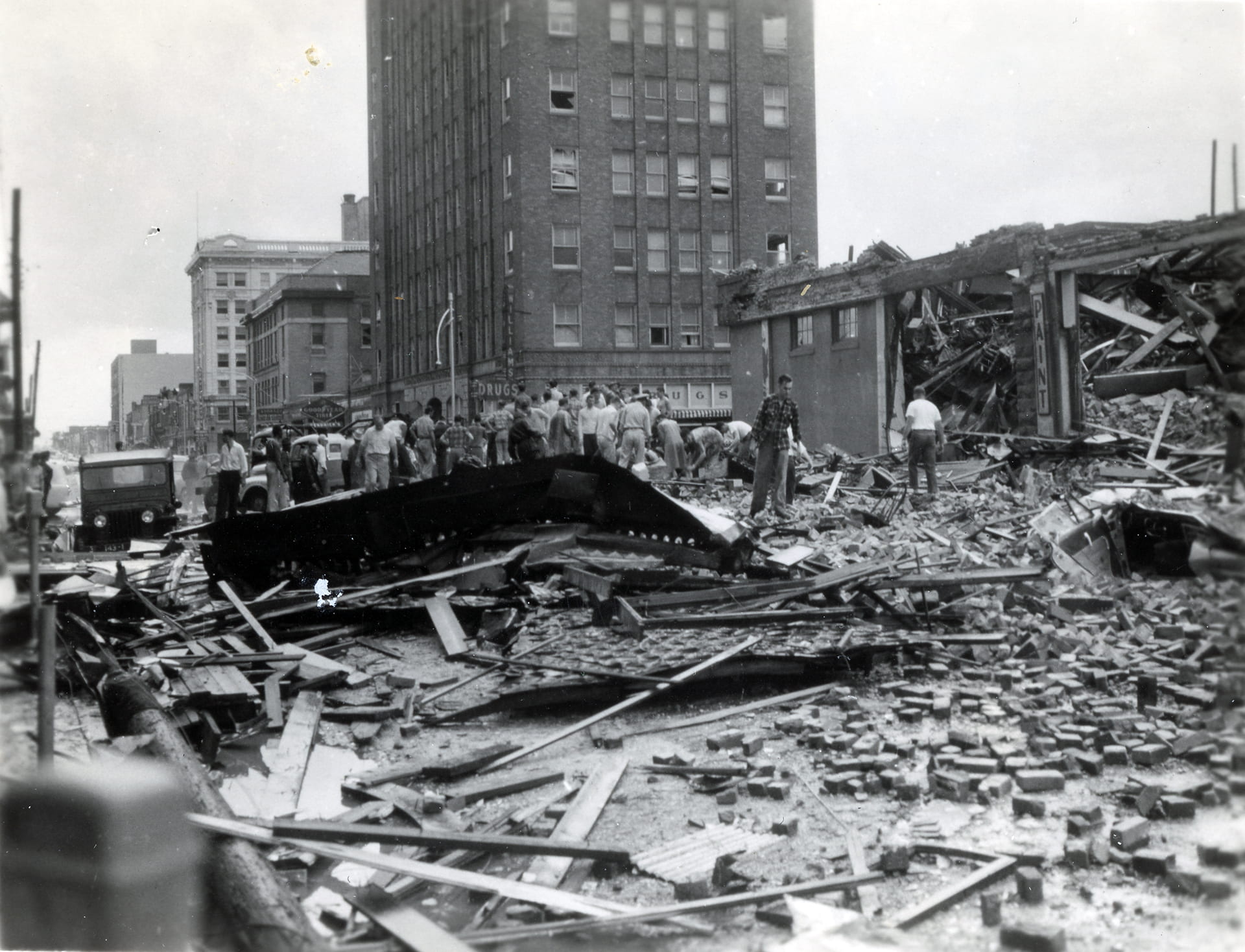
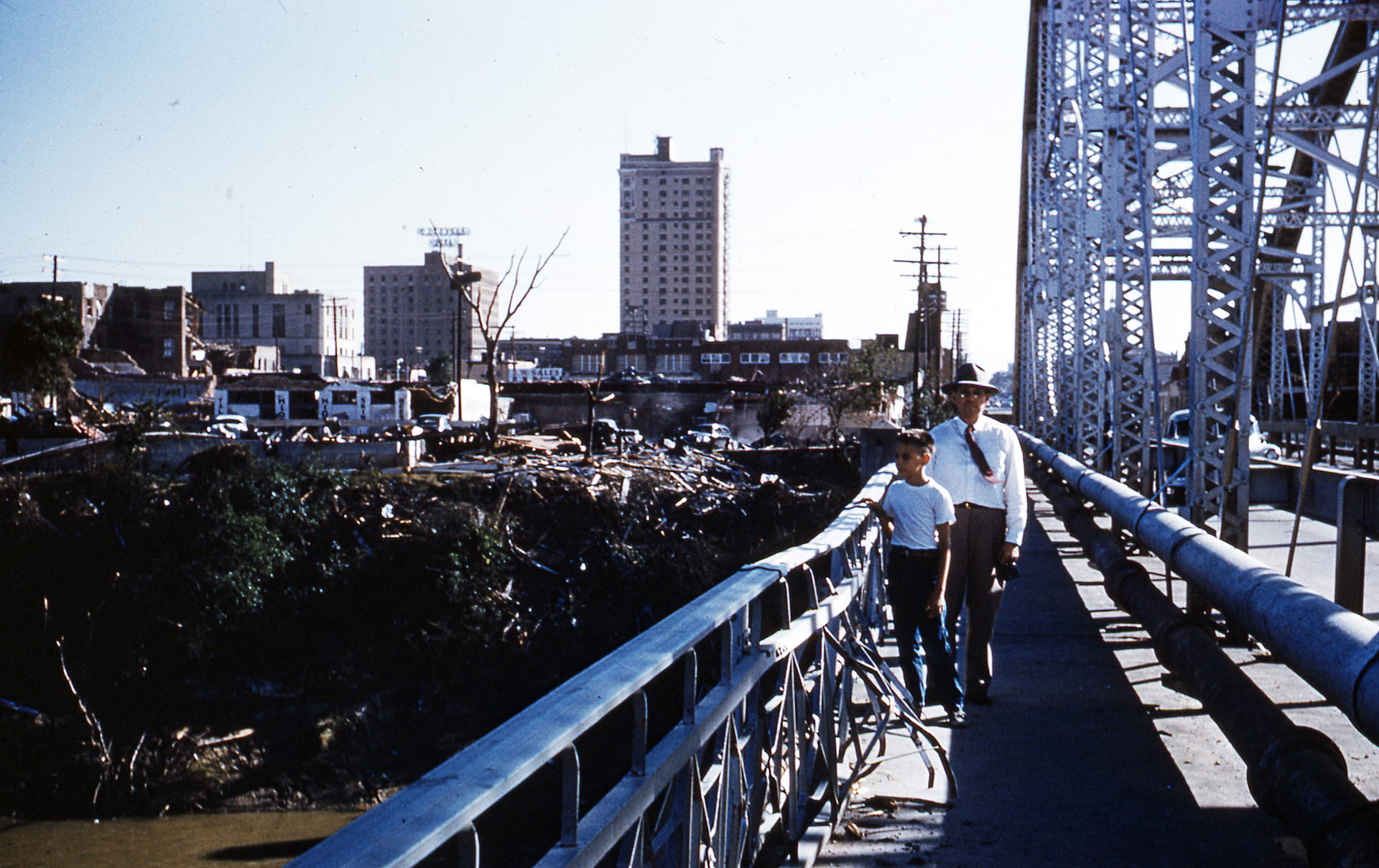
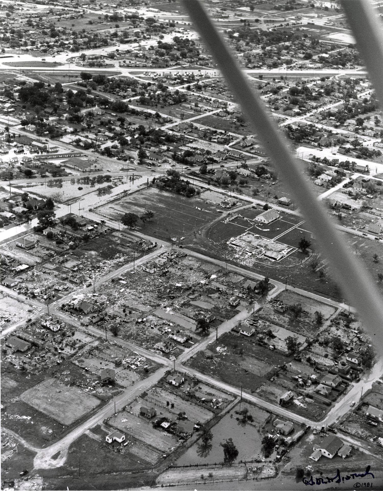
On May 11, 1953, the United States’ first recorded F5 tornado tore a path of destruction through downtown Waco. Wrapped in rain and debris, the tornado descended on shoppers and business people, schoolchildren and visitors alike: a “monster from the skies” that left 114 people dead and property damage totaling more than half a billion in 2023 dollars.
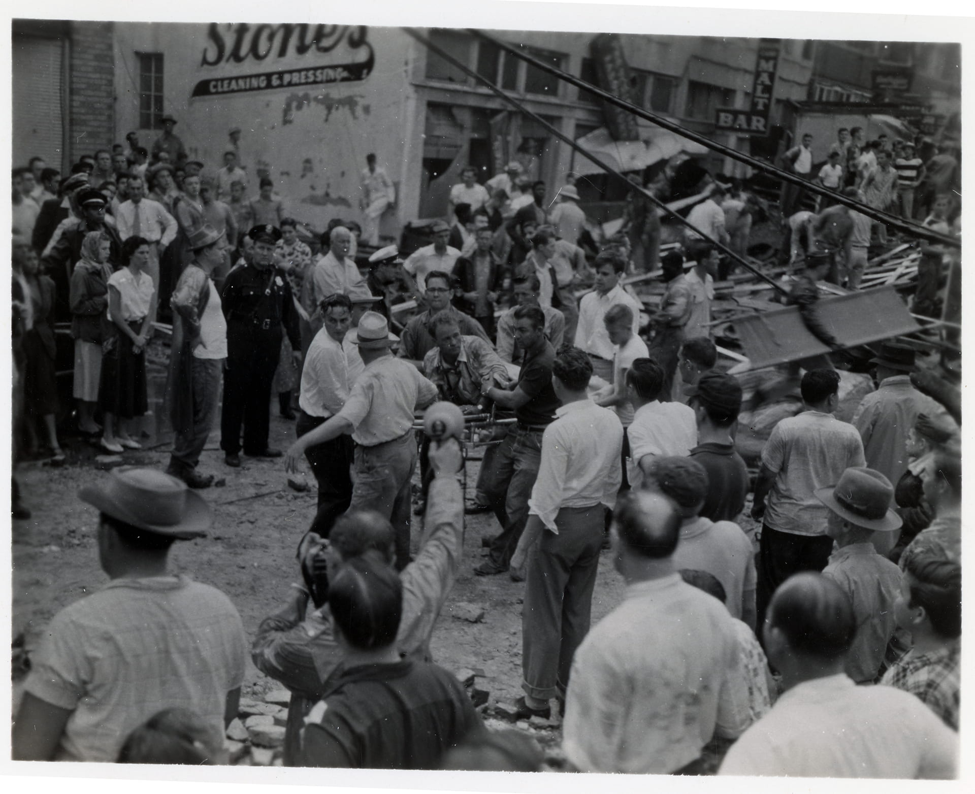
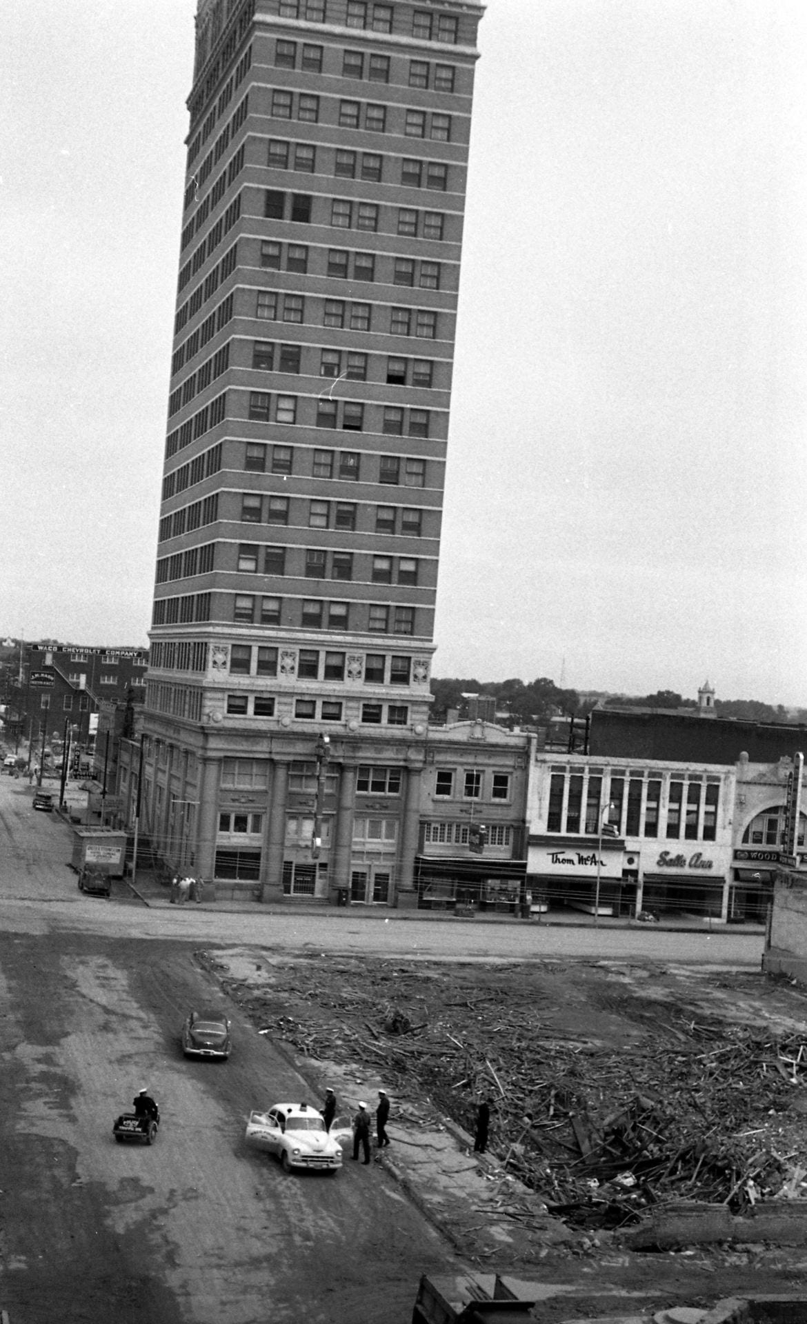
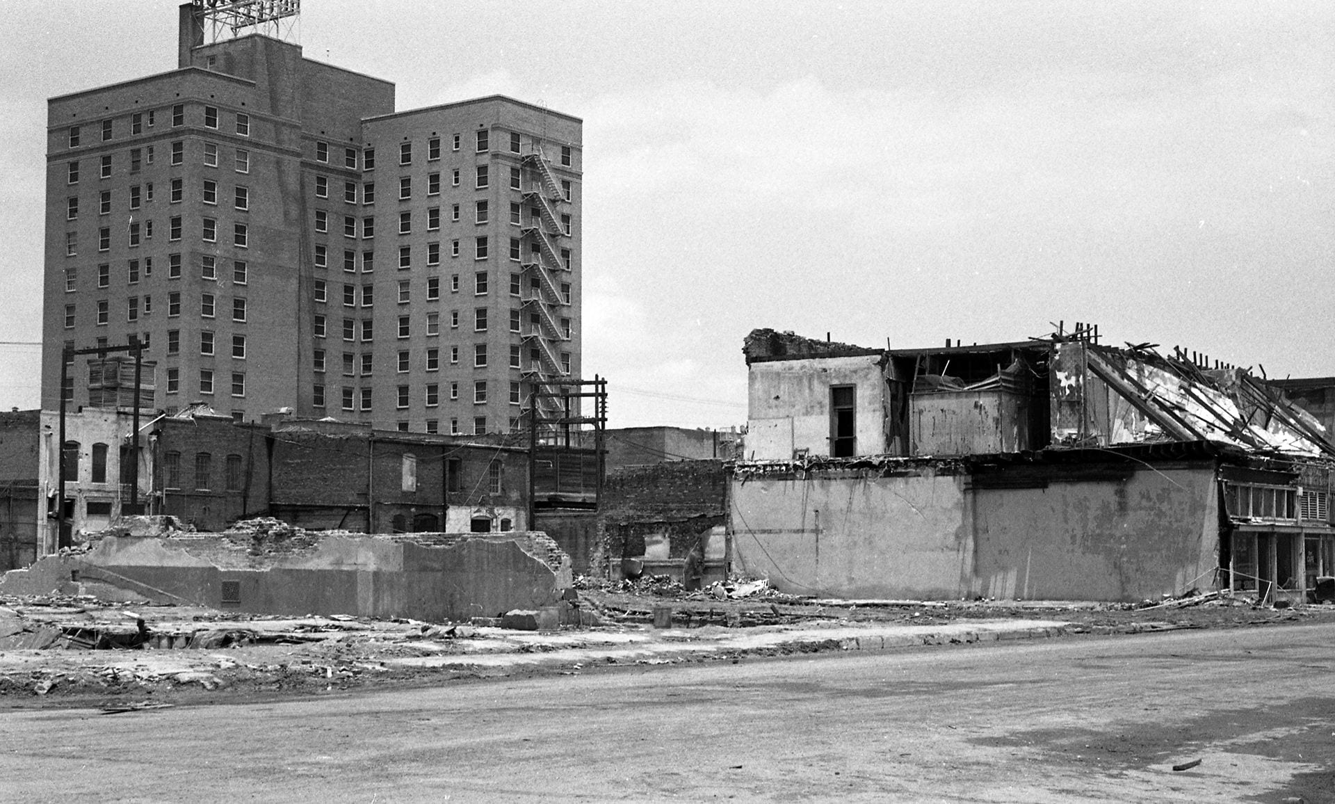
In commemoration of the 70th anniversary of this major event in Texas history, we present this digital exhibit of photos related to the storm: images of the way things were before May 11, 1953, of the damage left behind, and the legacy of what is visible today. While some buildings weathered the storm, like the mighty ALICO at 4th and Austin, others were obliterated completely, like the R.T. Dennis Furniture Company right across the street.
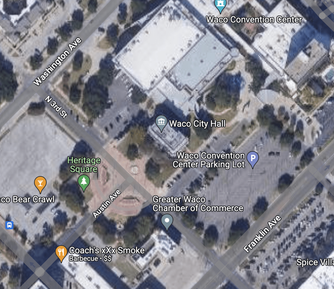
Also included in this exhibit is an interactive Google Map plotting the locations of these featured sites on a current map of Waco. While it does not encapsulate the entirety of the damage created by the storm, it gives modern Wacoans a sense of just how widespread, random, and far-reaching its impact proved to be.
Waco Tornado Remembrance Walk
Click here to access photos related to the 20203 walk.
Google Map of Locations Featured in this Exhibit
Click on the image below to access an interactive map of locations featured in this exhibit.

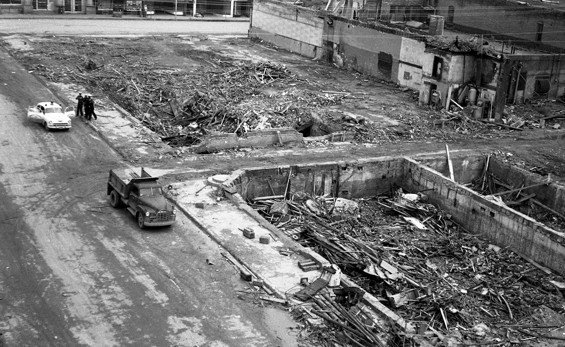
Photos of Affected Locations
The photos below refer to locations on the map created for this exhibit. To expand them to a larger size, simply click each image; it will open in a new window.
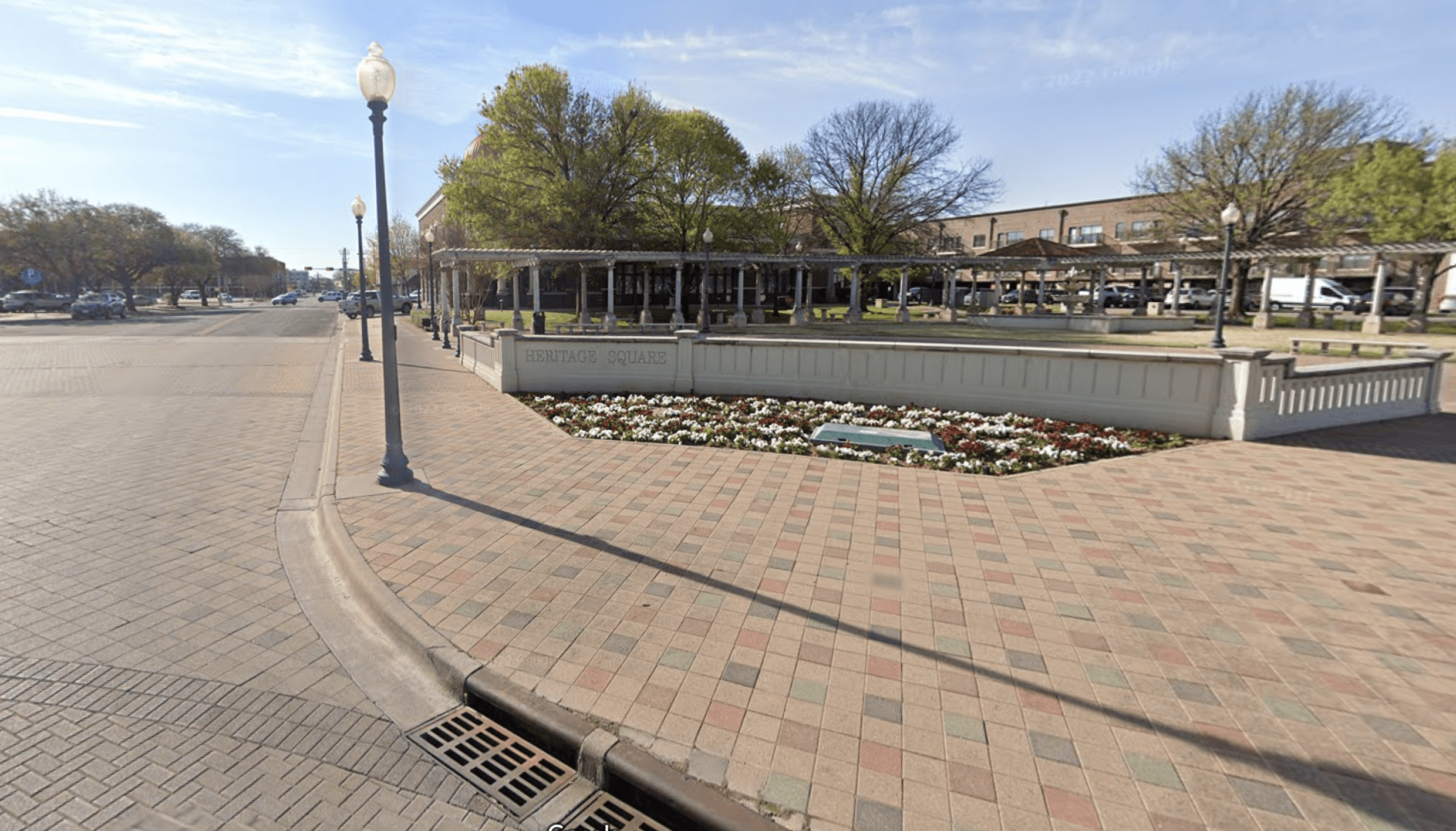
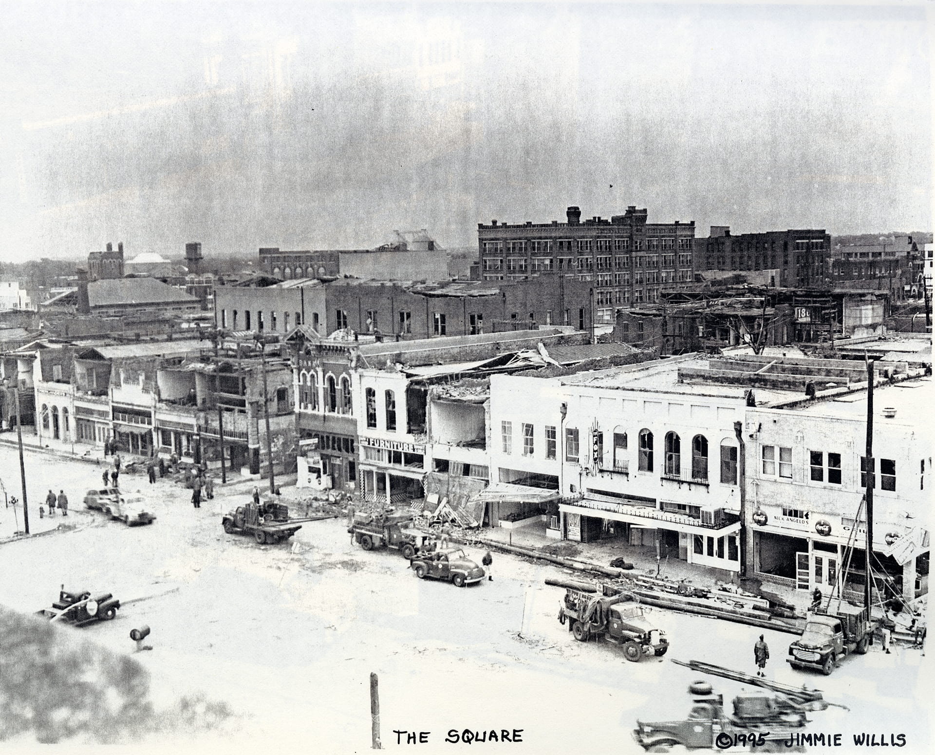
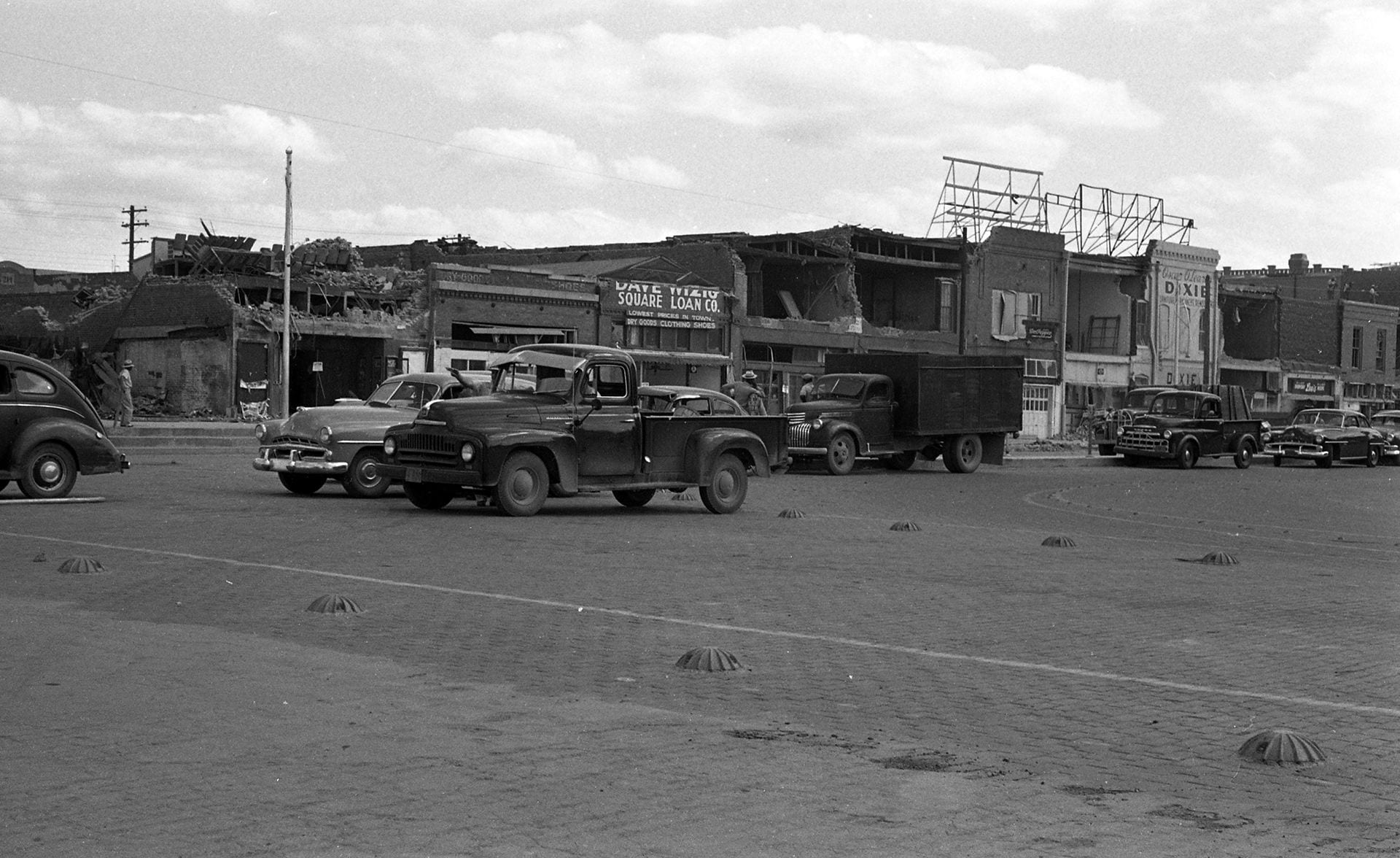
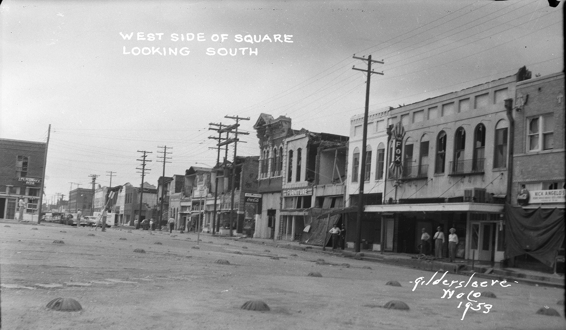
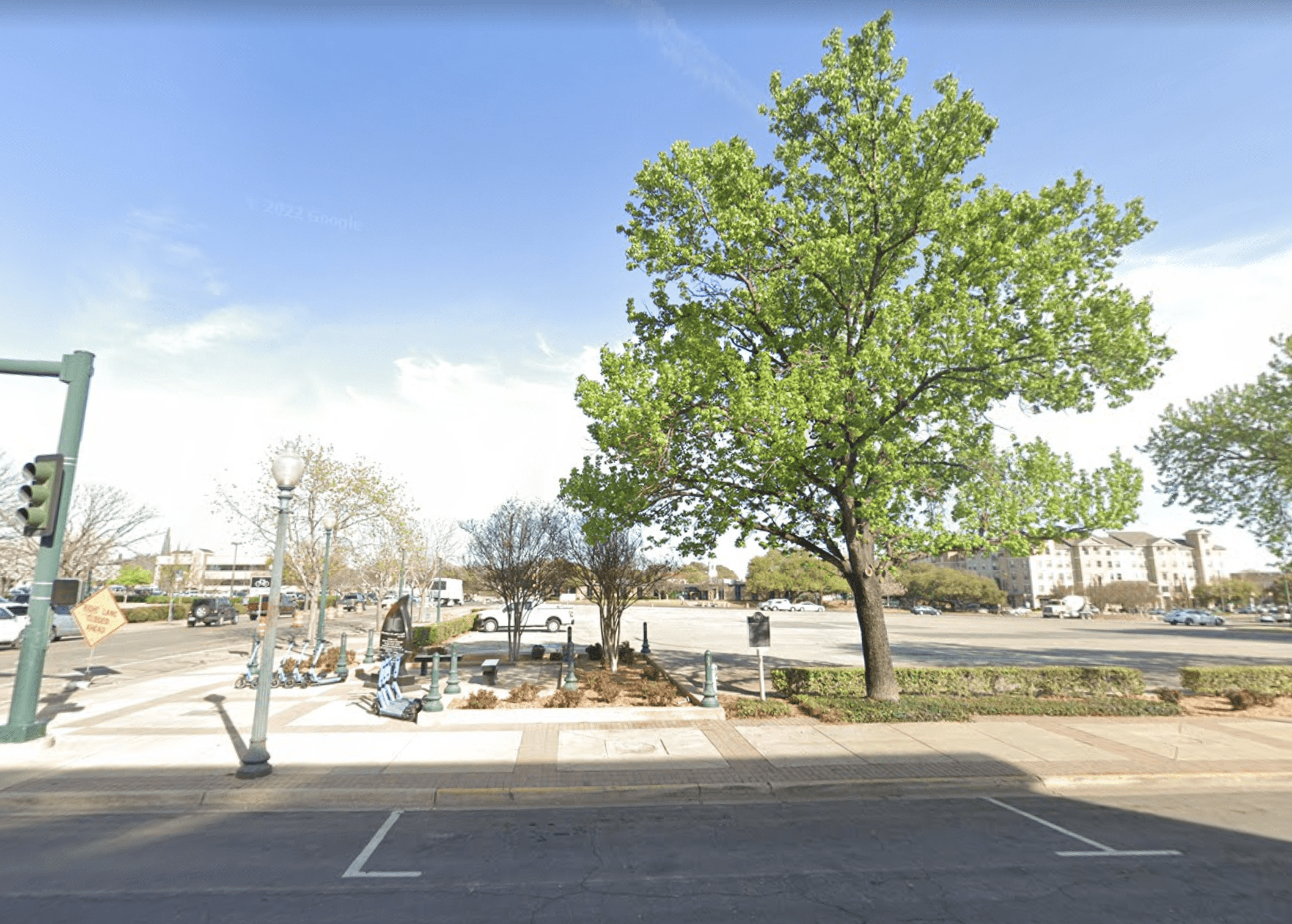
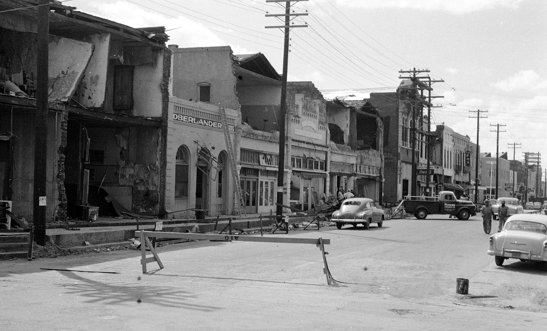
The Square, circling City Hall between 2nd and 3rd Streets and Franklin and Washington Avenues.

The Waco Square surrounded Waco’s City Hall in a configuration bounded by 2nd and 3rd Streets and Washington and Franklin Avenues. Points of entry included Bridge Street – which ran into the Square between the east side of the square and the Suspension Bridge – and Austin Avenue, which made its start at the Square and became a main thoroughfare through downtown Waco.
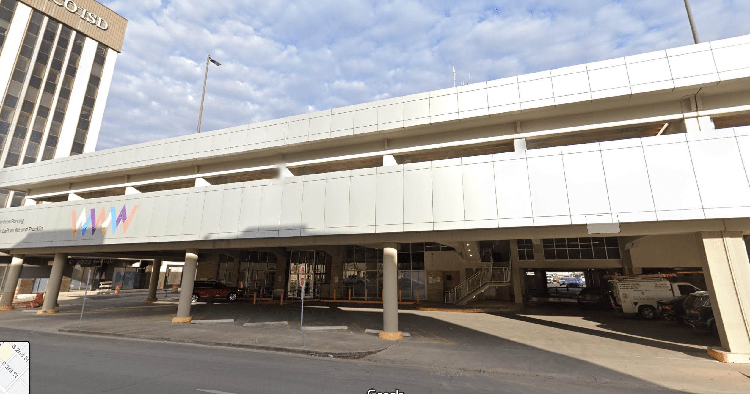
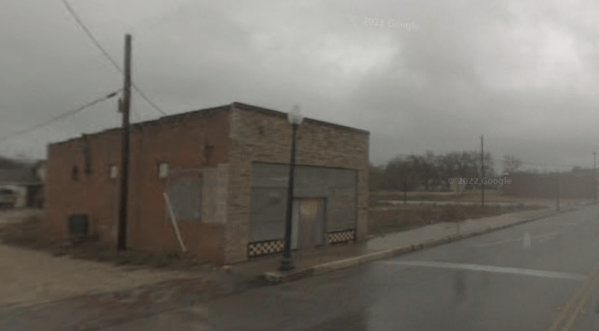
Note: For places in this exhibit that were located on the Square, there may not be a photo of the modern view included simply because it falls within an area that is a parking lot today. Others, which were located on the corner or near something more visually interesting, will include a modern day photo.
Featured Locations Around the Waco Square ca. 1953
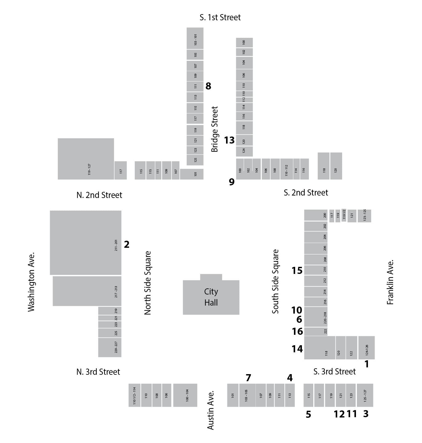
- B&B Club (124 S. 3rd)
- Clifton-Simpson Hardware Co. (211 North Side Square)
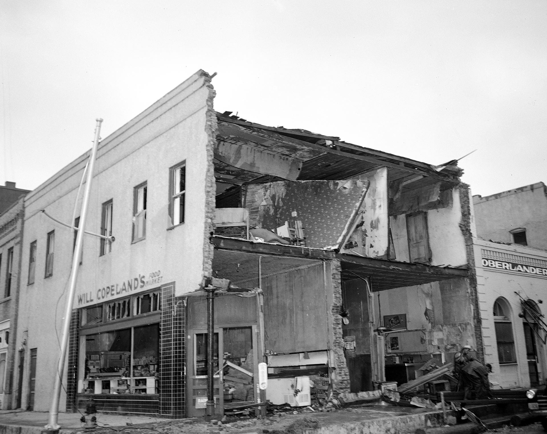
- Will Copeland’s Food Market (127 S. 3rd)
- Cut Rate Drugs (113 S. 3rd)
- Harry Daum Dry Goods (115 S. 3rd)
- Dixie Appliance Co. (220 South Side Square)
- Fox Theater (105 S. 3rd)
- Goodway Tailors / Goodway Cleaners (111 Bridge St.)
- Iglehart’s Furniture & Appliances (100 S. 2nd)
- Lyon Bros. Grocery & Market (218 South Side Square)
- Oberlander’s (123 S. 3rd)
- Square Barber Shop (John Pinto) (121 S. 3rd)
- Universal Life Insurance Co. (120 1/2 Bridge St.)
- Waco Variety Store (224 South Side Square)
- Dave Wizig (210 South Side Square)
- Irving Wizig (214 South Side Square)
Ace Furniture Co., 207 N. 3rd Street


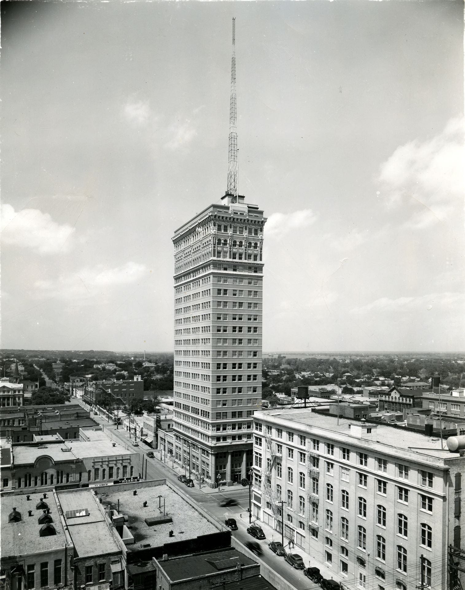
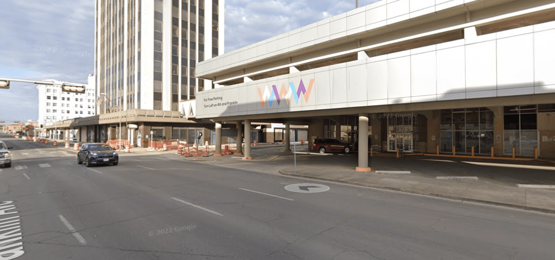
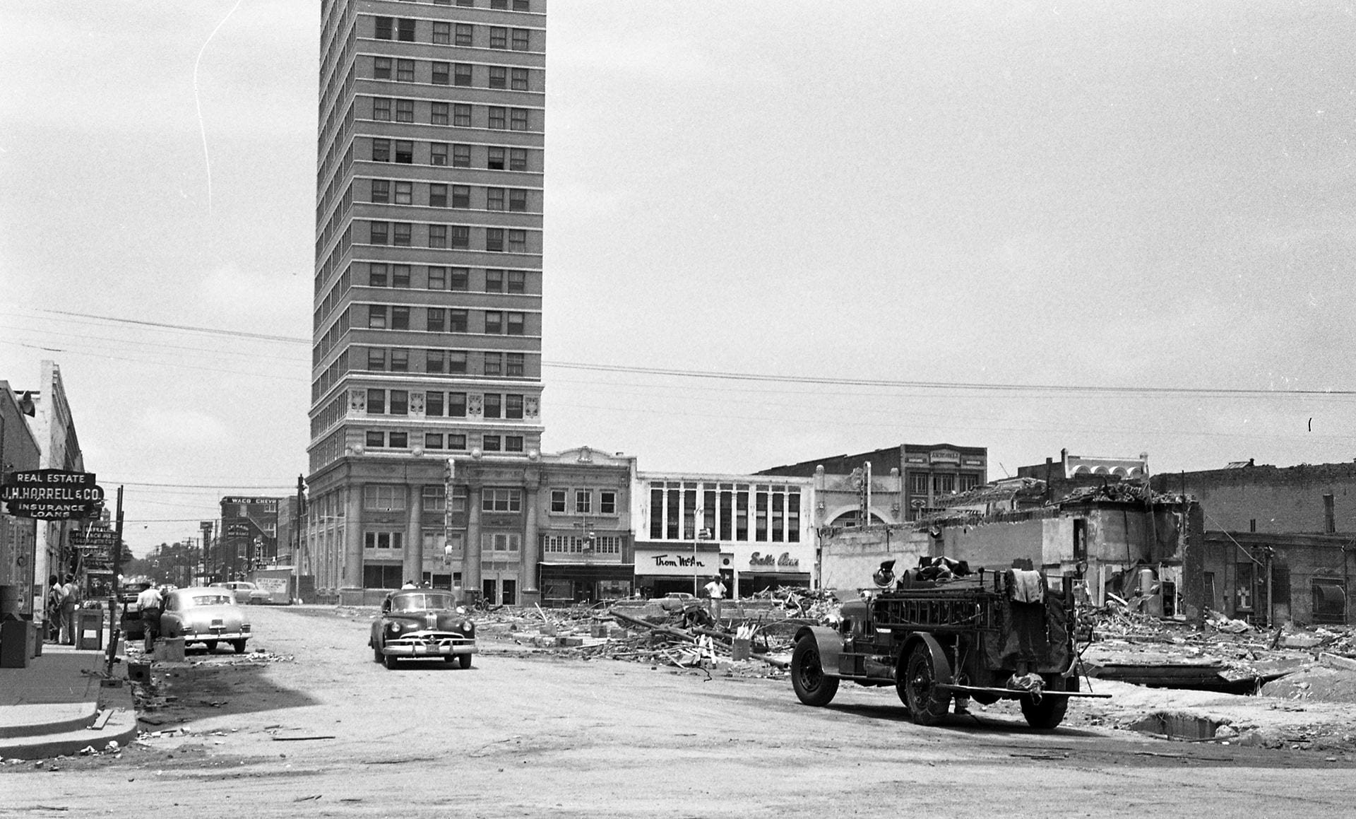
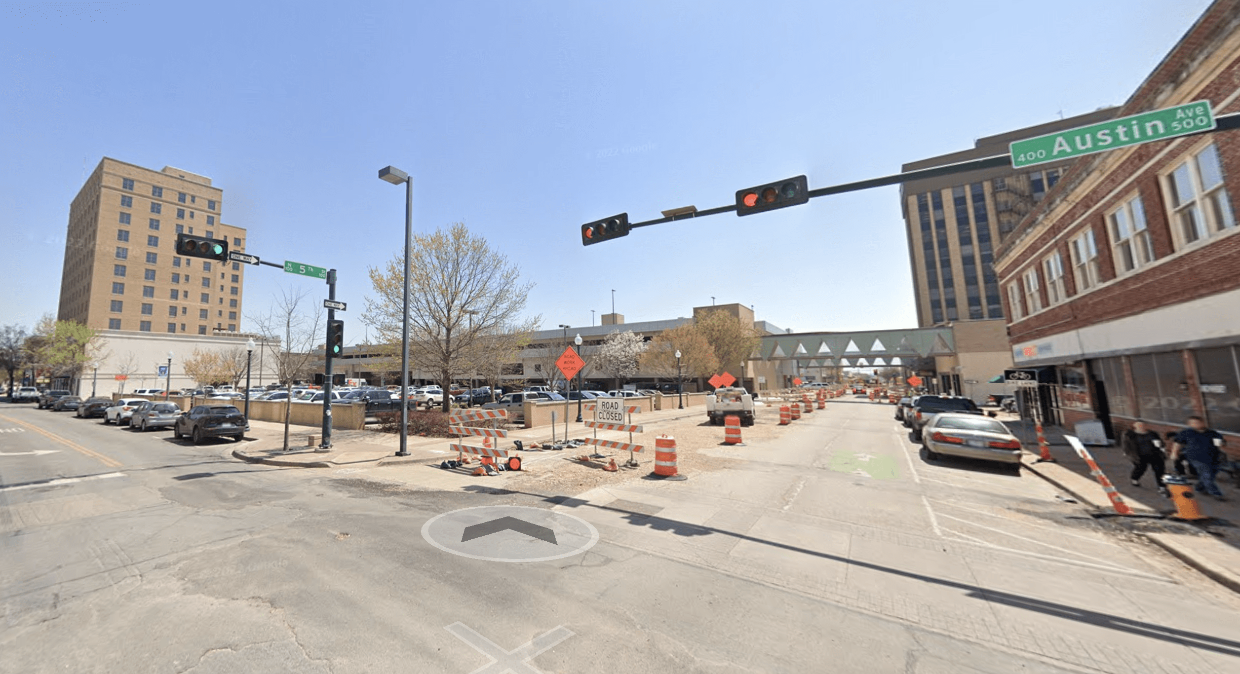
Amicable Life Insurance Co. (ALICO) Building, 425 Austin Ave.
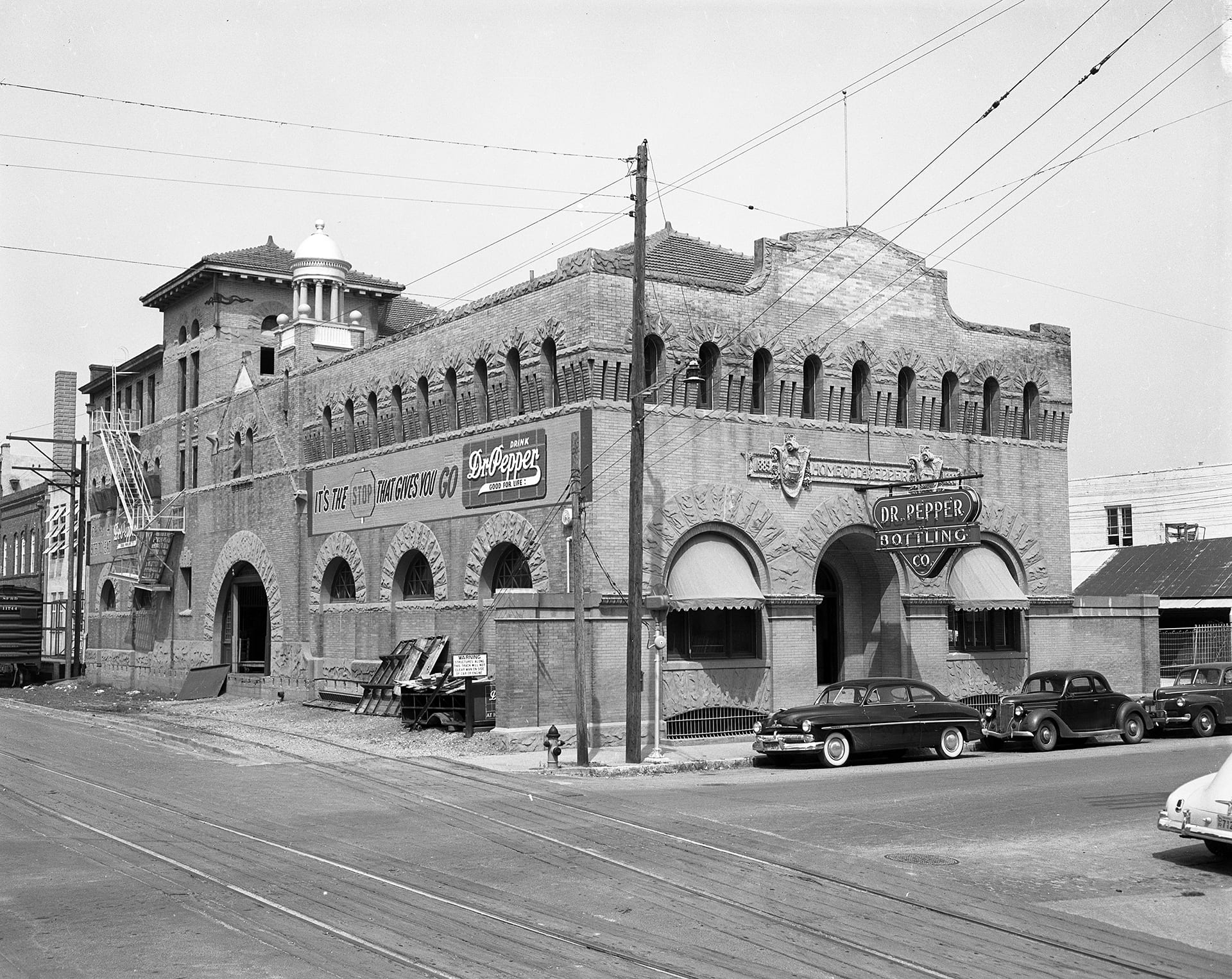
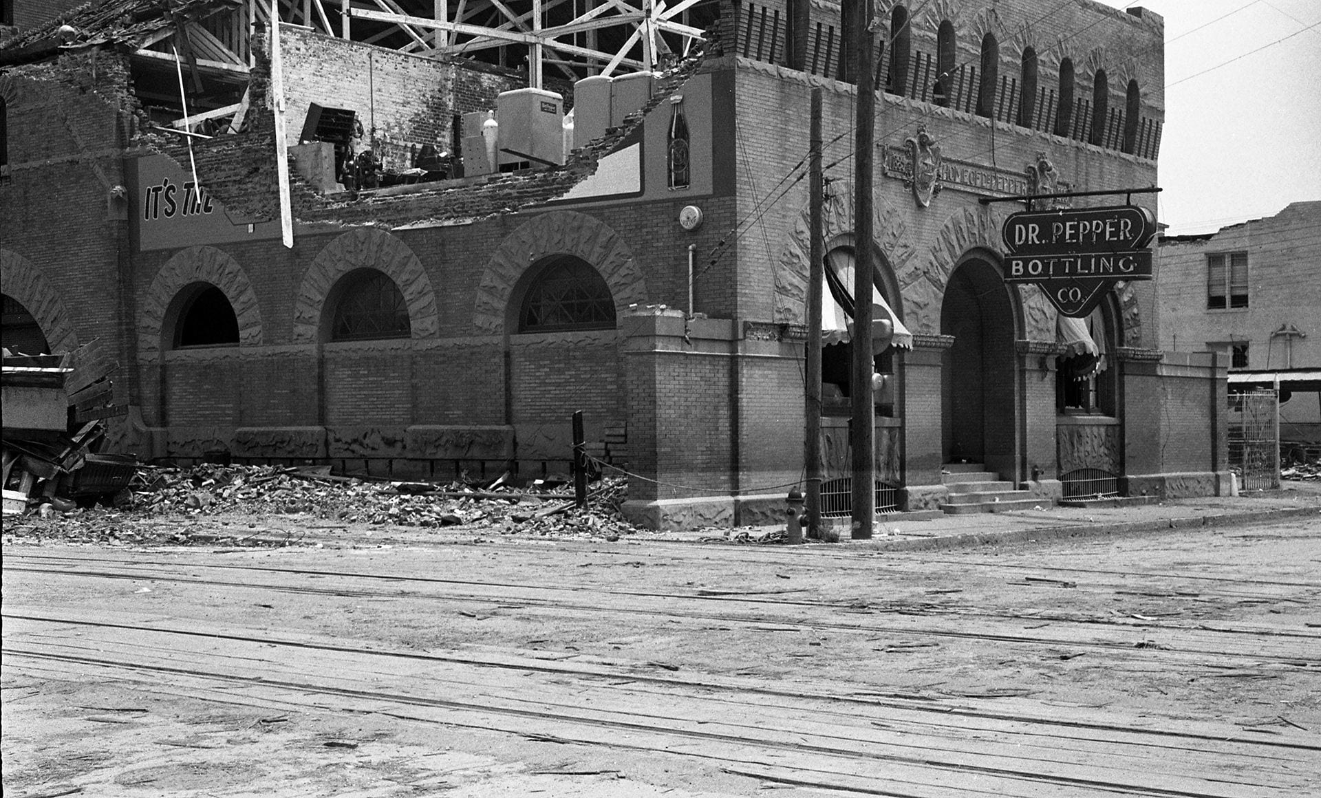
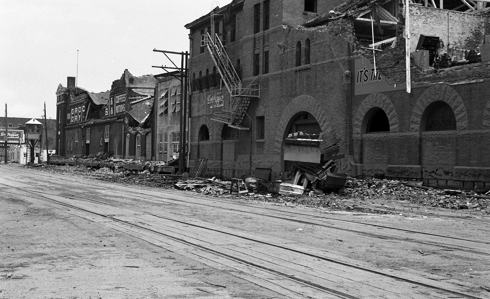
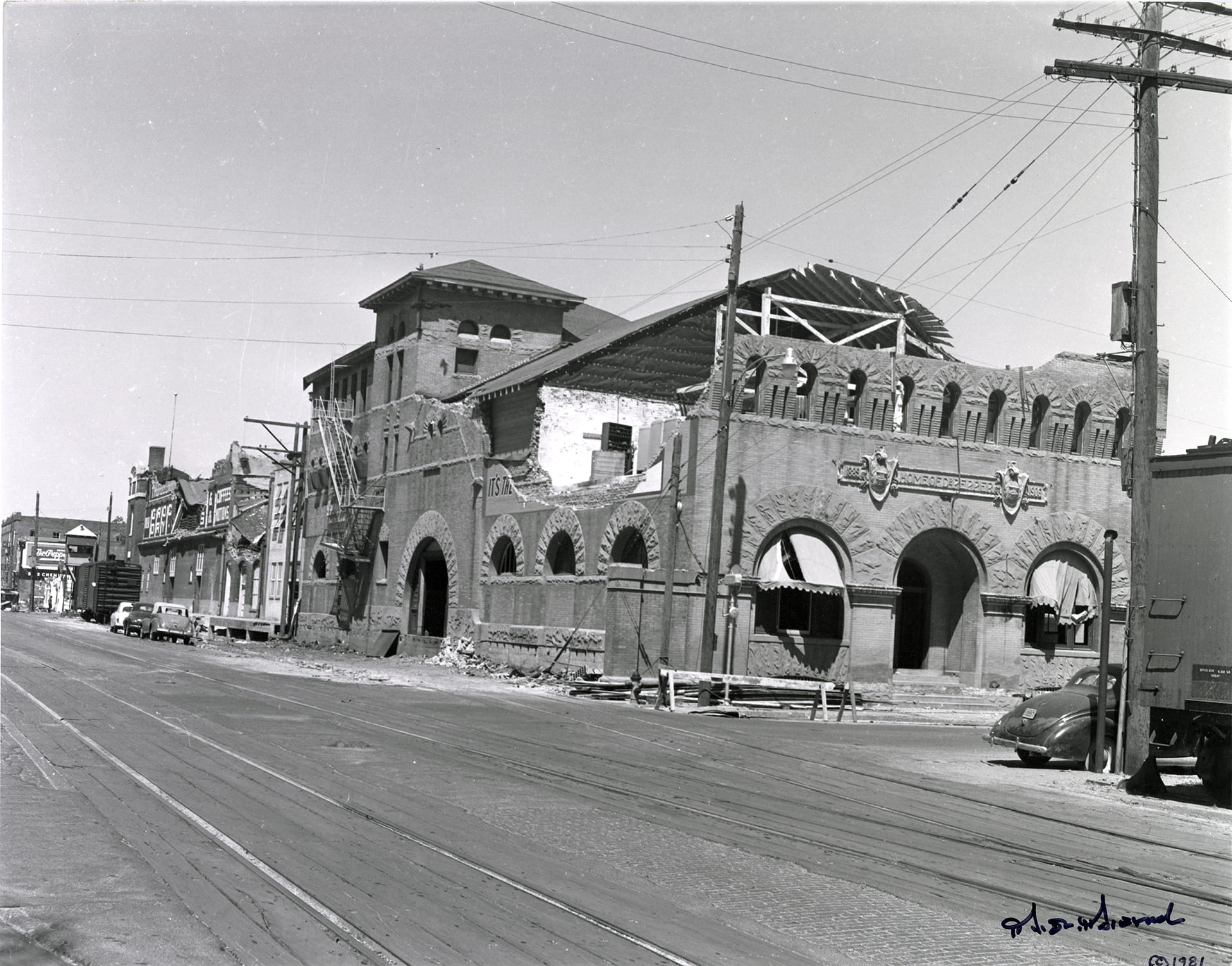
Artesian Manufacturing and Bottling Co. (Dr Pepper Museum), 300 S. 5th Street


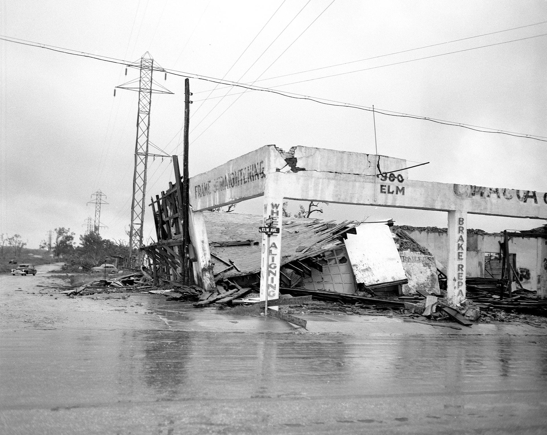
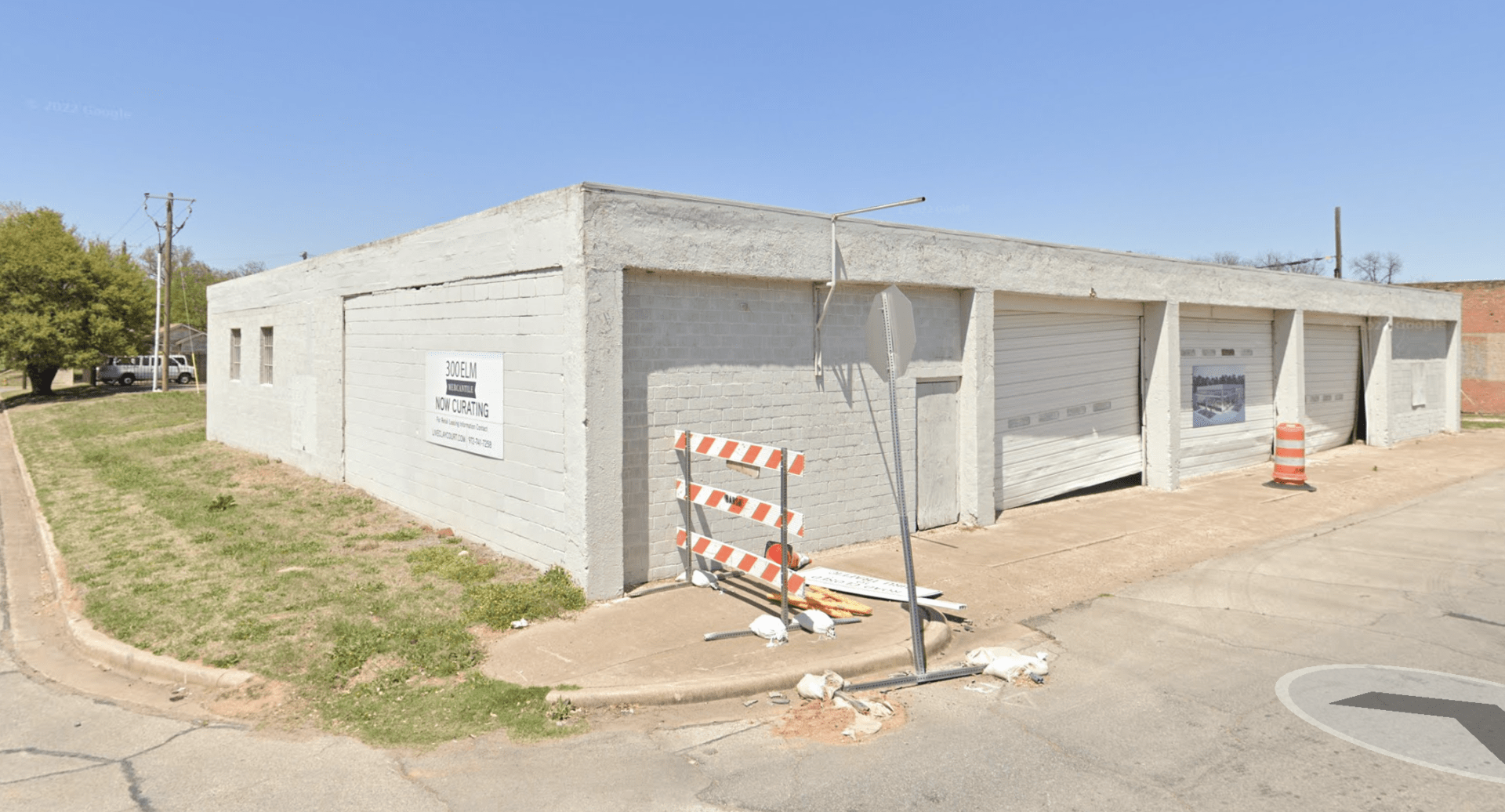
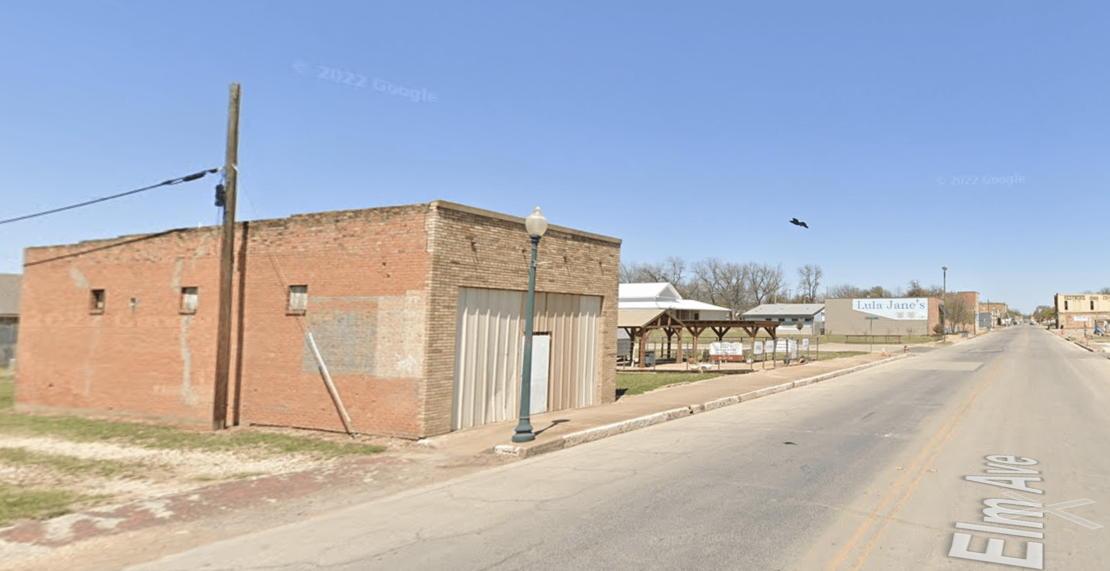
Automobile Repair Shop, 300 Elm Ave.
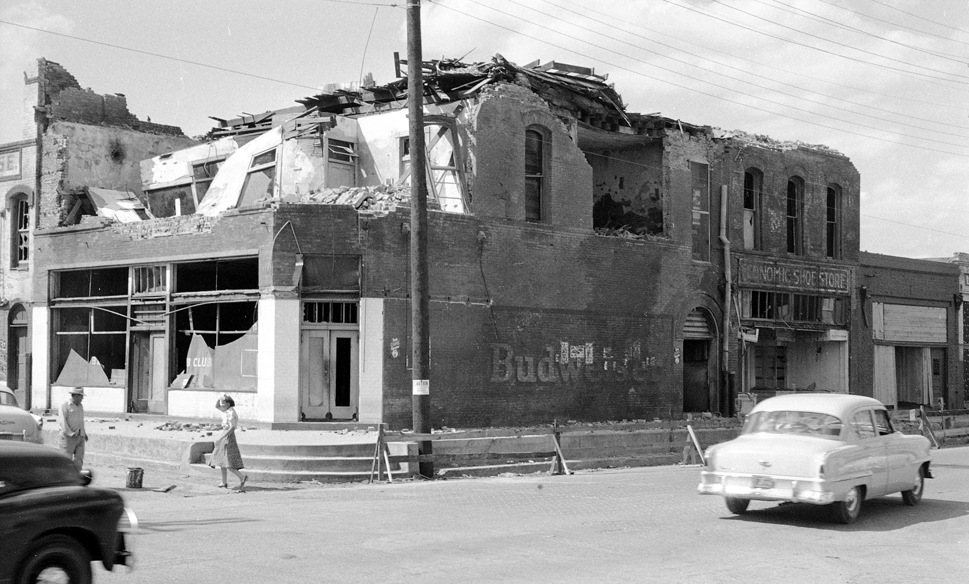
B&B Club, 124 S. 3rd Street (South of the Square)
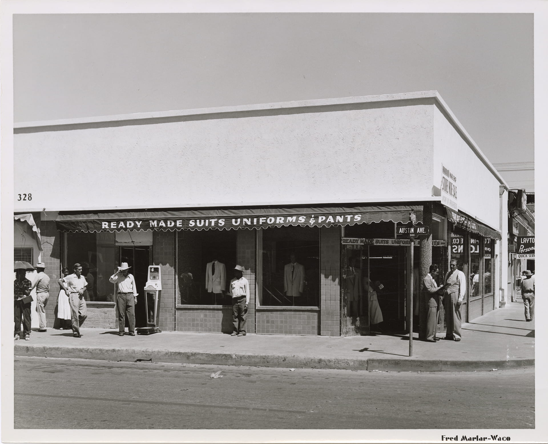
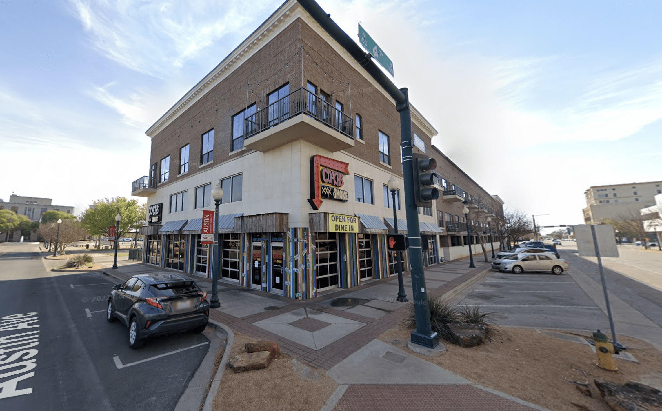
Bell Tailors, 332 Austin Ave.


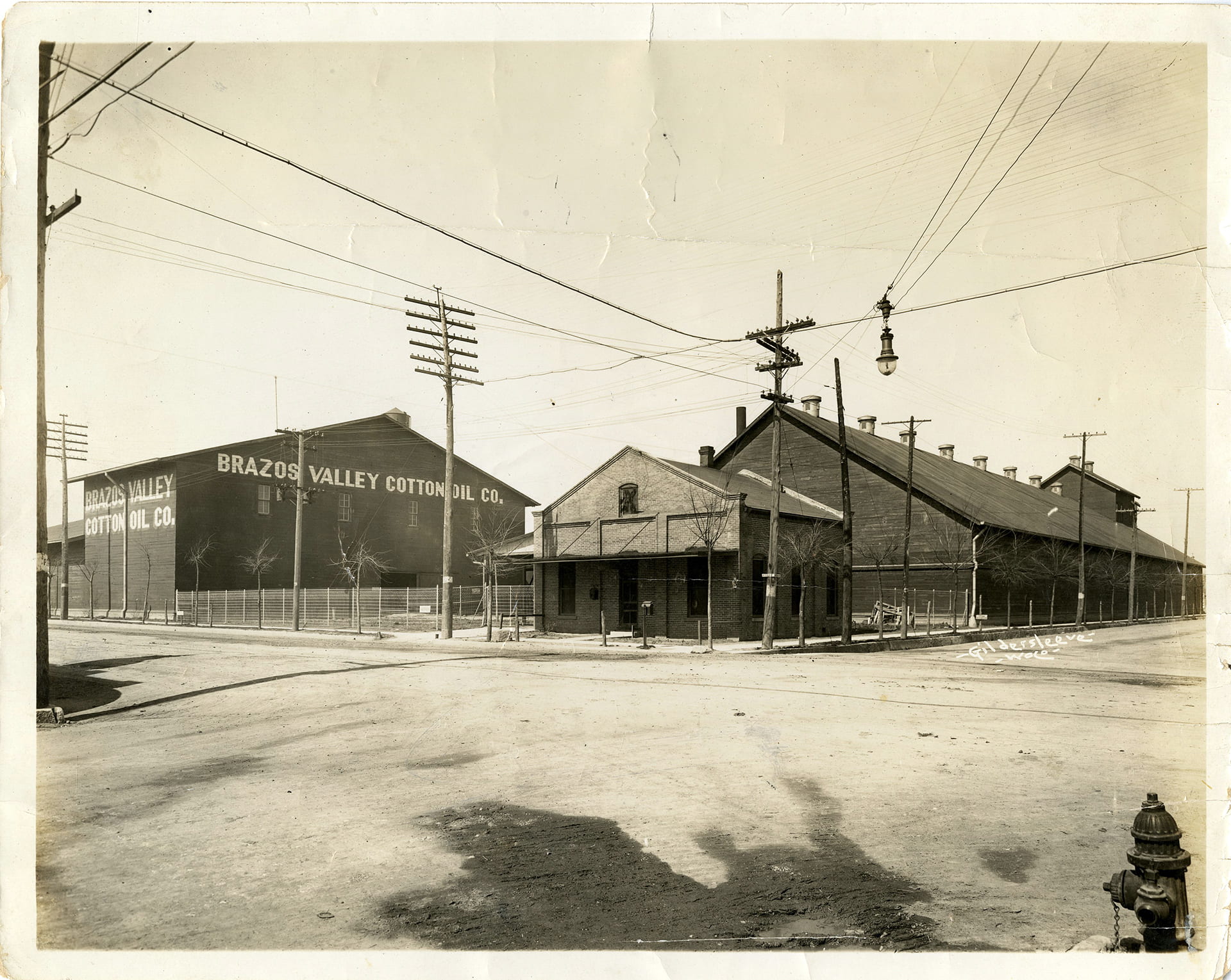
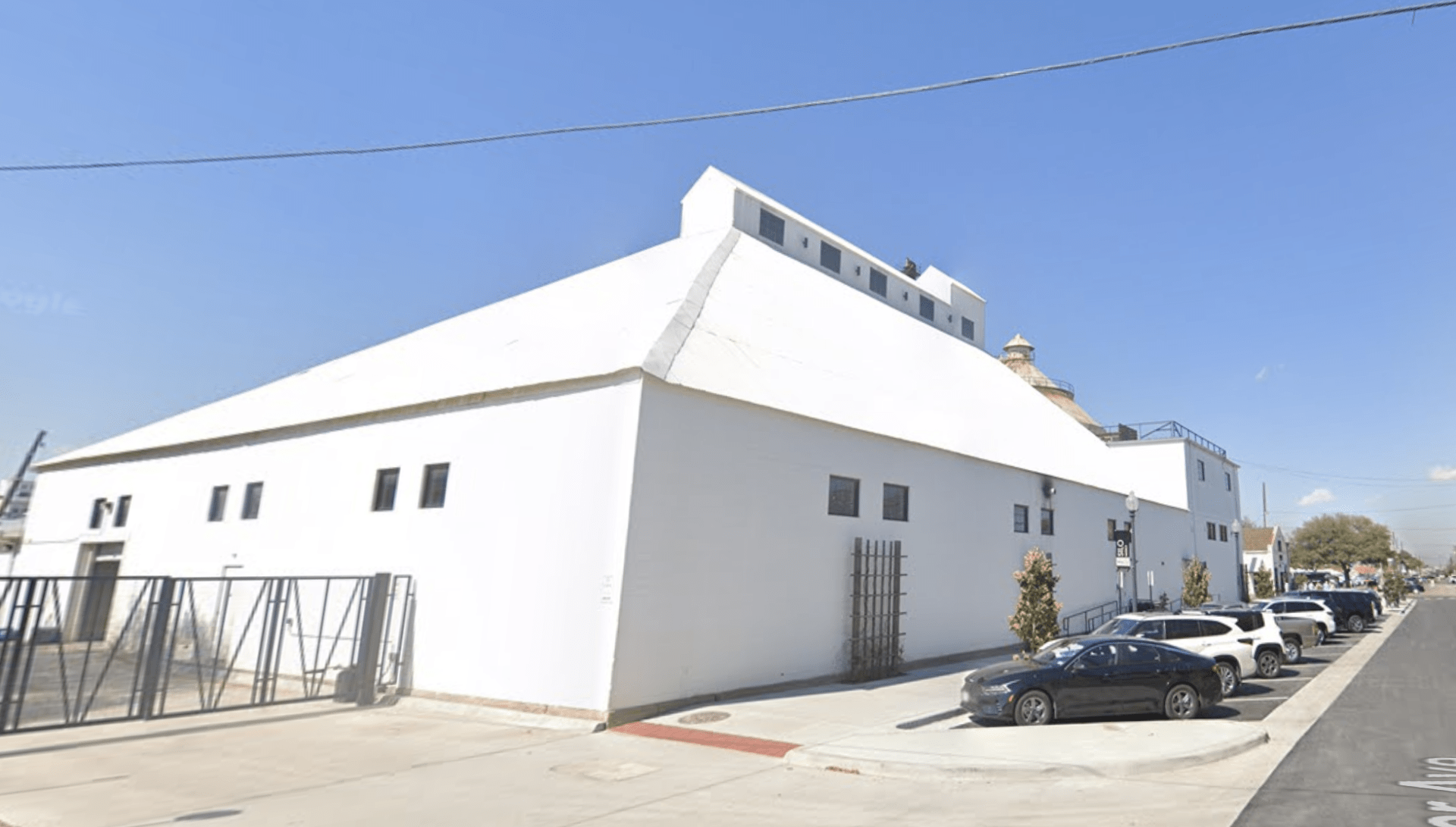
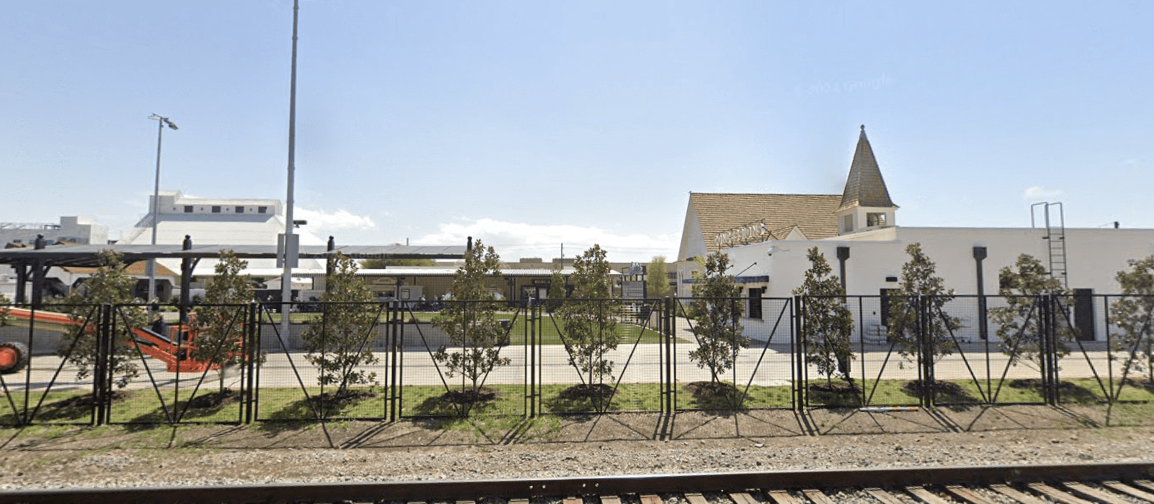
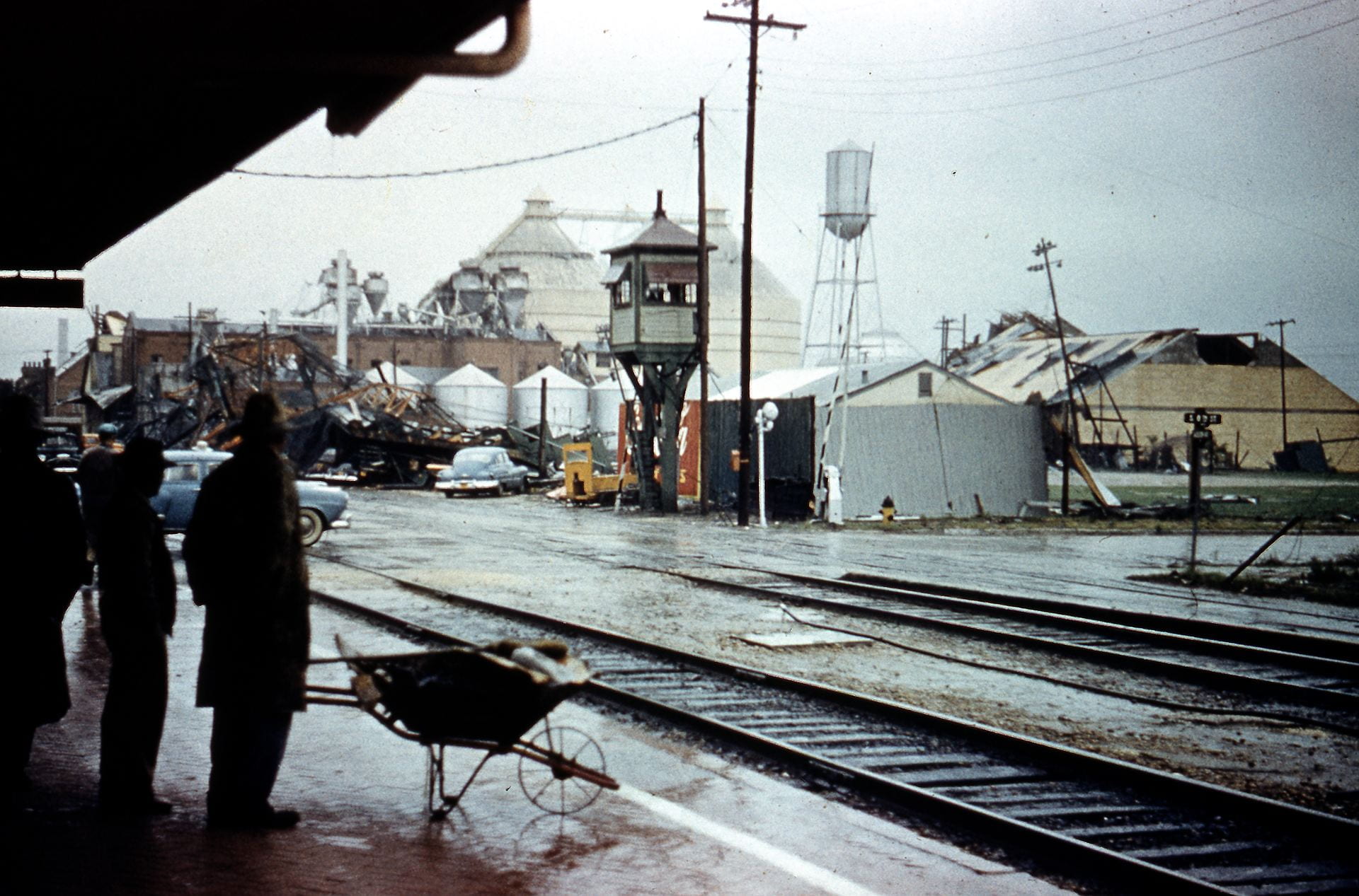
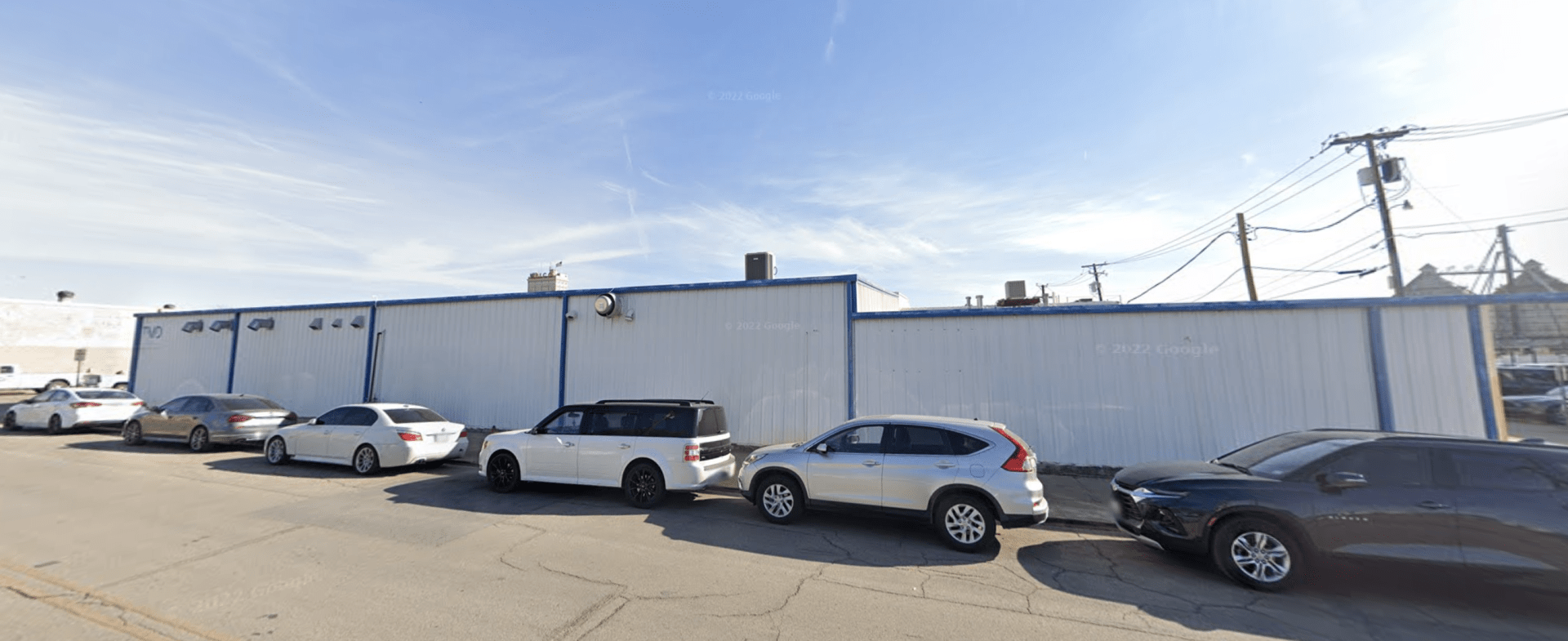
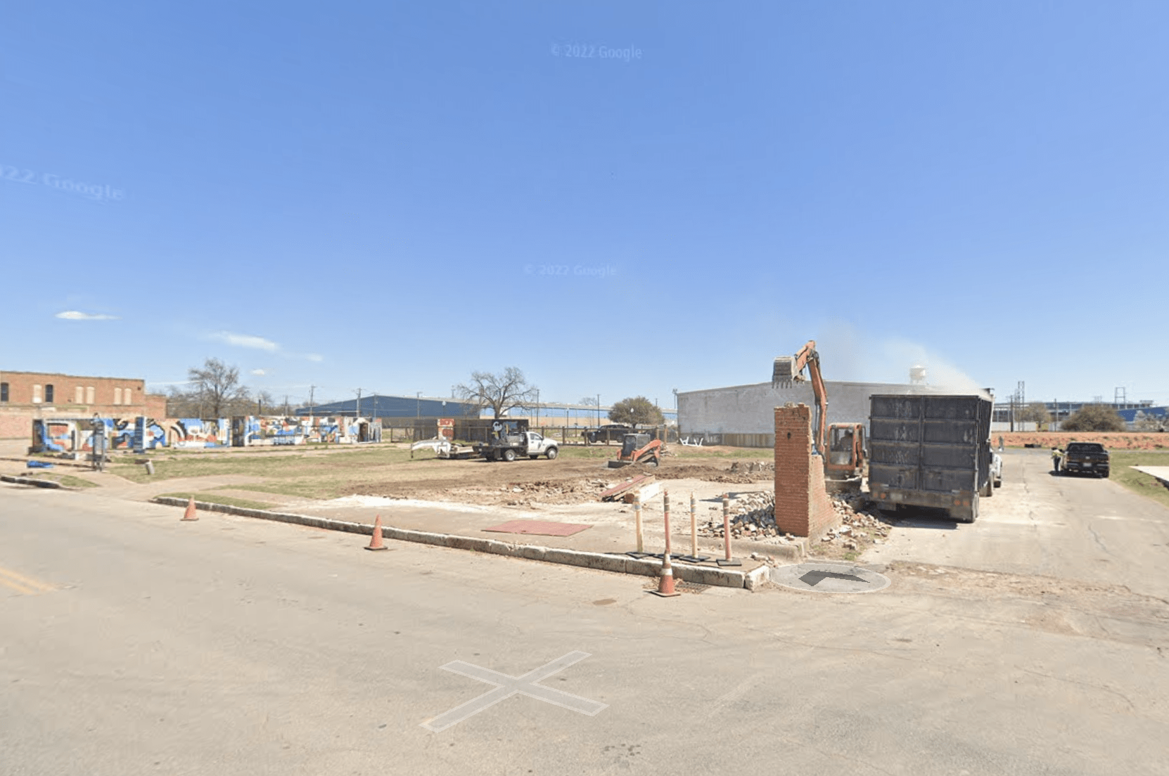
Brazos Valley Cotton Oil, 601 Webster (today’s Magnolia Silos)

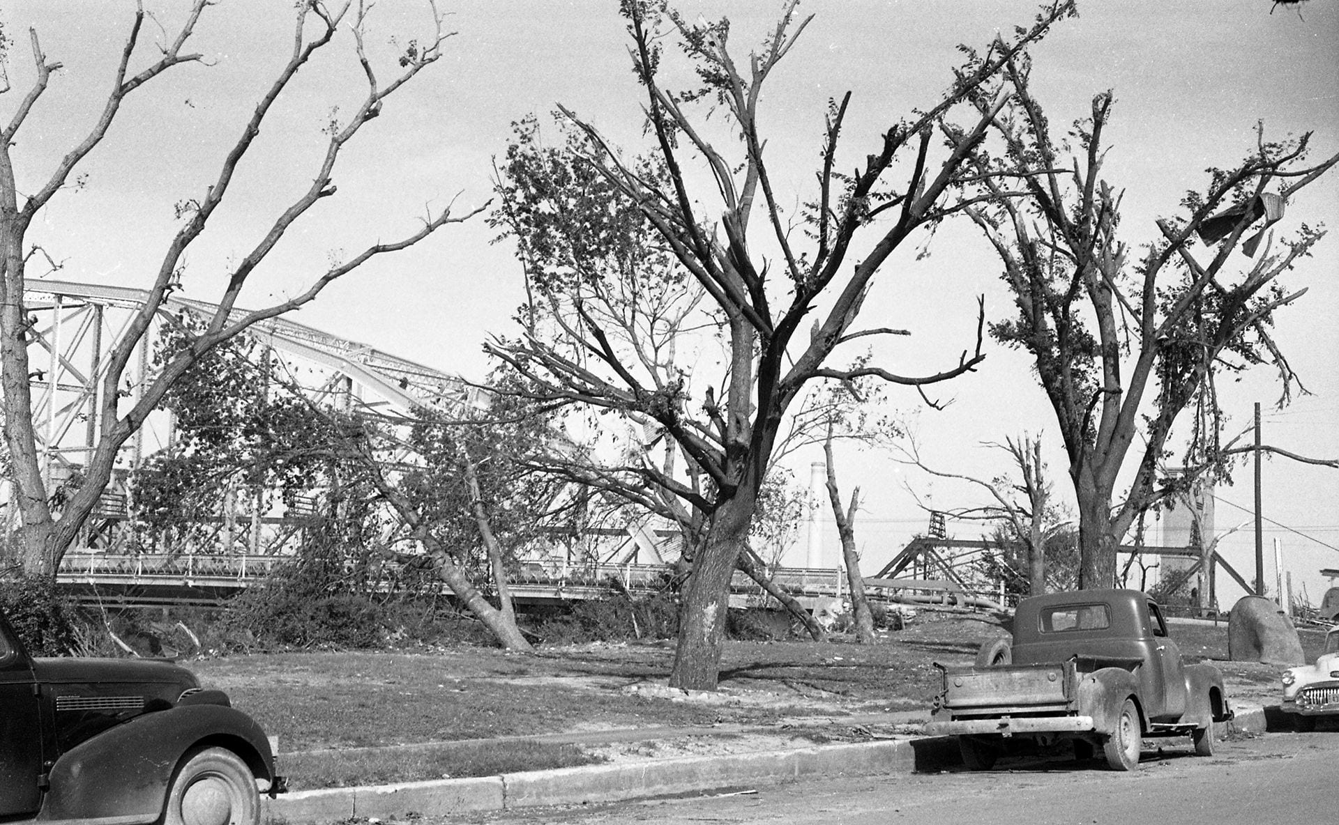
Bridge Street, south of Waco Suspension Bridge (today’s Waco Convention Center/Hilton)


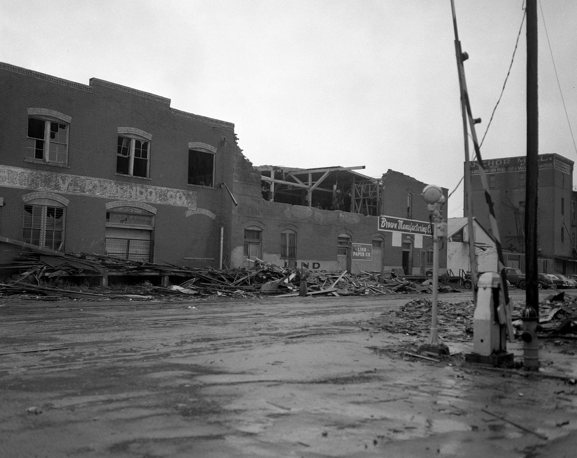
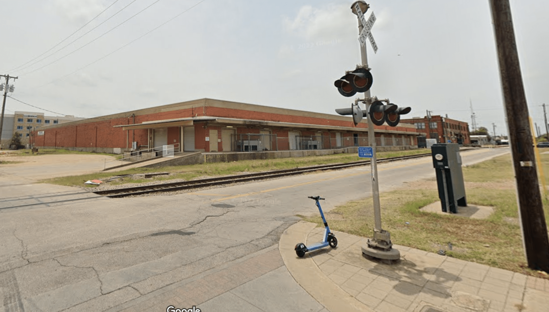
Brown Manufacturing, 217 Jackson
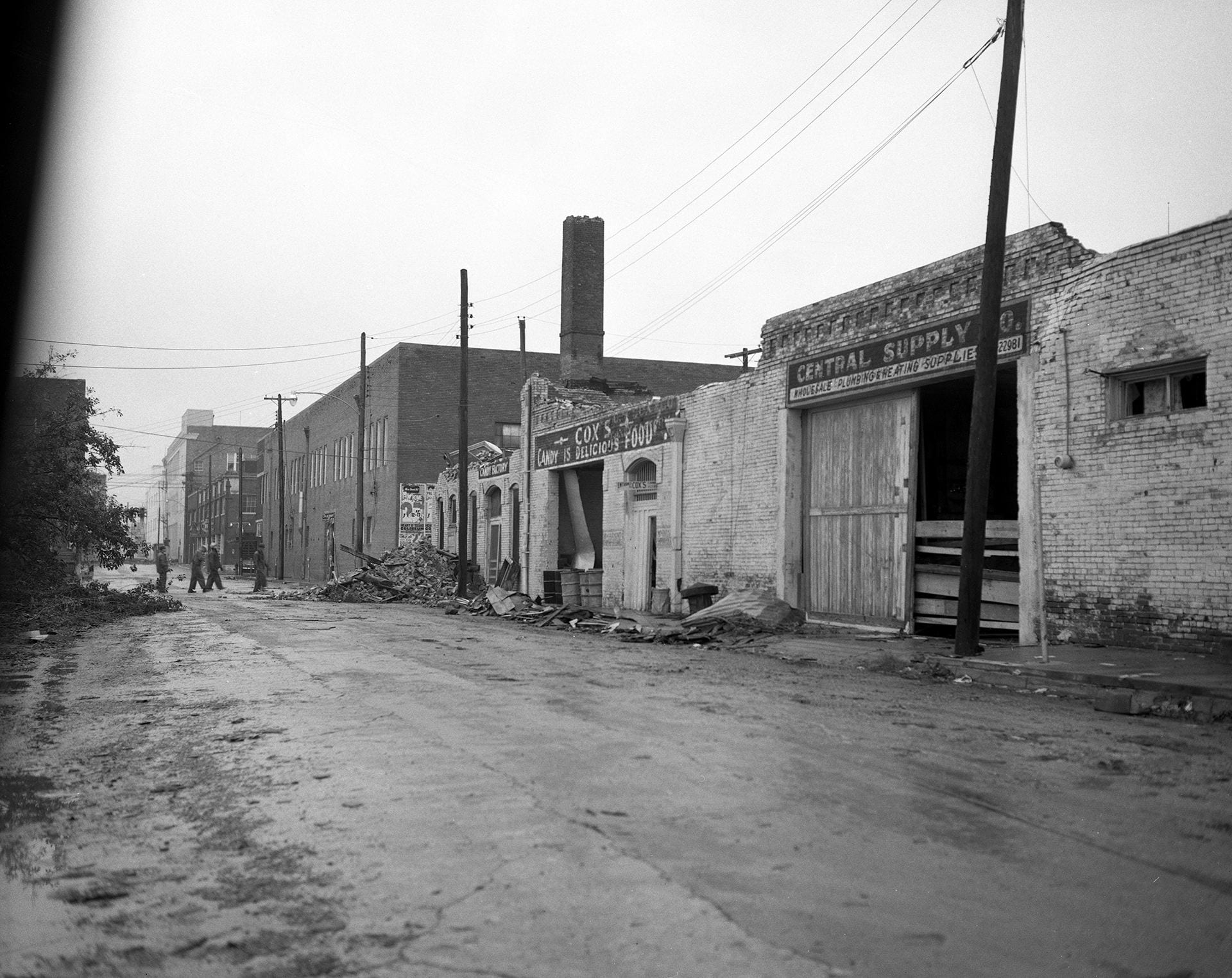
Central Supply Co., 218 S. 7th Street
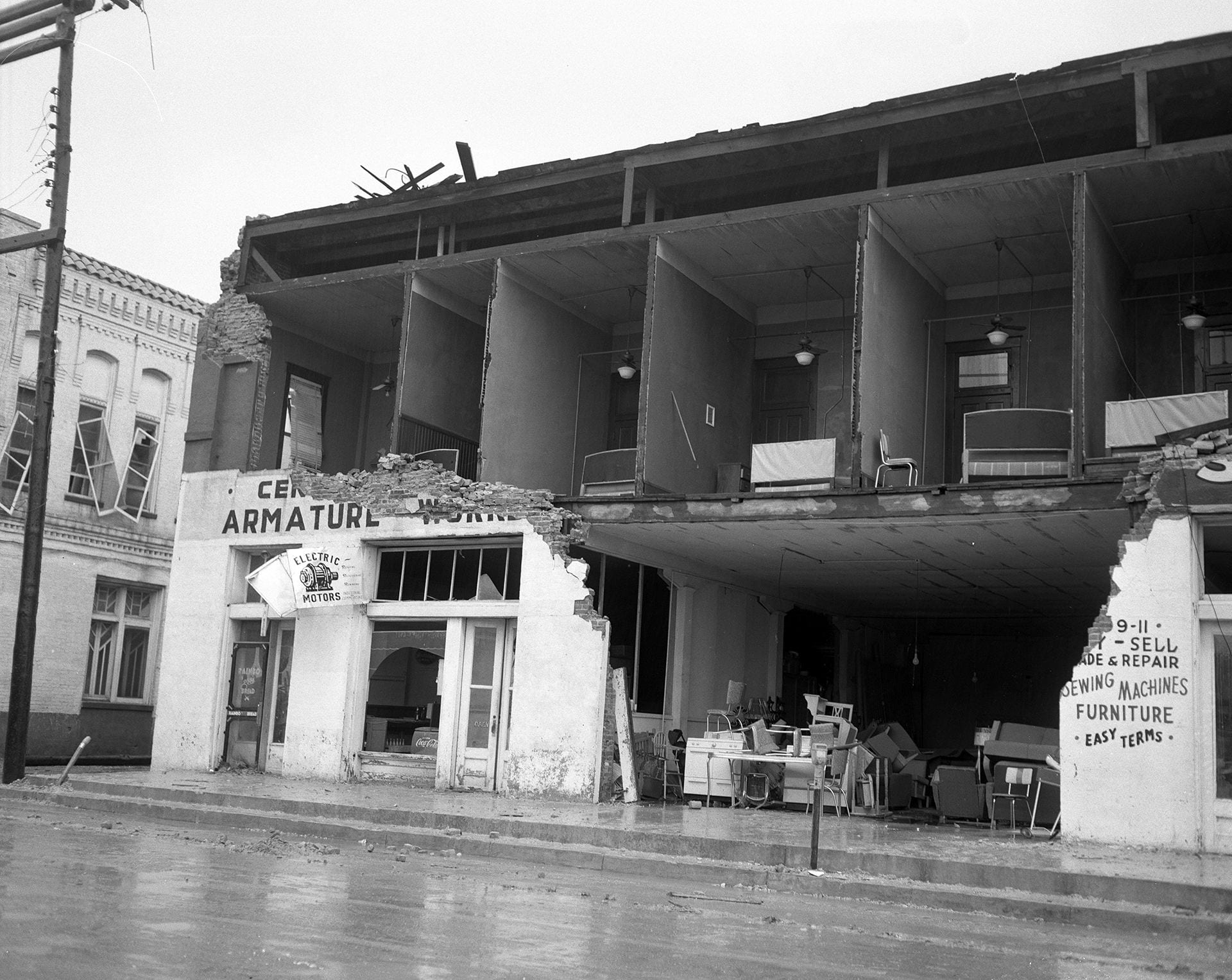
Central Texas Armature Works, 213 N. 3rd Street

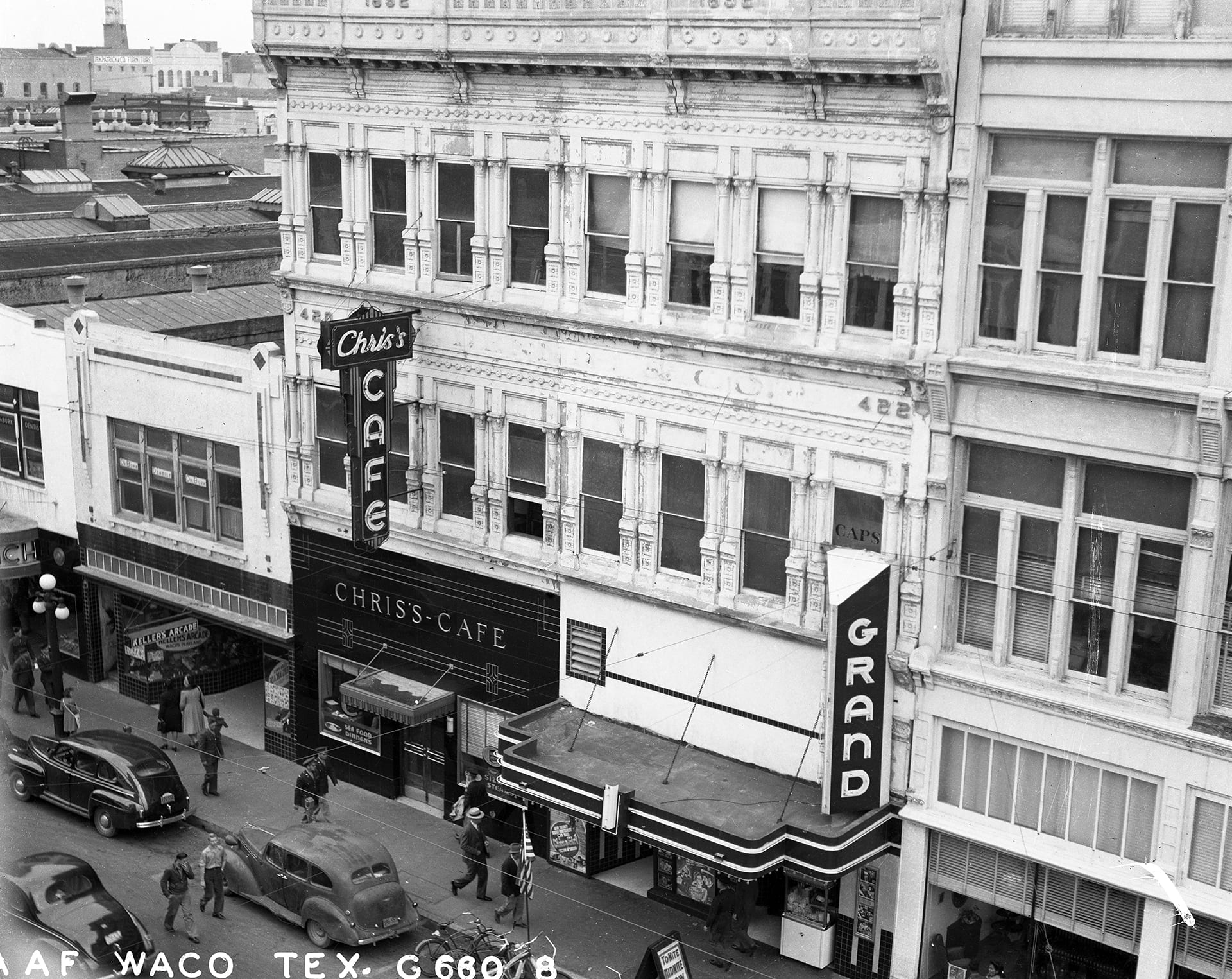
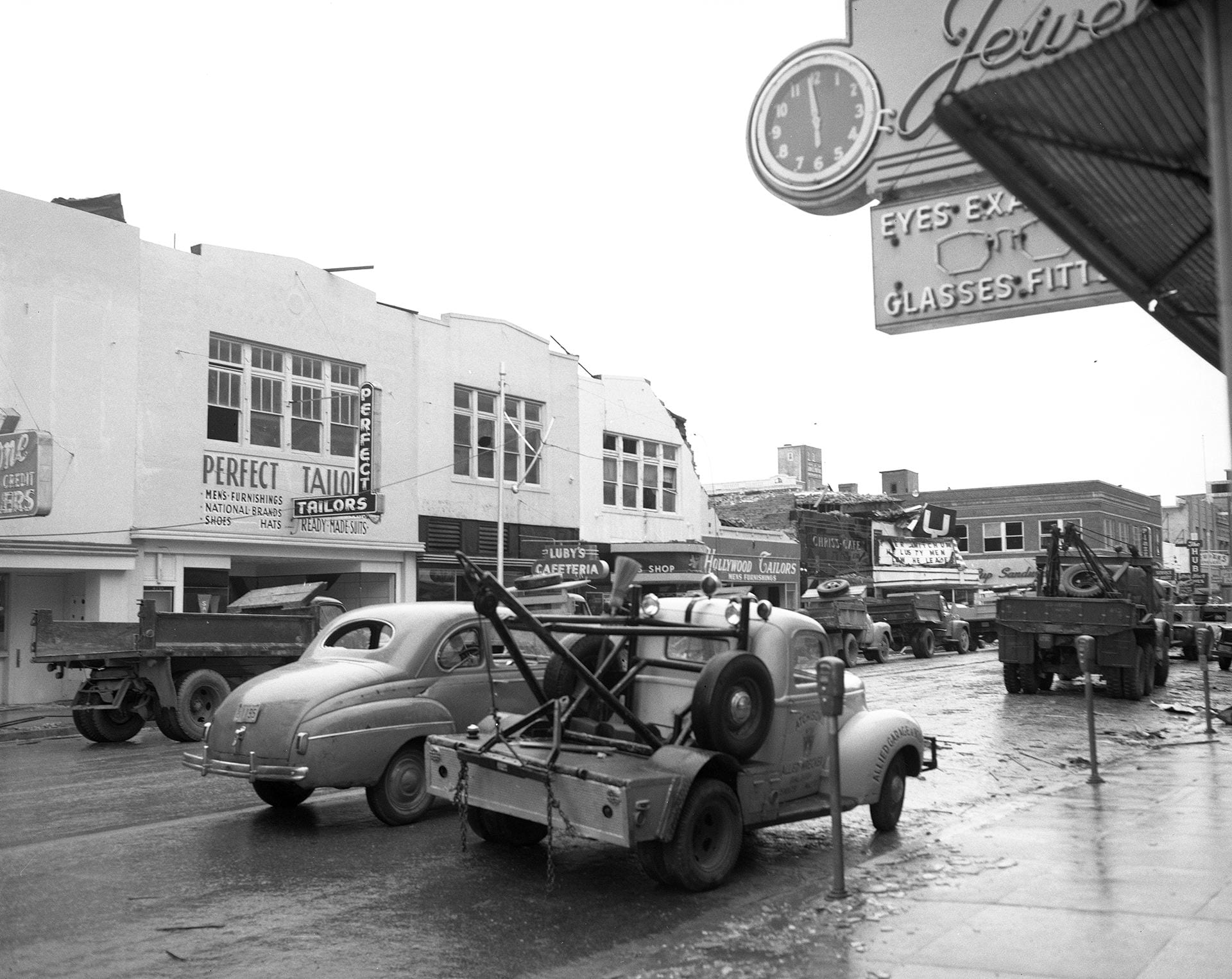
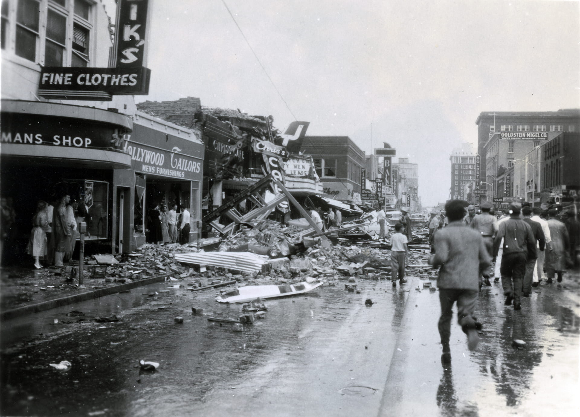
Chris’s Cafe, 420 Austin Ave.


Clifton-Simpson Hardware, 211 North Side Square

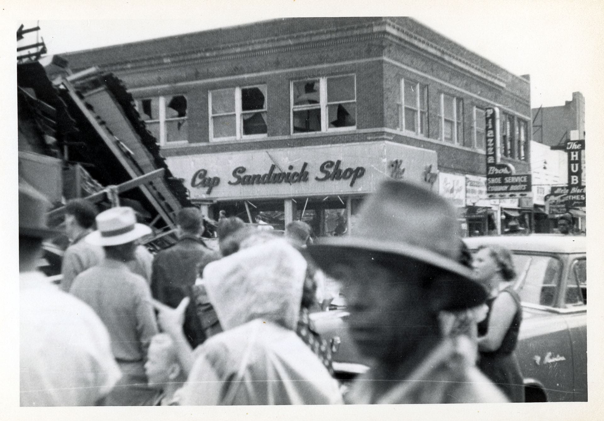
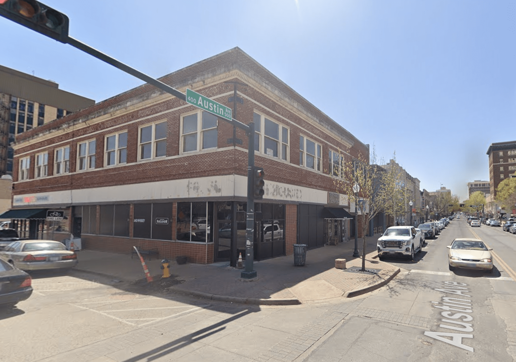
Coffee Cup Sandwich Shop, 500 Austin
Cooper Company, 300 block of 4th Street

Will Copeland’s Food Market, 127 S. 3rd (South of the Square)
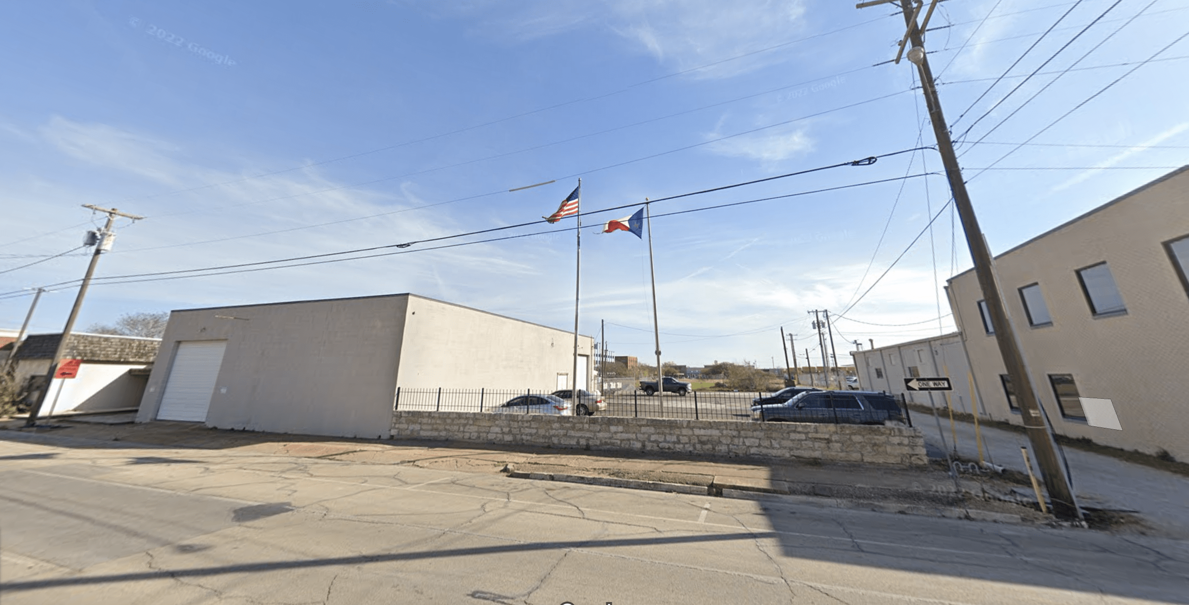
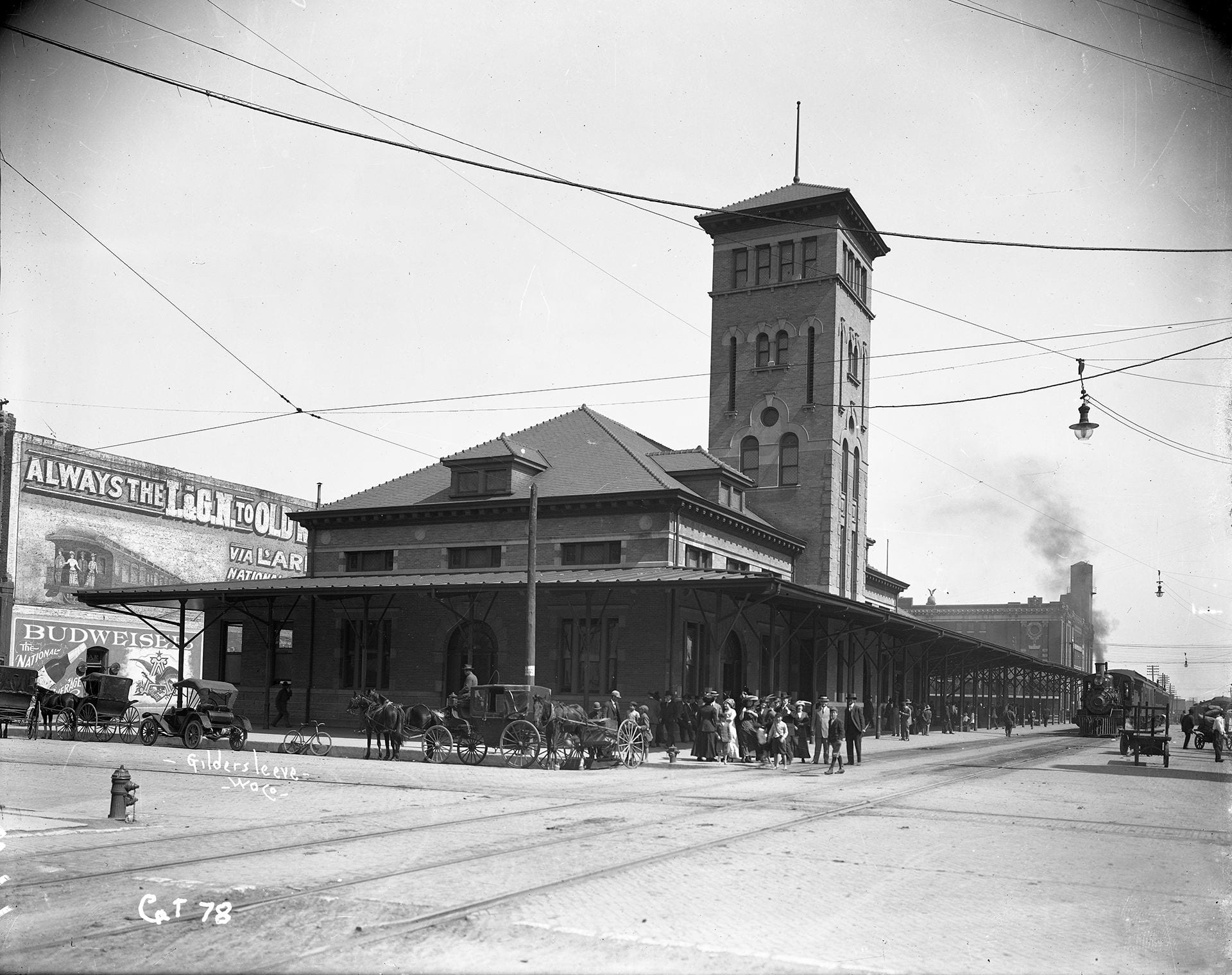
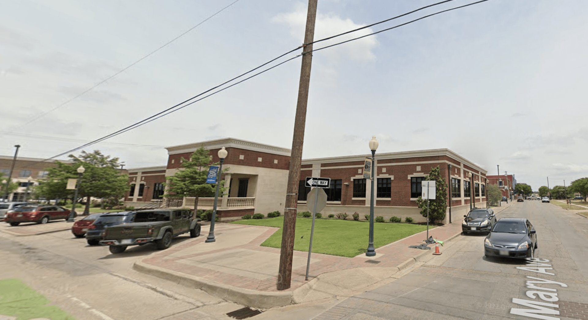
Cotton Belt Depot, 4th and Mary

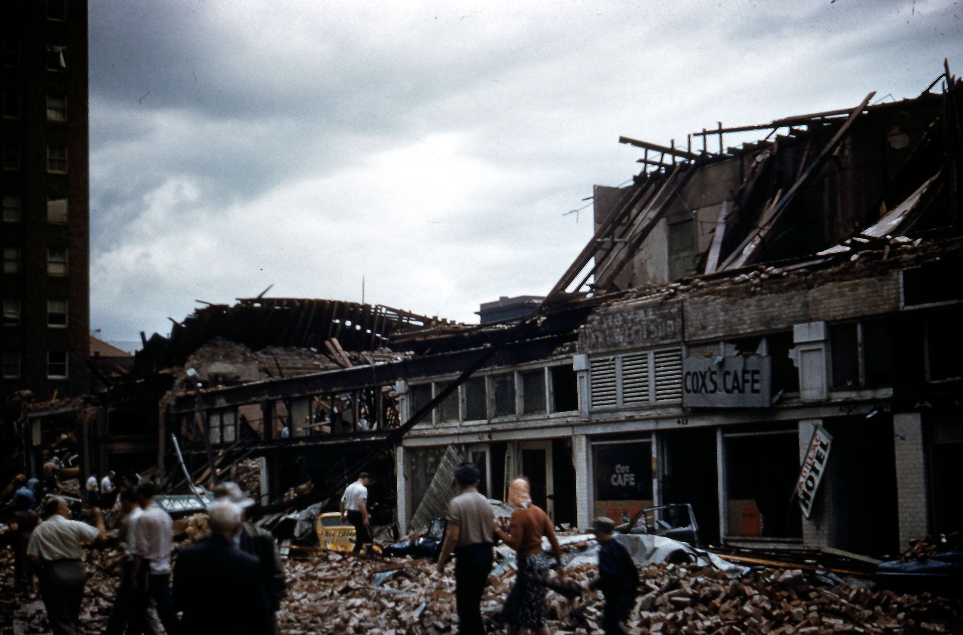
Cox’s Cafe, 413 Franklin
Cut Rate Drugs, 113 S. 3rd (South Side of Square)
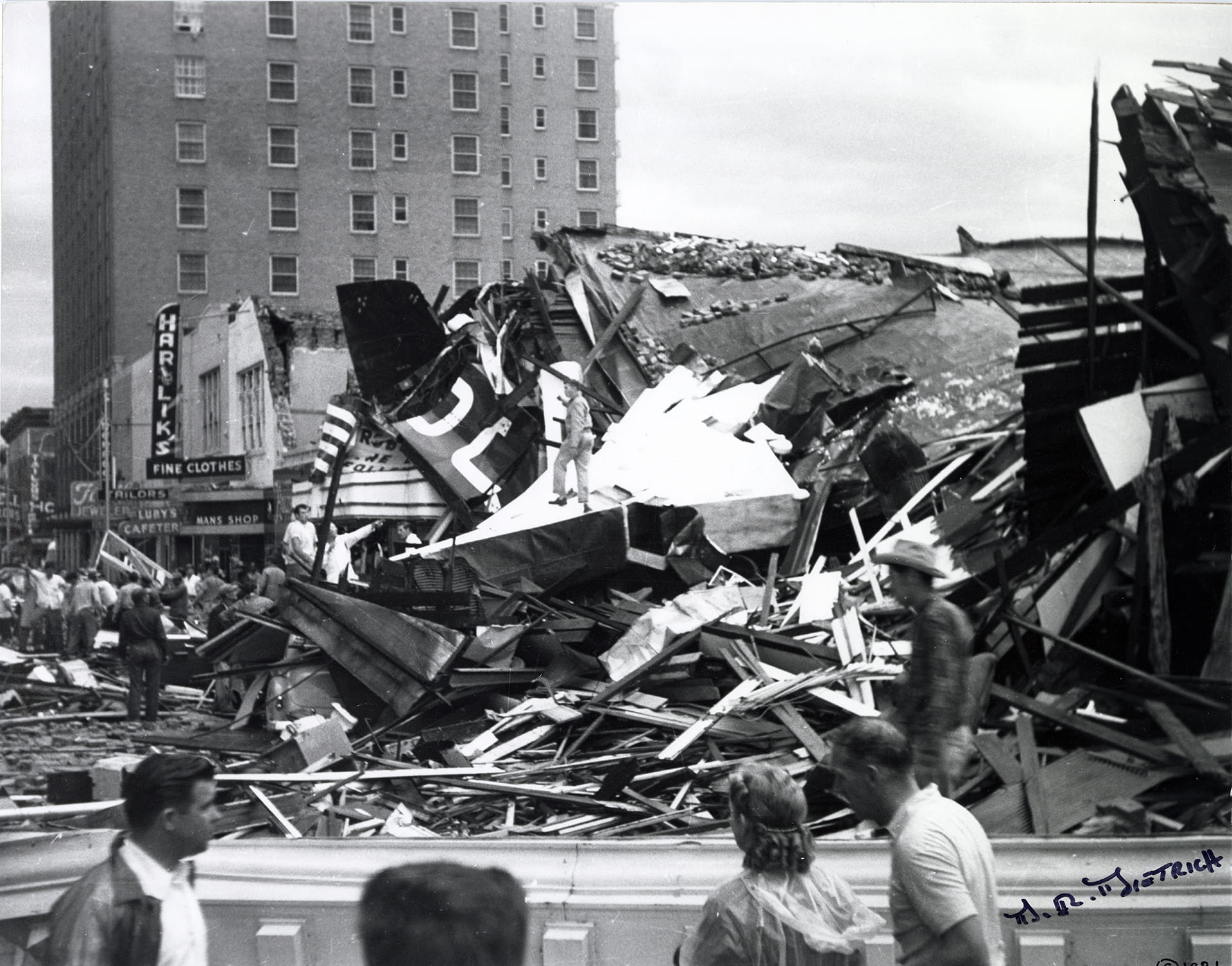
Harry Daum Dry Goods, 115 S. 3rd (South Side of Square)

Dixie Appliance, 220 South Side Square
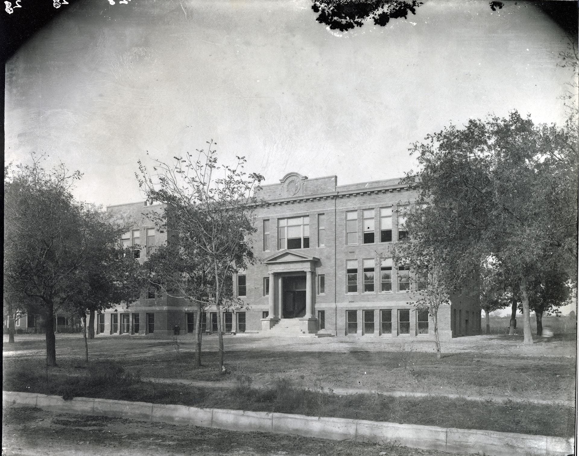
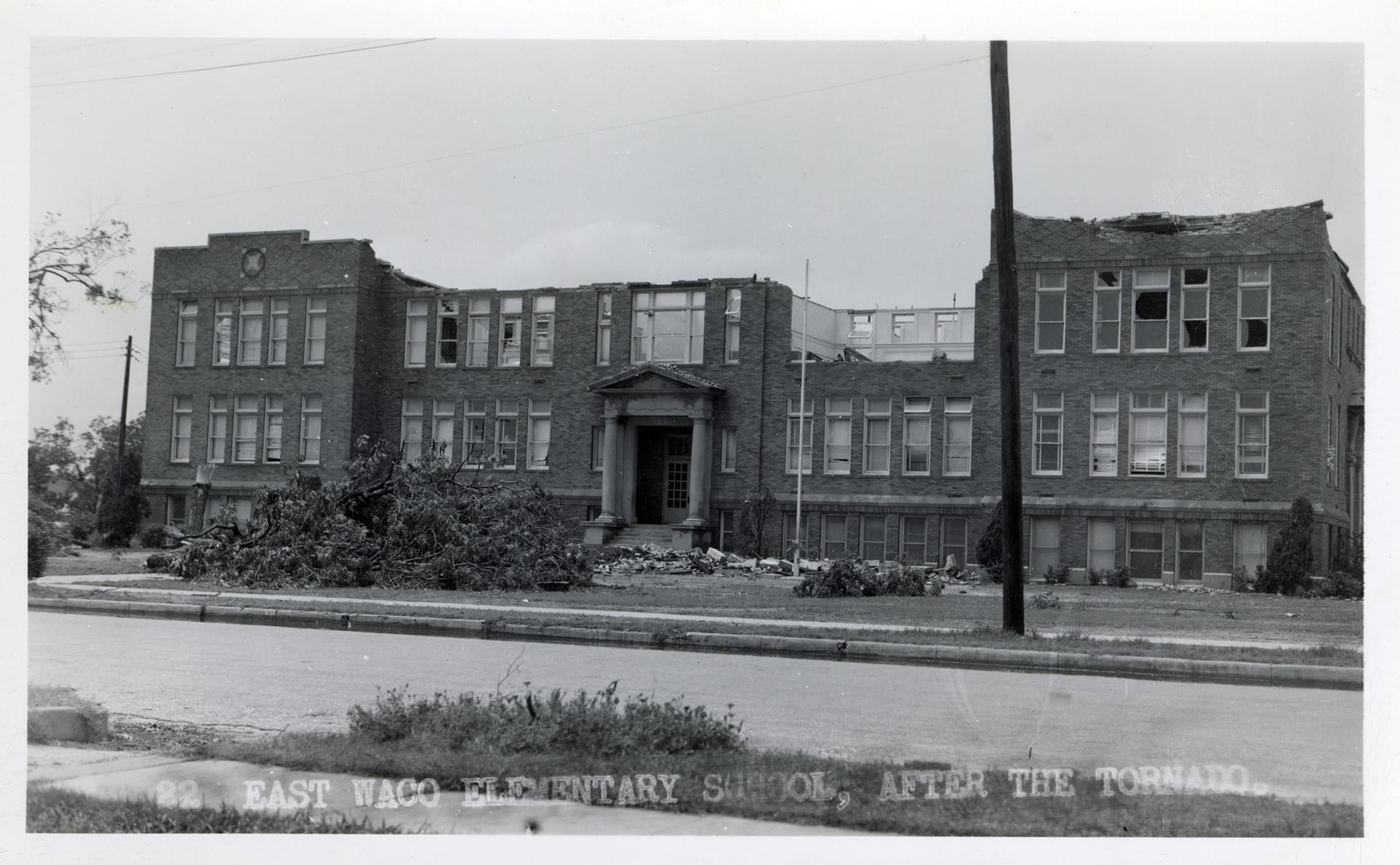
East Waco Elementary School, 409 Turner St.

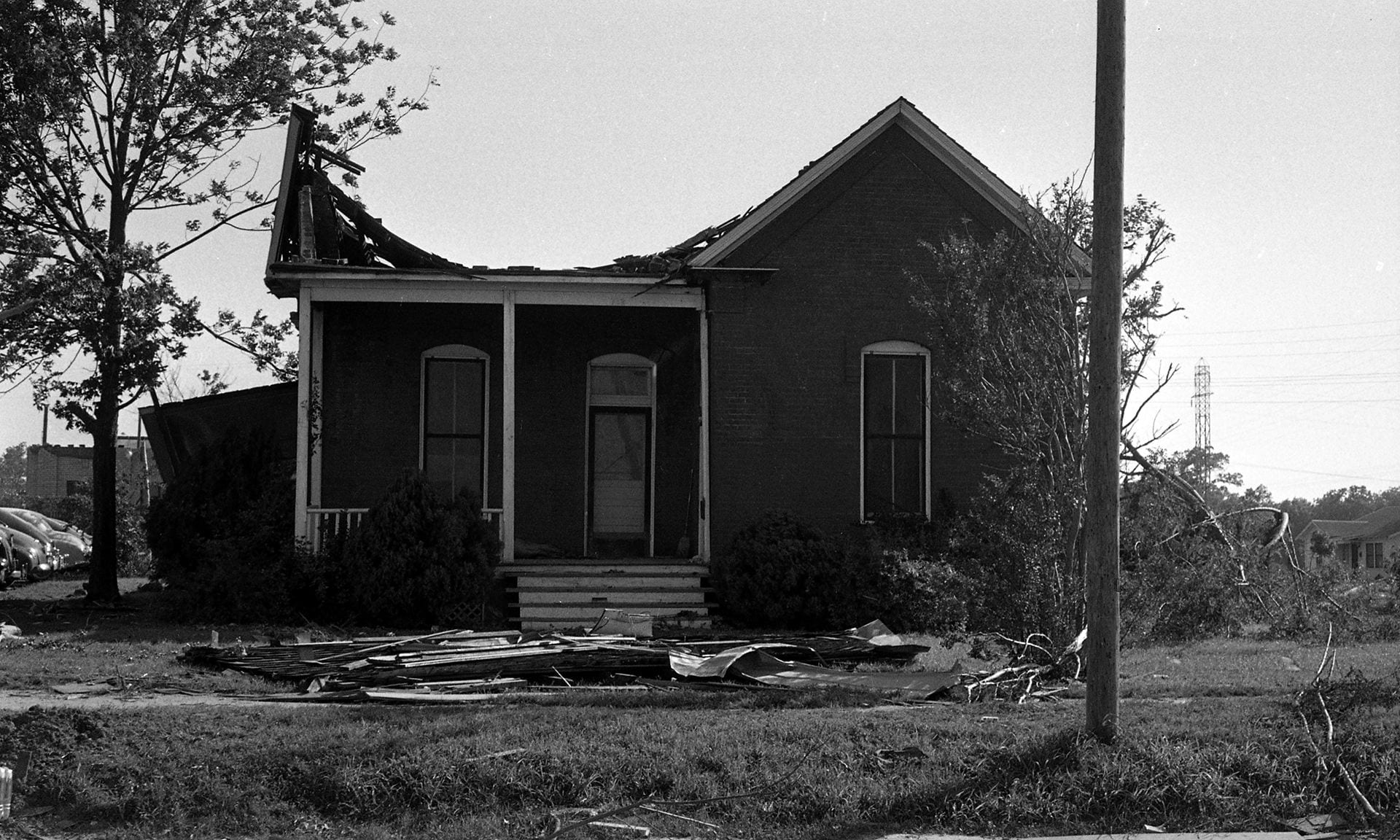
First Methodist Church, 5th and Jackson


Fox Theater, 105 S. 3rd (South Side of Square)
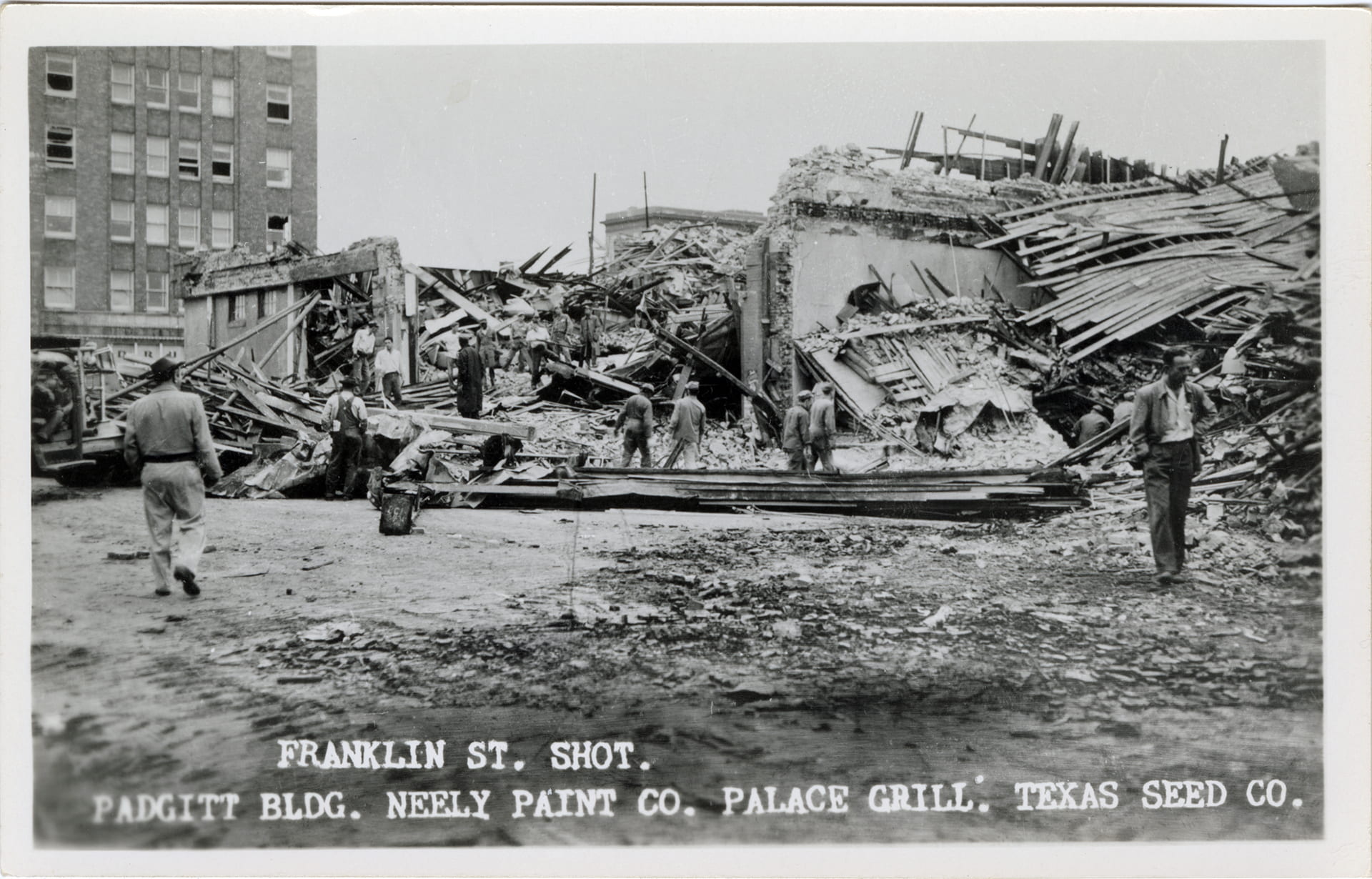
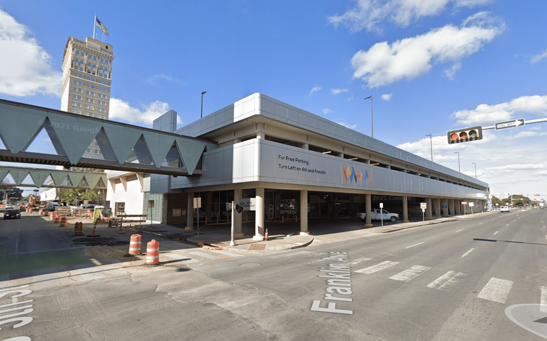
Franklin Ave., between 4th and 5th Streets

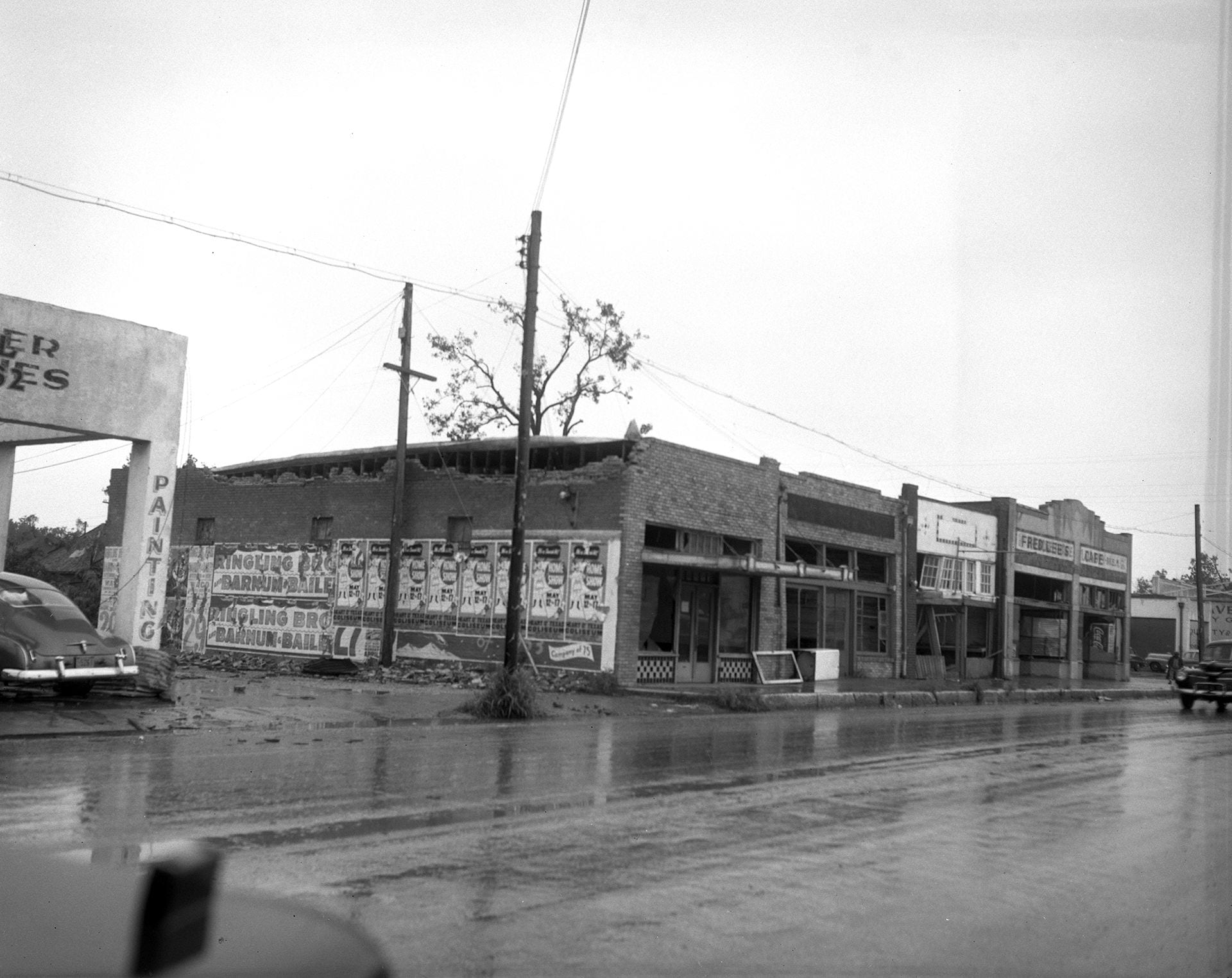
Fred Lee’s Cafe, 316 Elm
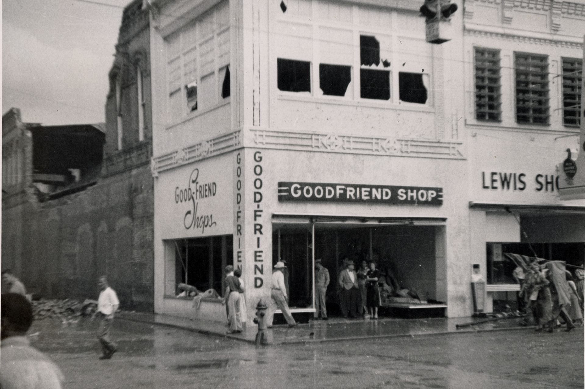
Goodfriend Shop, 700 Austin Ave

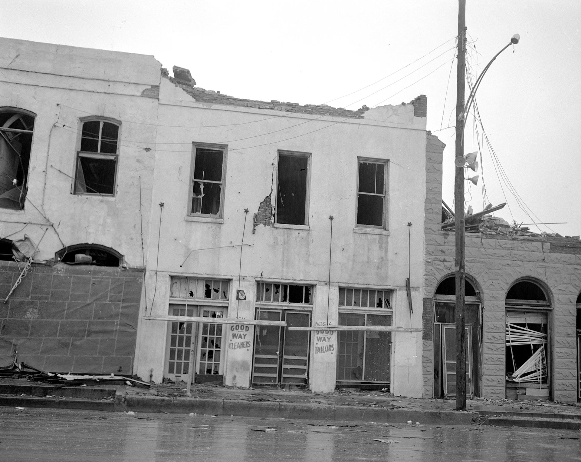
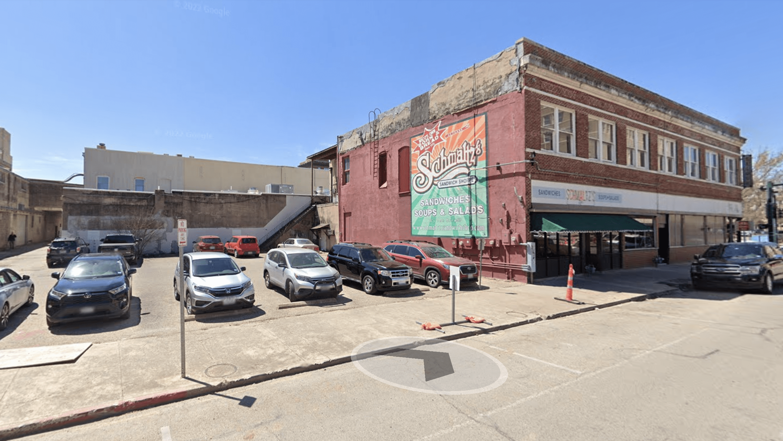
Goodway Cleaners, 111 Bridge Street (Just off the Square)
Health Camp Malt Bar, 107 S. 5th

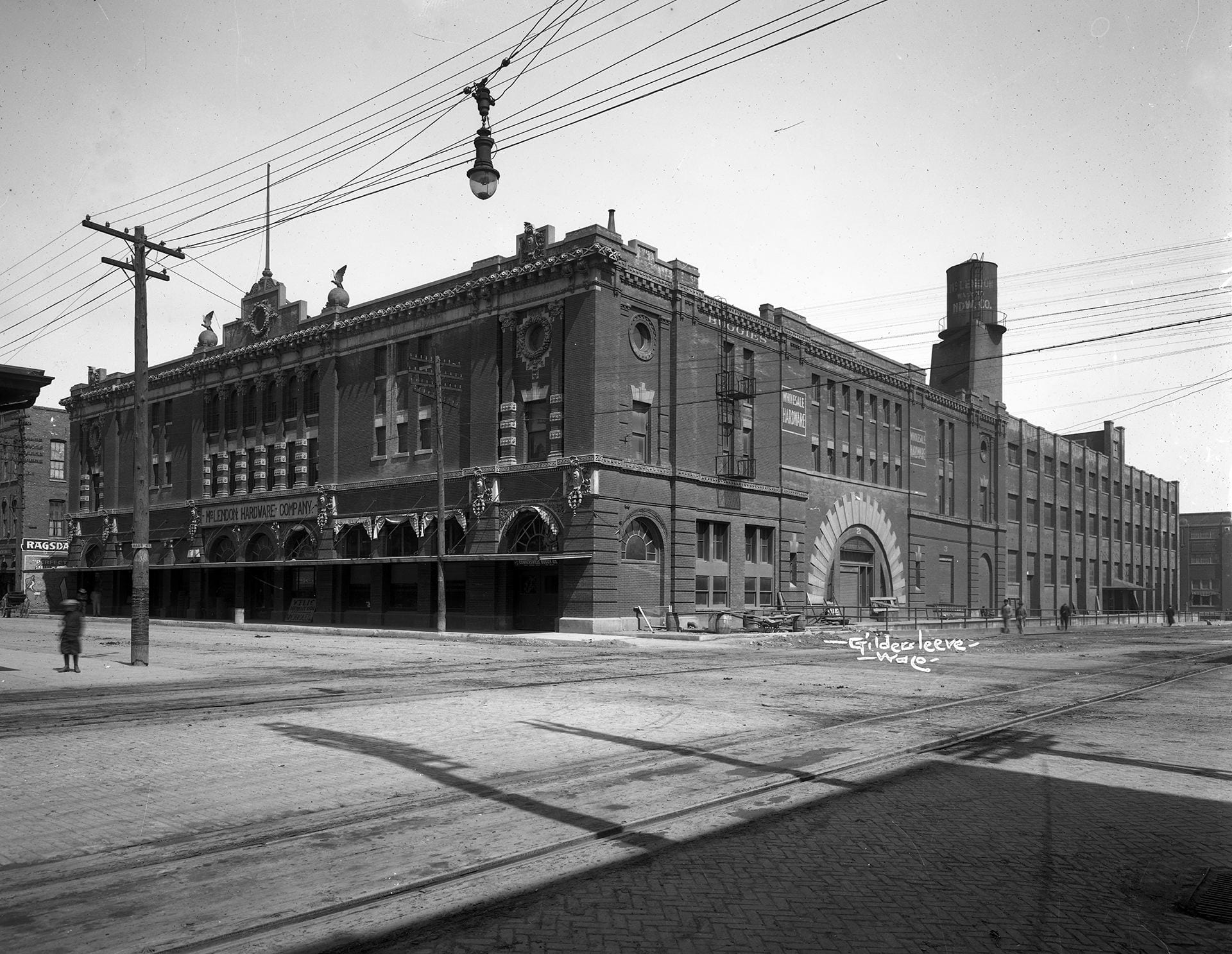
Higginbotham Hardware Co. / McLendon Hardware Company, 220 S. Third St.


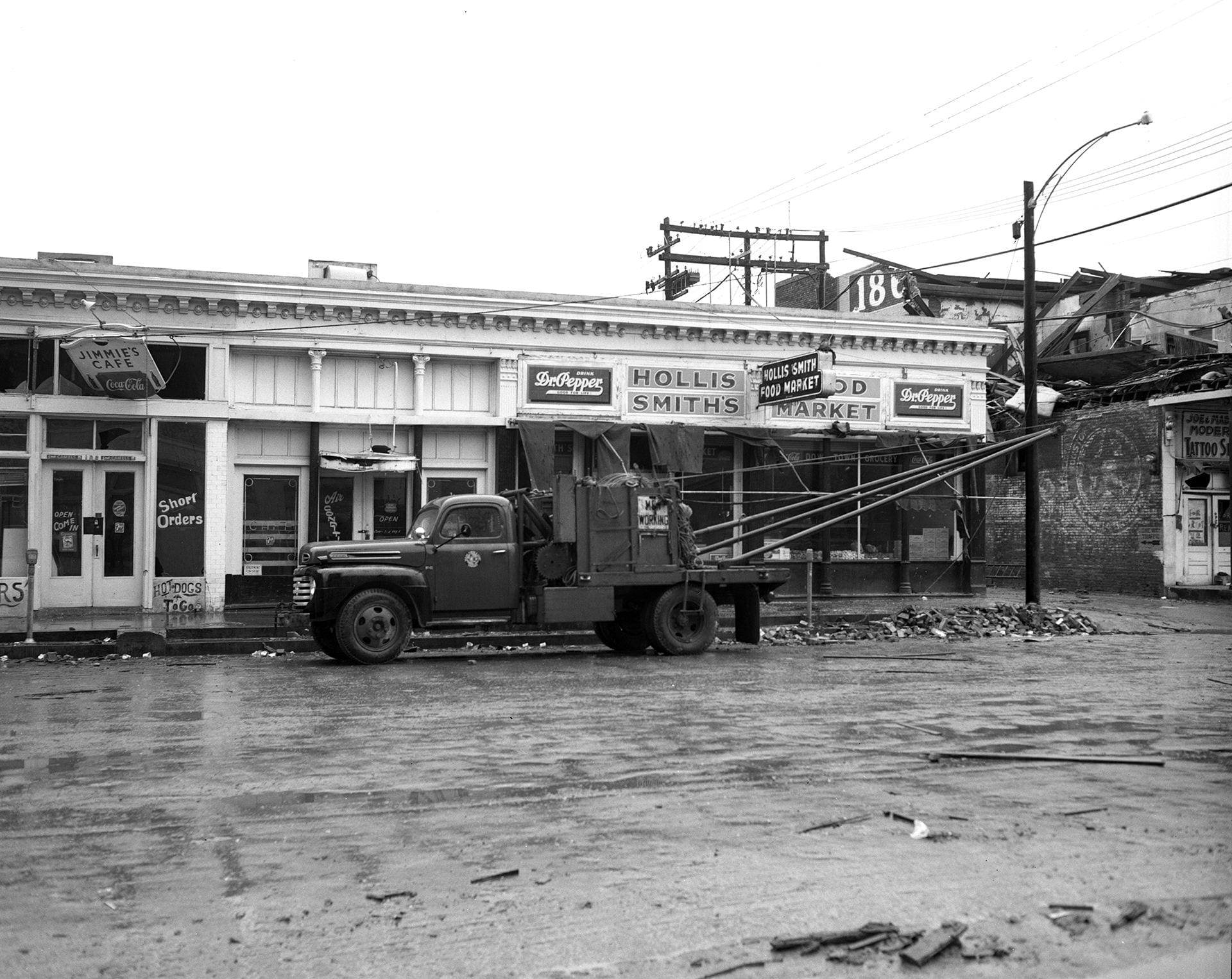
Hollis Smith’s Food Market, 112 S. 4th
Iglehart’s Furniture & Appliances, 100 S. 2nd (Bridge Street at the Square)

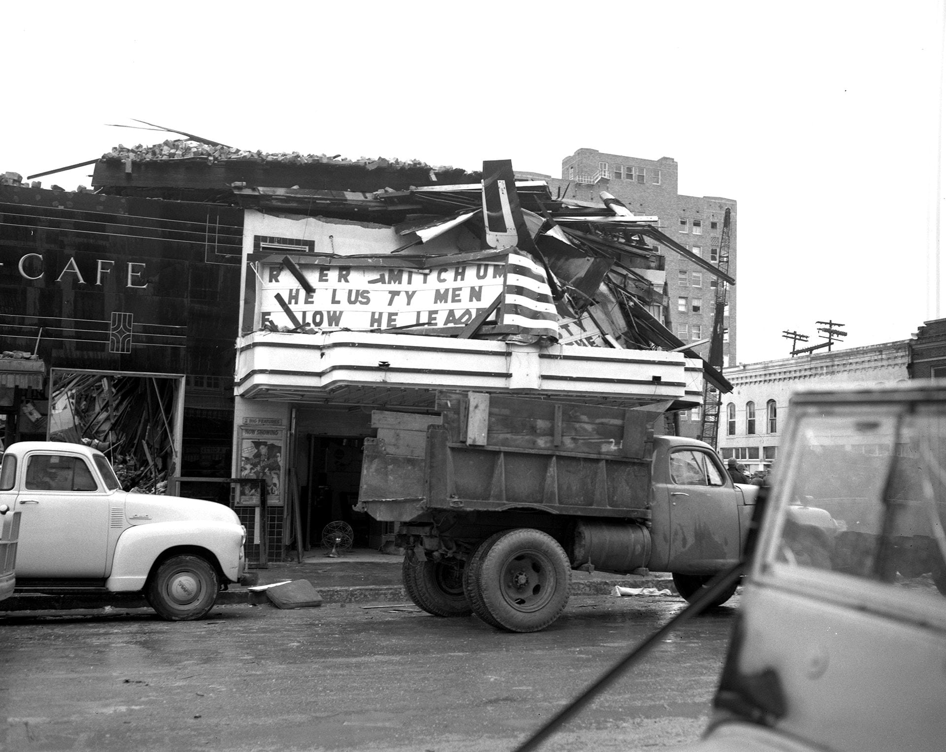
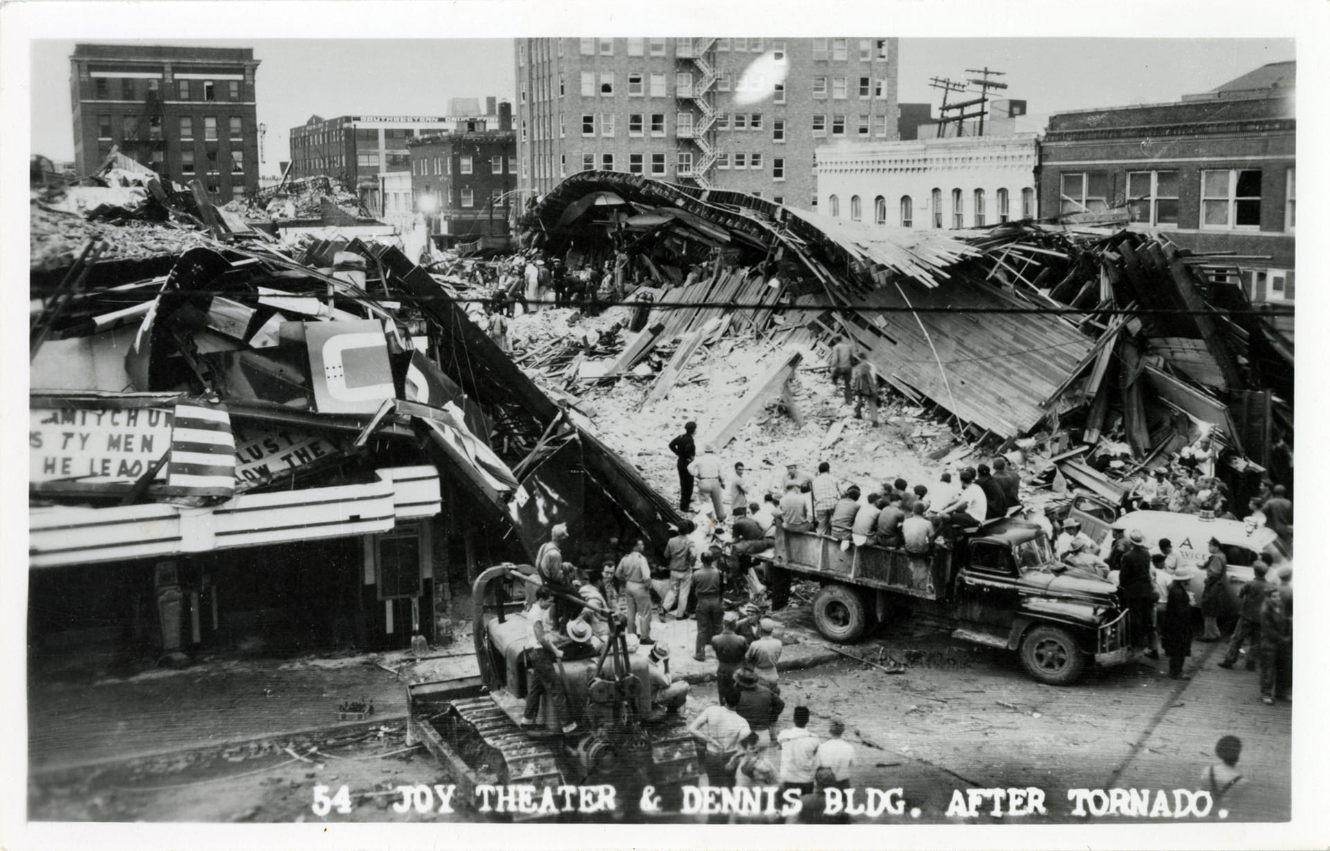
Joy Theater, 422 Austin Ave.


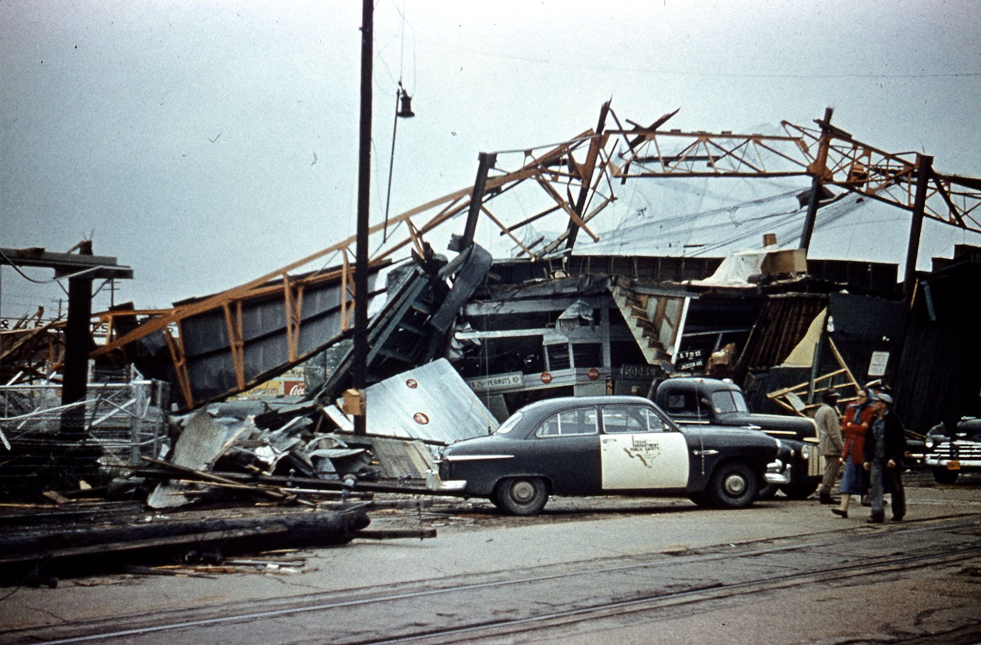
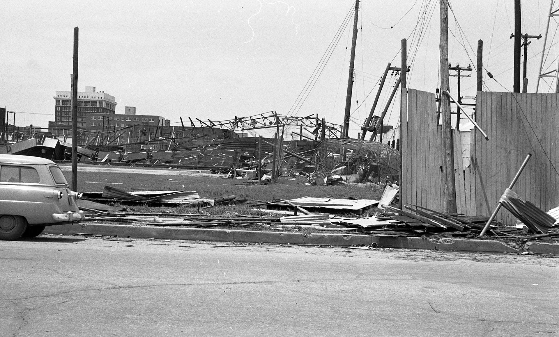
Katy Park, 600 Block of Jackson


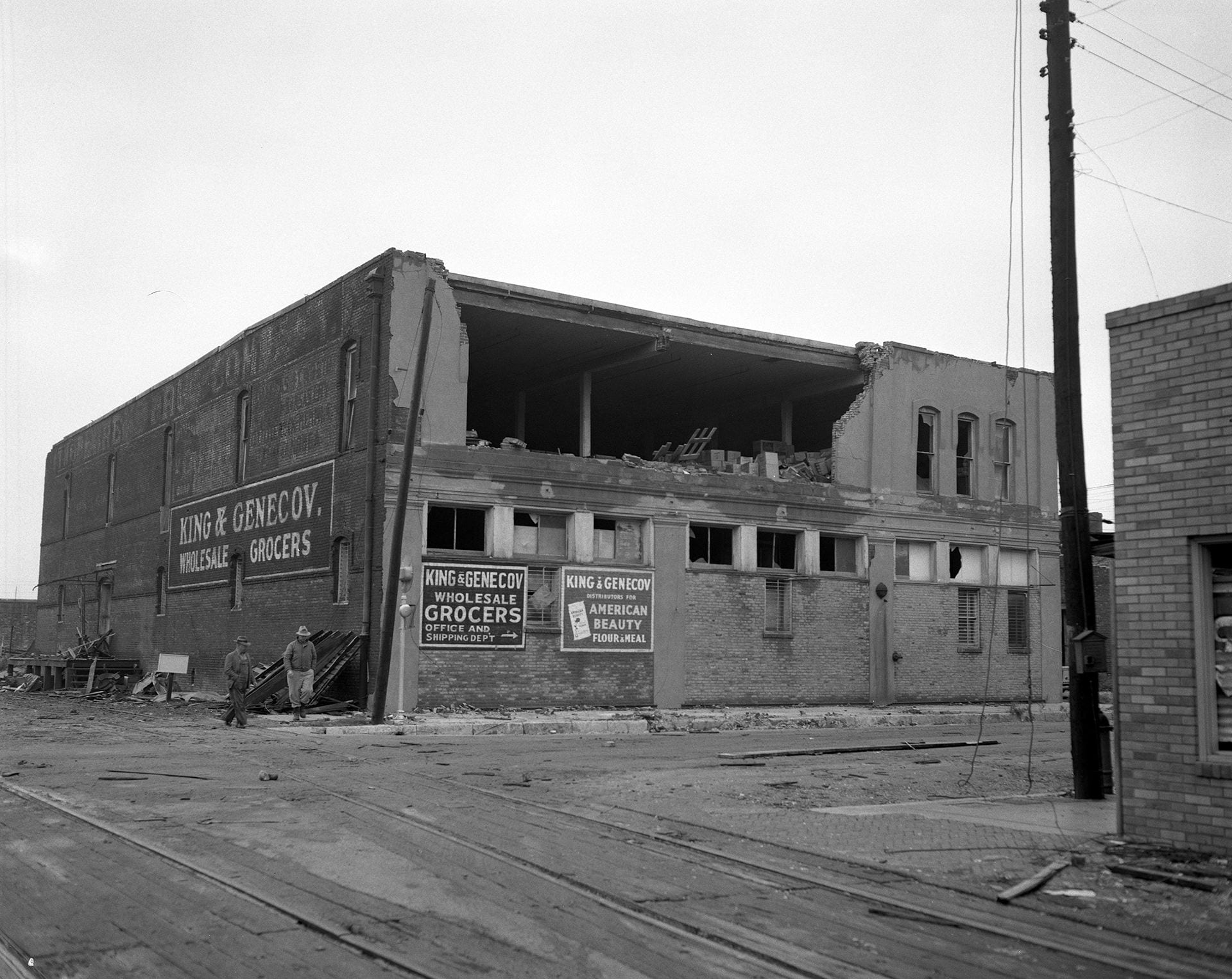
King & Genecov Wholesale Grocers, 300 S. 3rd St.
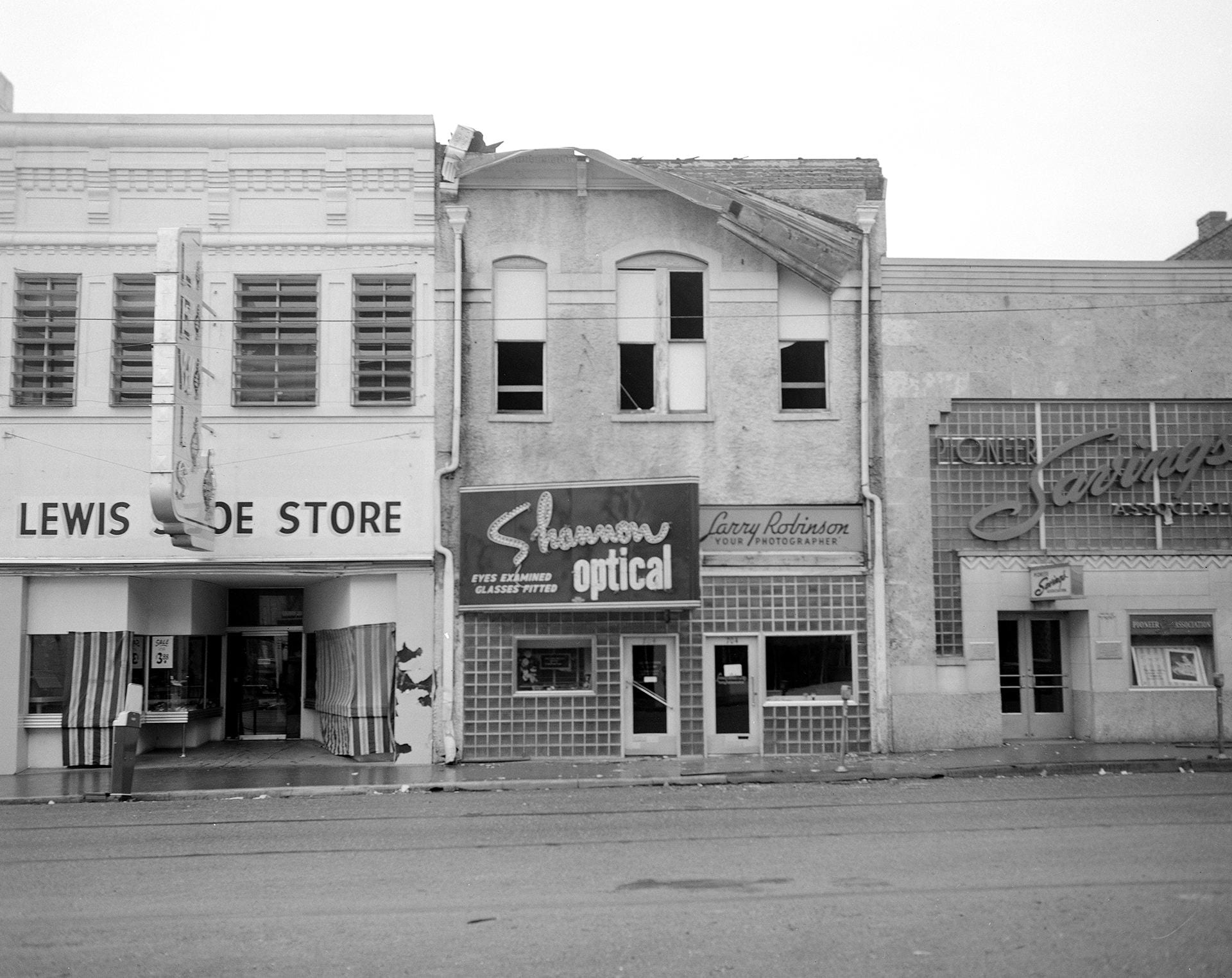
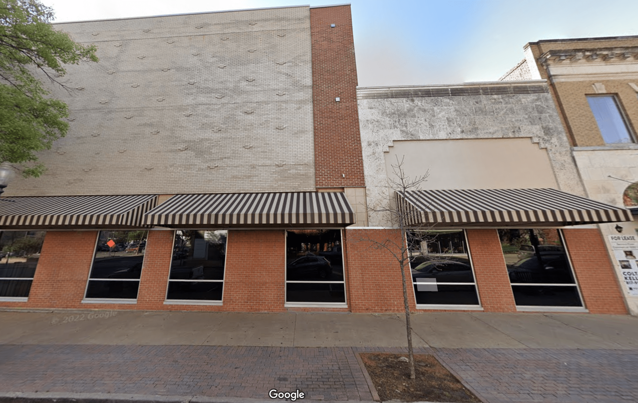
Lewis Shoe Store, Shannon Optical, Pioneer Savings and Loan, 700 block of Austin Ave.
Lyon Brothers Grocery & Market, 218 South Side of Square)

Missouri, Kansas & Texas (Katy) passenger depot, view up 700 block of Jackson toward the Brazos Valley Cotton Oil facility

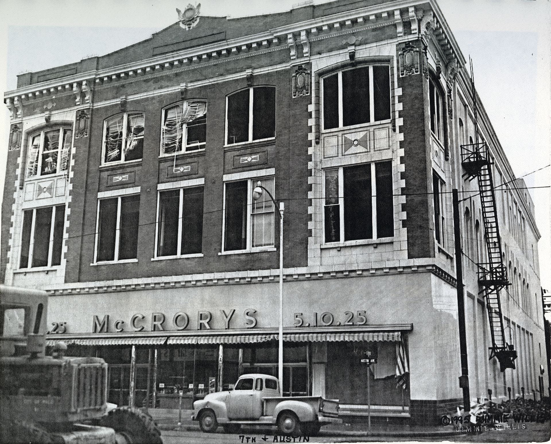
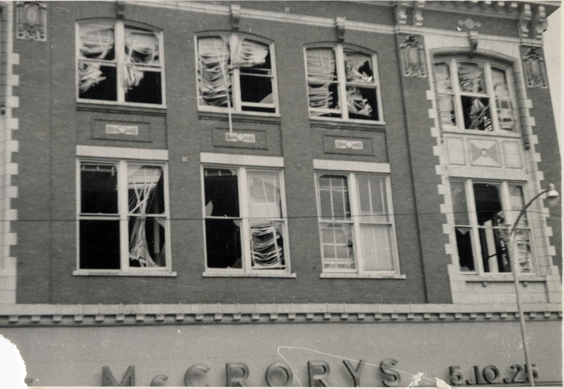
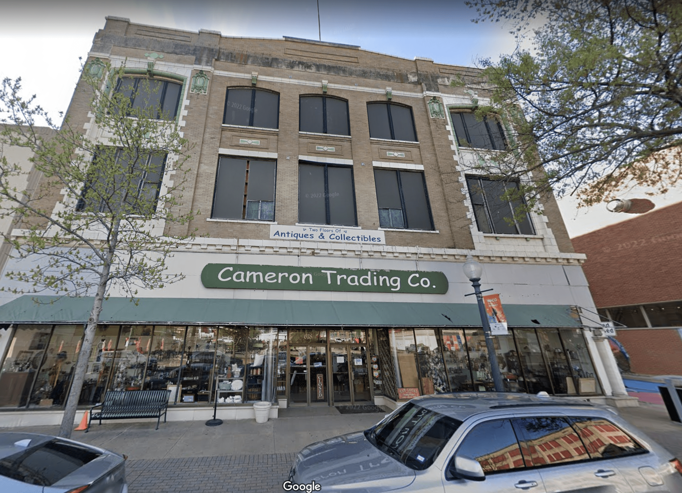
McCrory’s 5-10-25 Store, 618 Austin
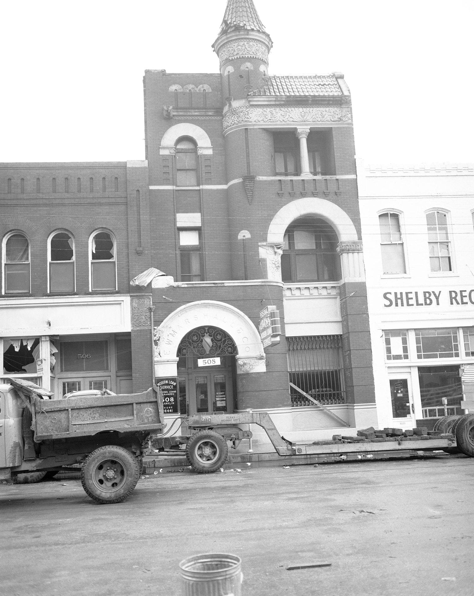
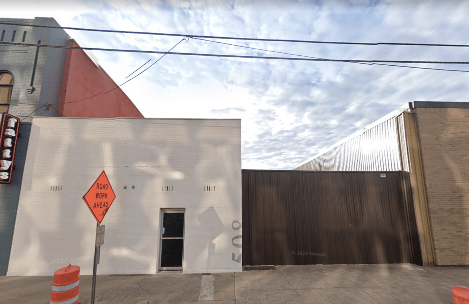
Modern Loan Service, 508 Franklin Ave.
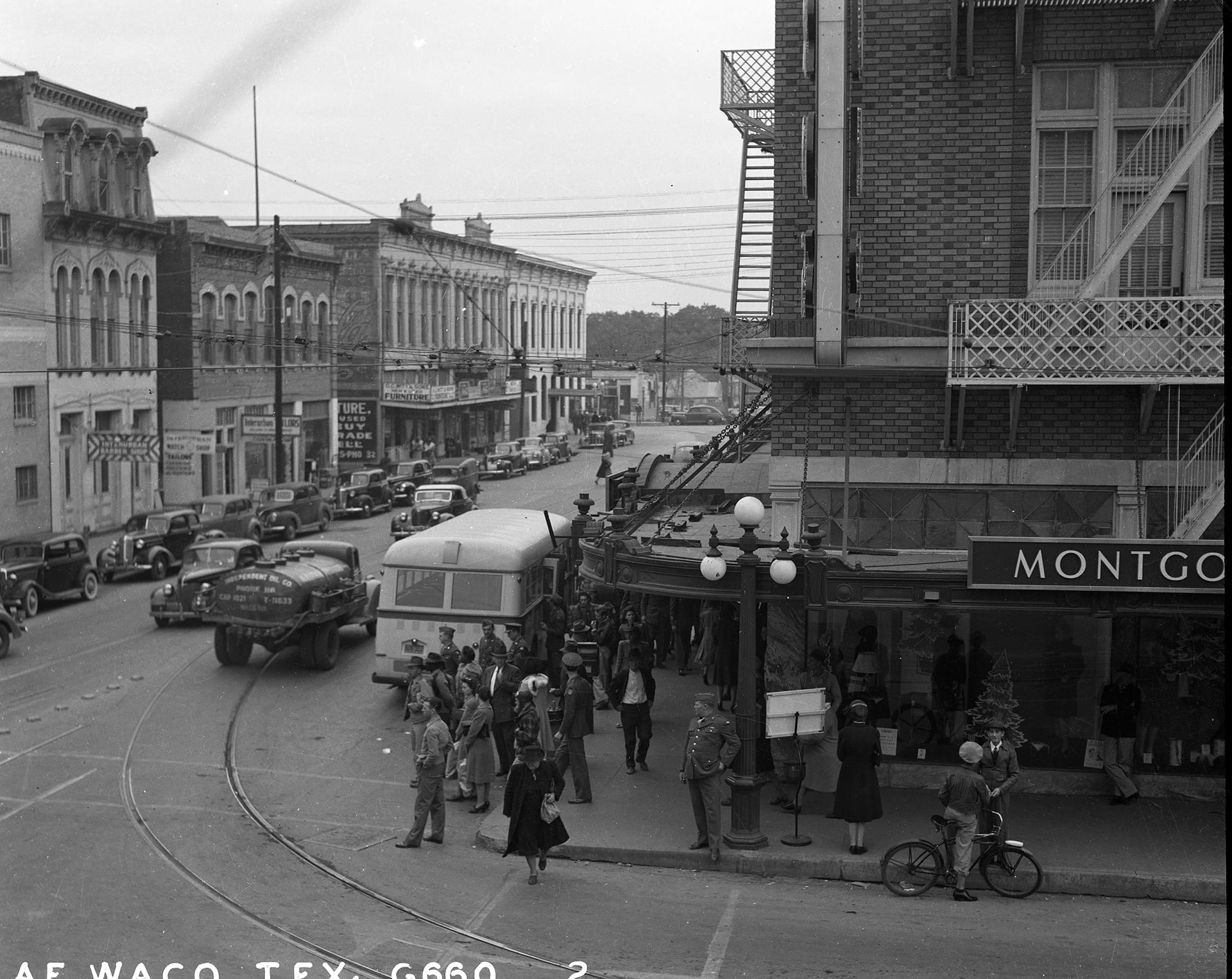
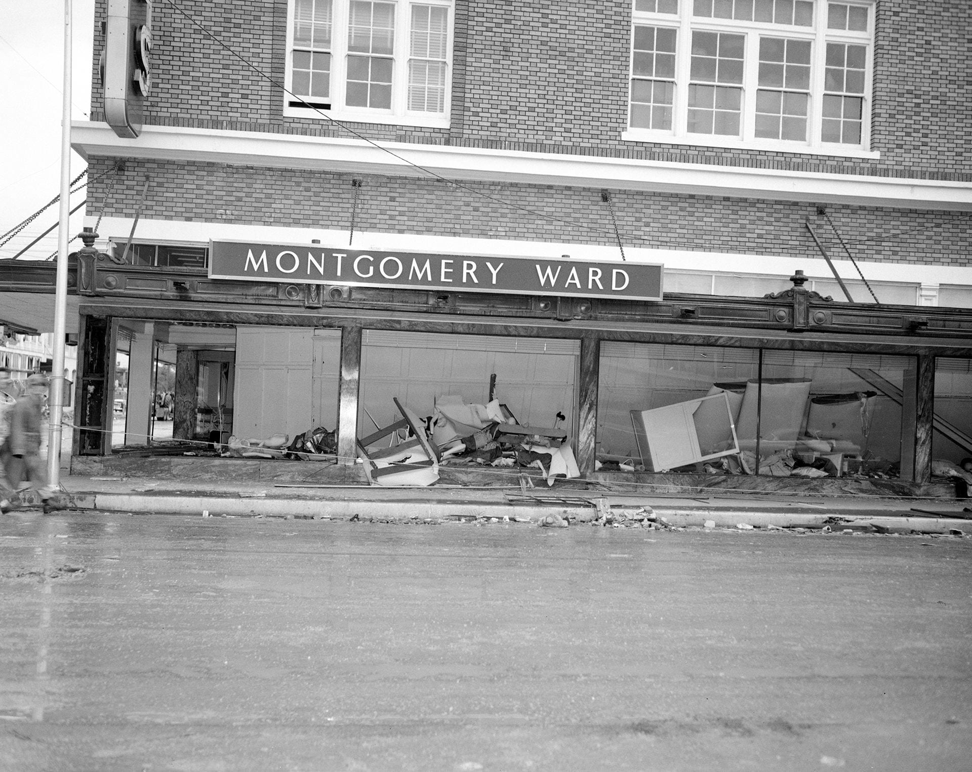
Montgomery Ward’s Department Store, 3rd and Austin Ave.
Neely Paint Co., 423 Franklin

New Waverly Hotel, 217 S. 3rd


Nortex Hides and Produce, 116 N. 1st


Oberlander’s, 123 S. 3rd St. (South of the Square)
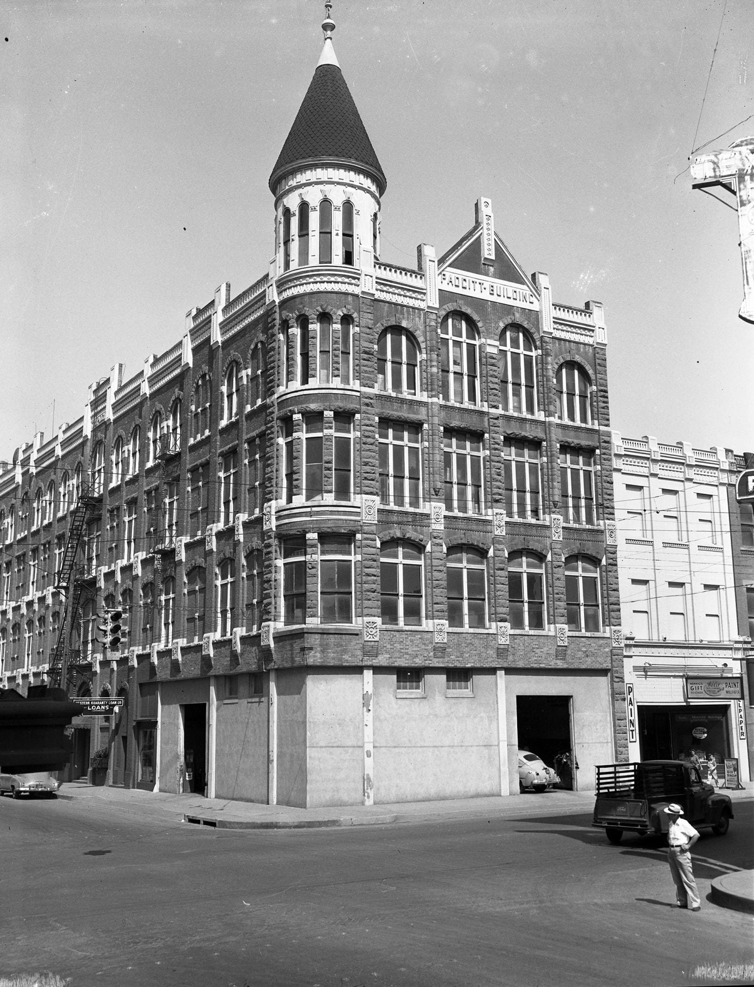
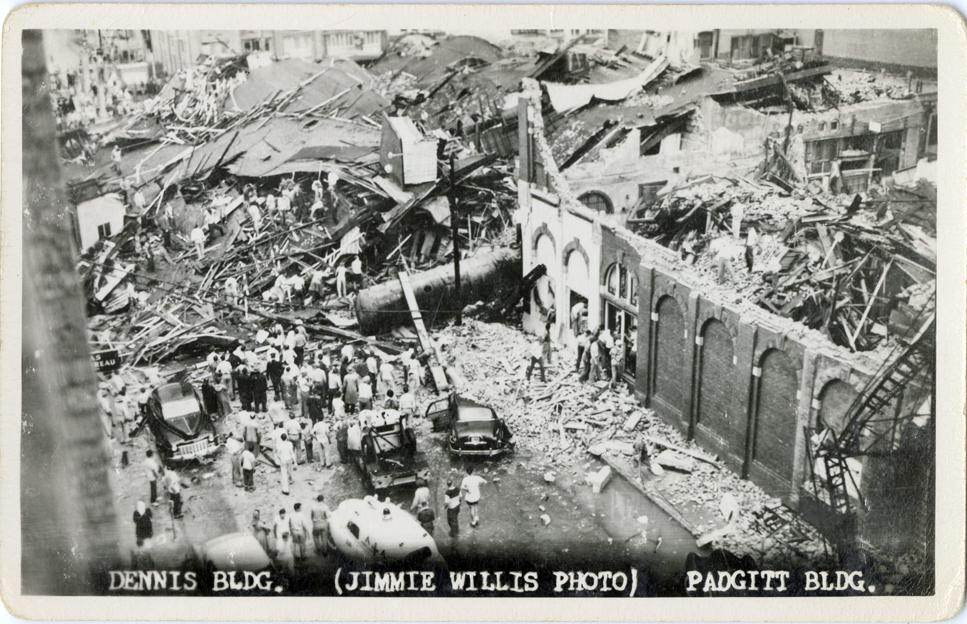
Padgitt Building, 423-427 Franklin Ave.


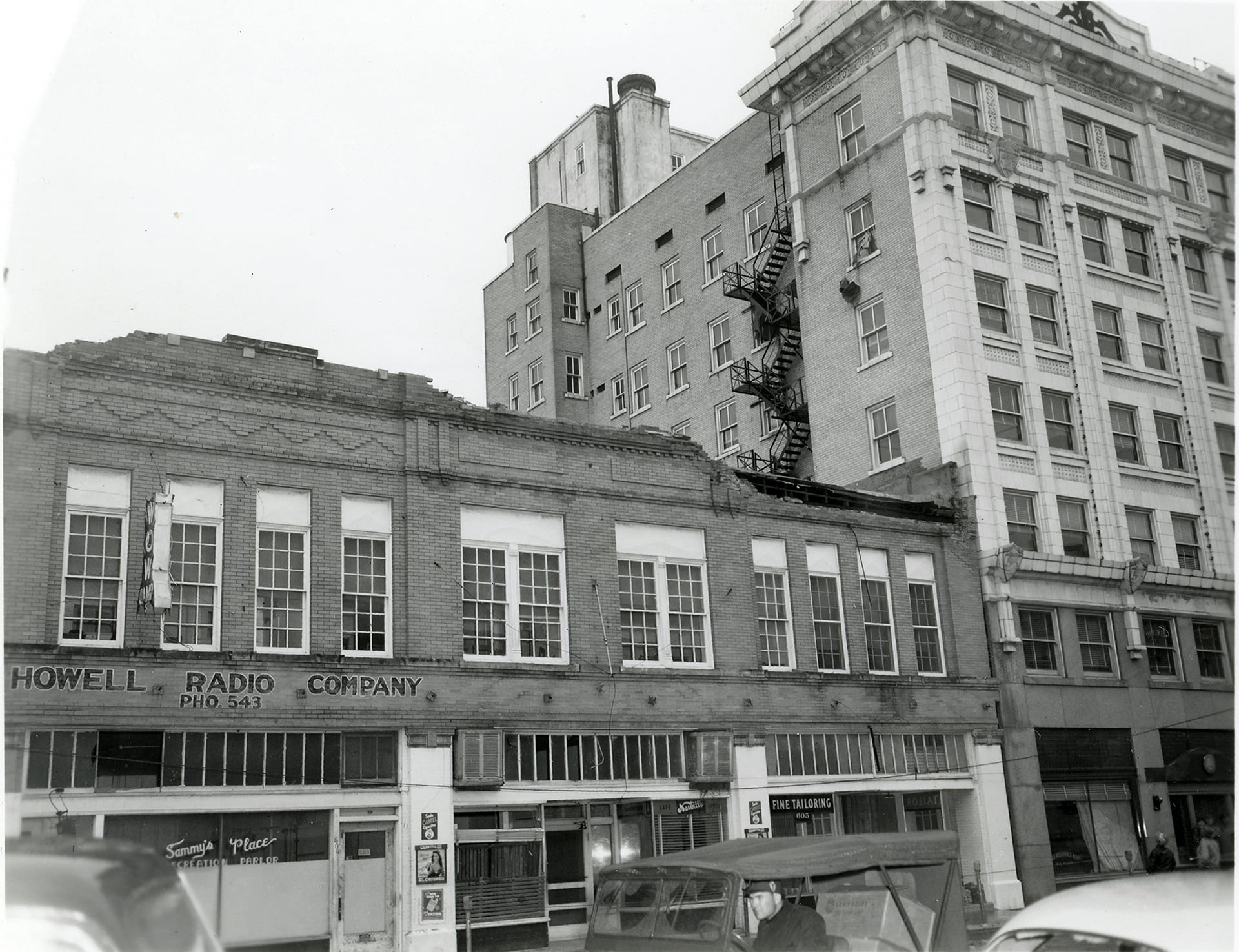
Howell Radio Company & Praetorian Building, 600 block of Franklin

Railway Express Agency, Hicks Rubber Co., Star Tire, 200-300 block of S. 4th Street

Residential Neighborhood, near intersection of Faulkner Ln and Gholson Rd.


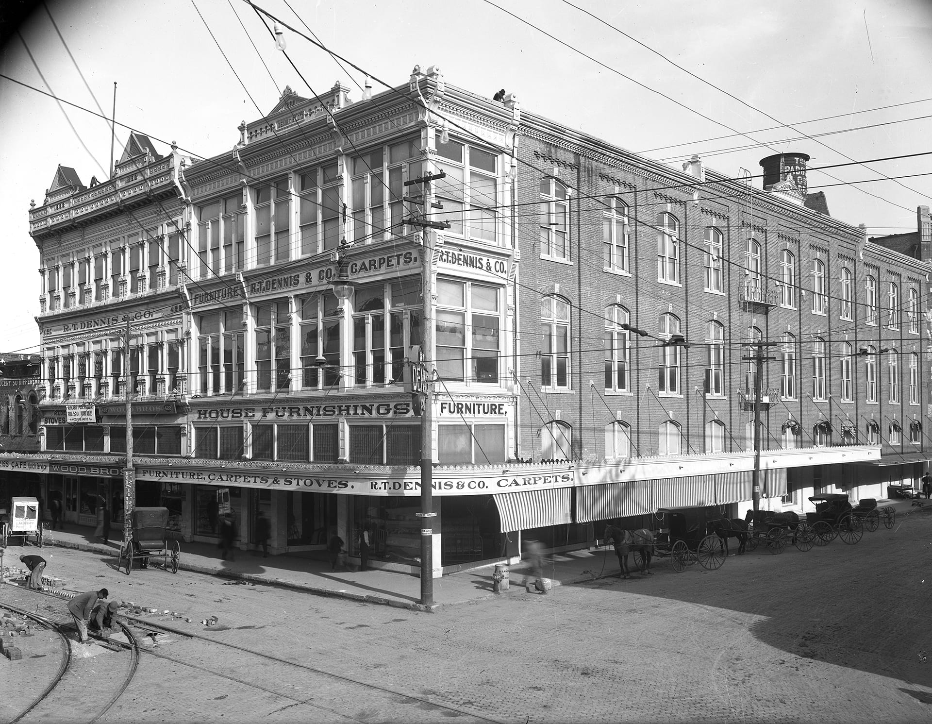
R.T. Dennis Furniture Company, 426-428 Austin Ave.


Rubinsky’s Boston Store, 205 S. 3rd

Sellers Tool Co., 304 S. 8th Street

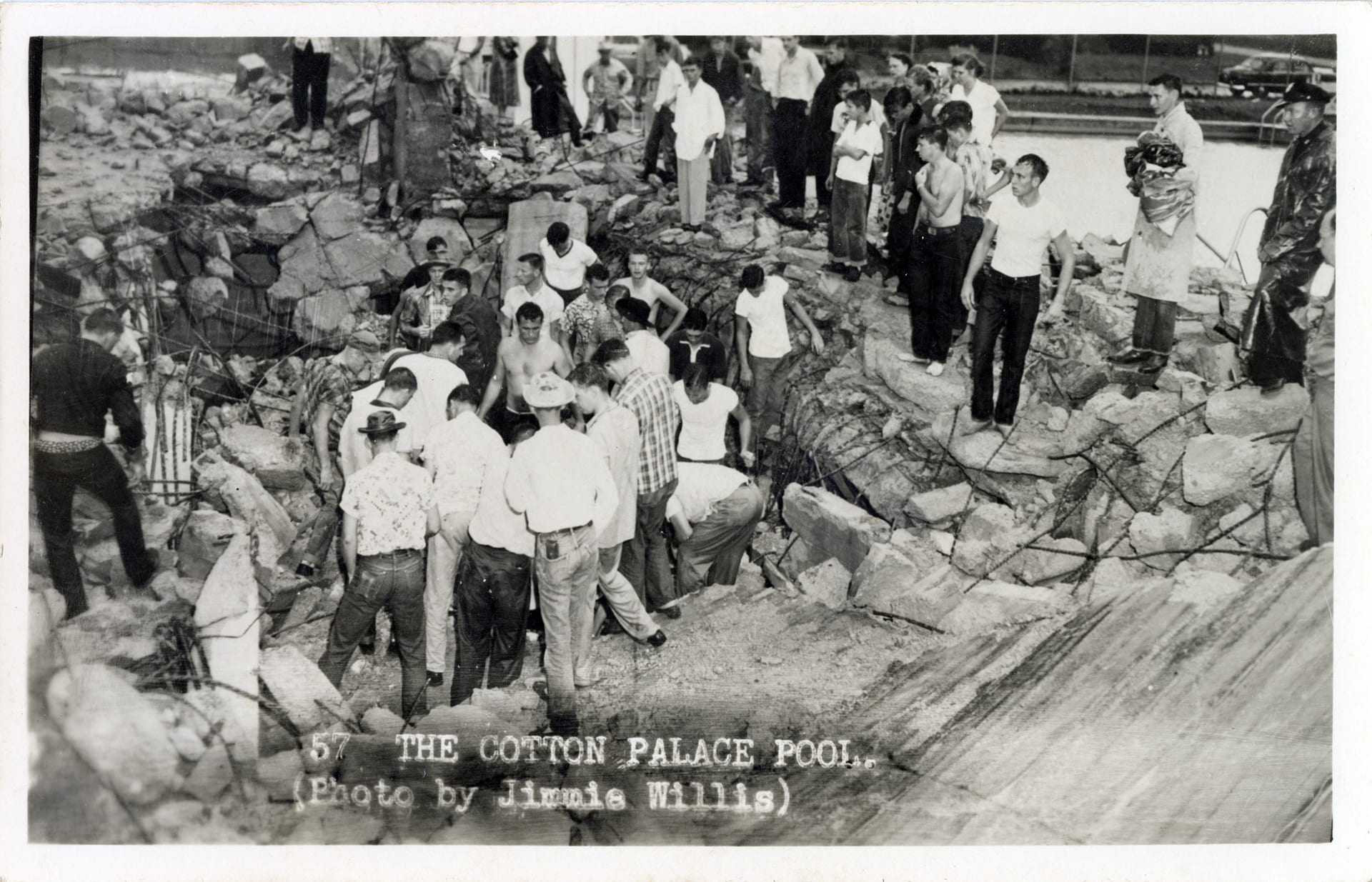
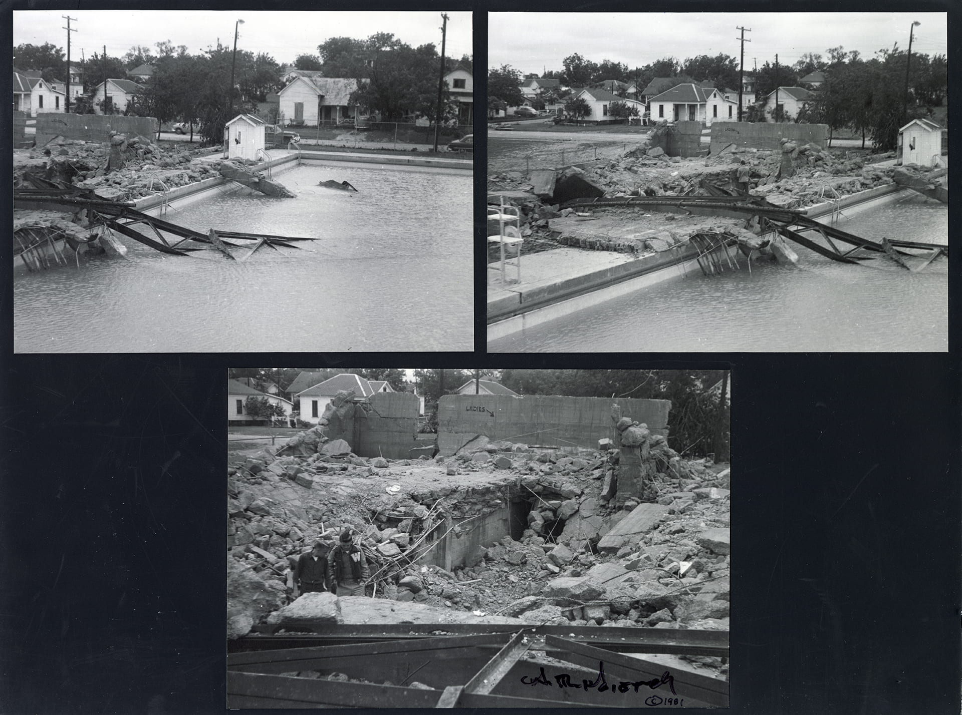
Sun Pool / Cotton Palace Pool, 601 S. 13th Street


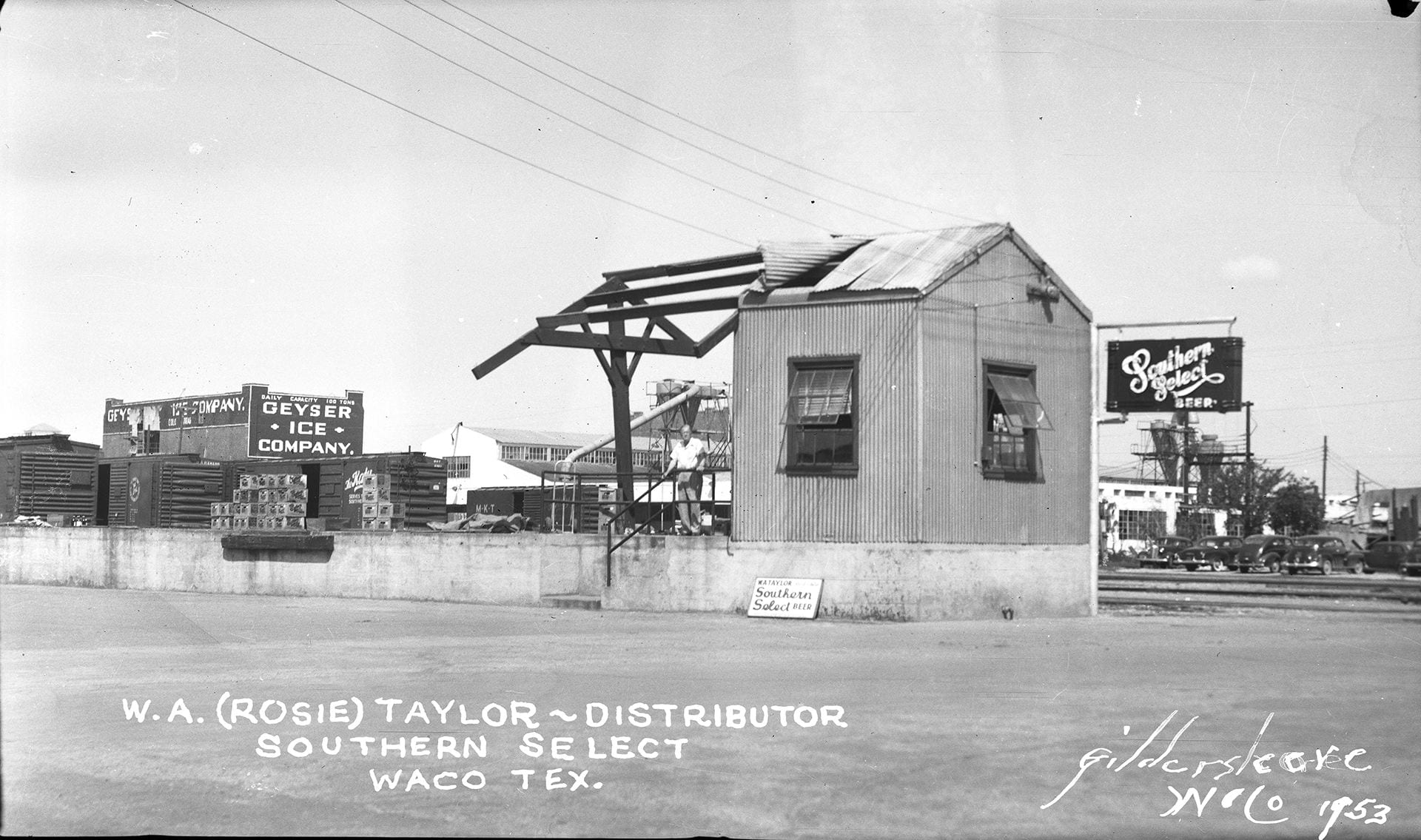
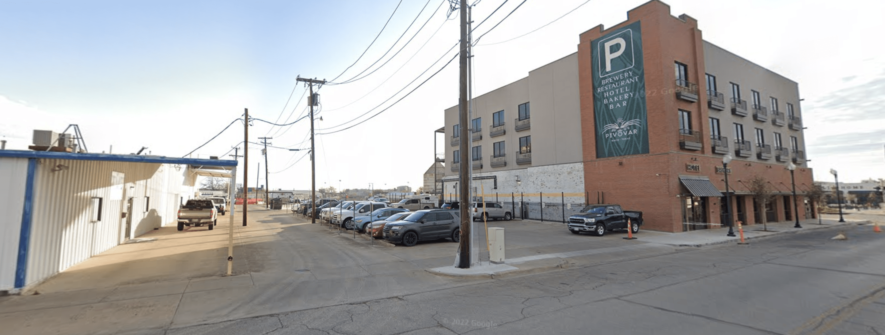
W.A. “Rosie” Taylor – Distributor of Southern Select Beer, 314 S. 11th Street

Texas Seed Co., 417 Franklin Ave.


Thomason Drug Store, 300 Block of S. 8th Street

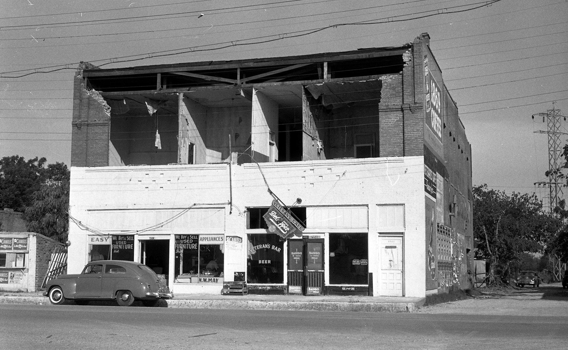
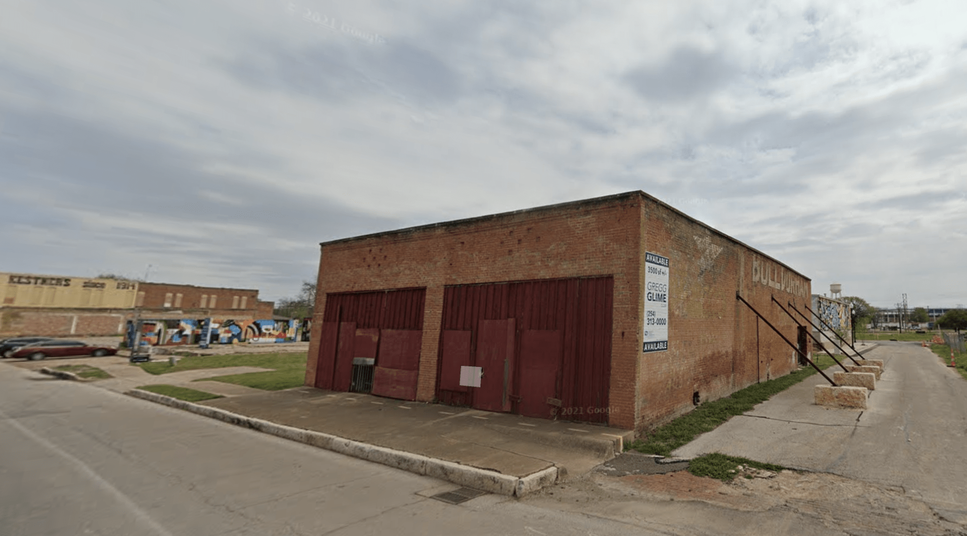
Veteran’s Cafe, 401 Elm Ave.
Waco Marble & Granite Works, 105 Elm Ave.


Washington Ave. Bridge, Washington Ave. at the Brazos River

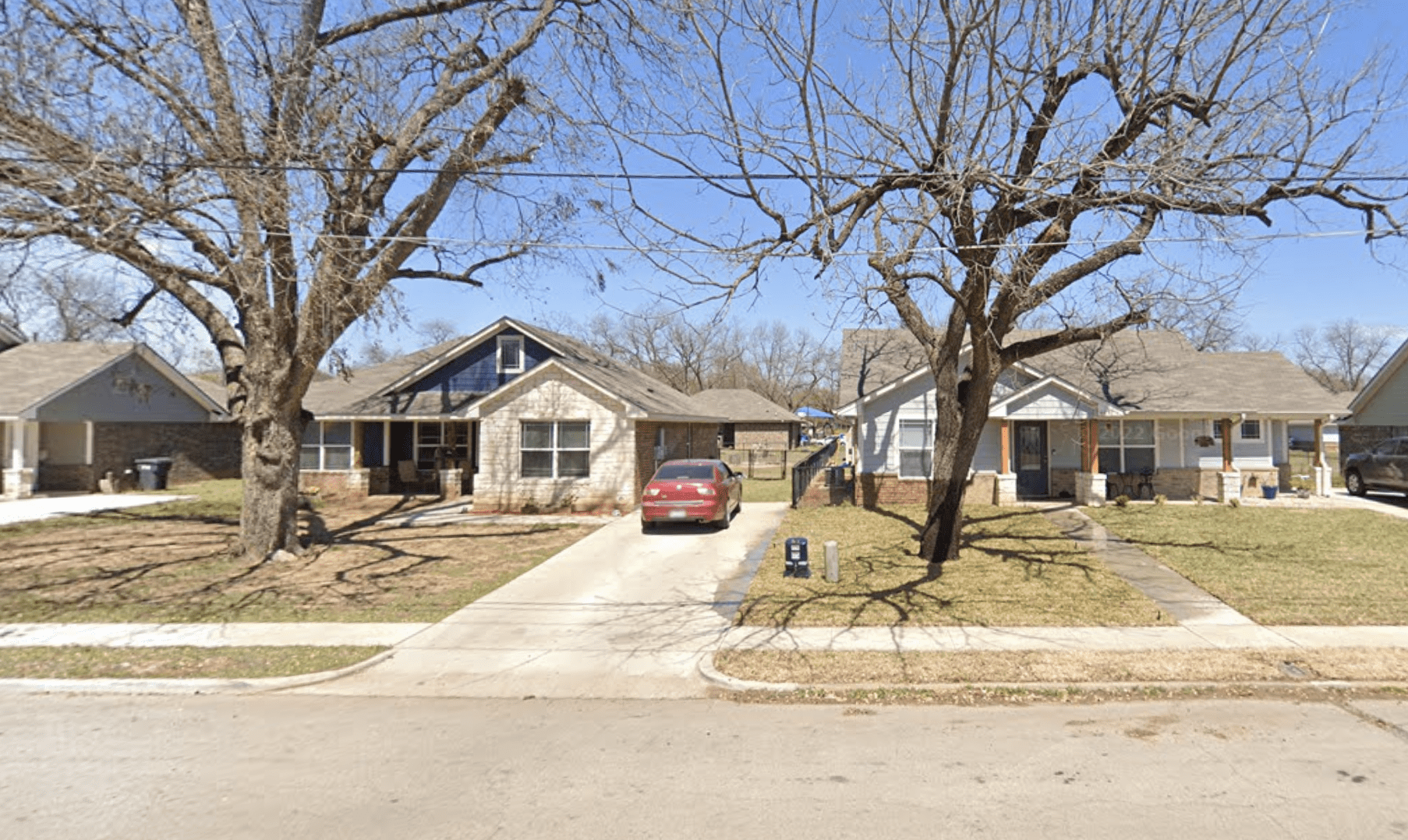
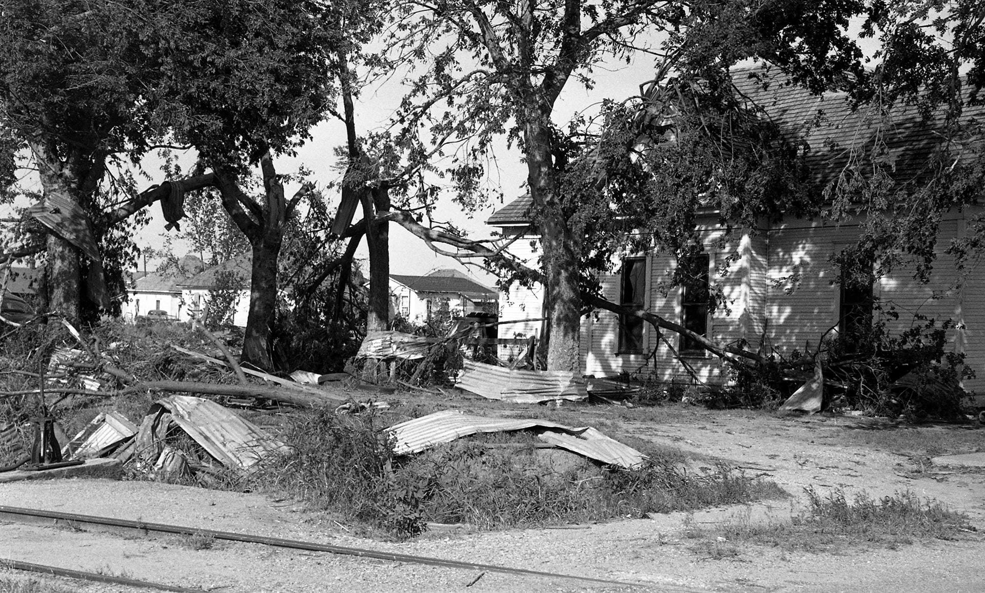
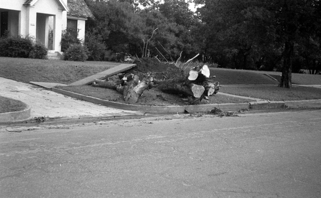
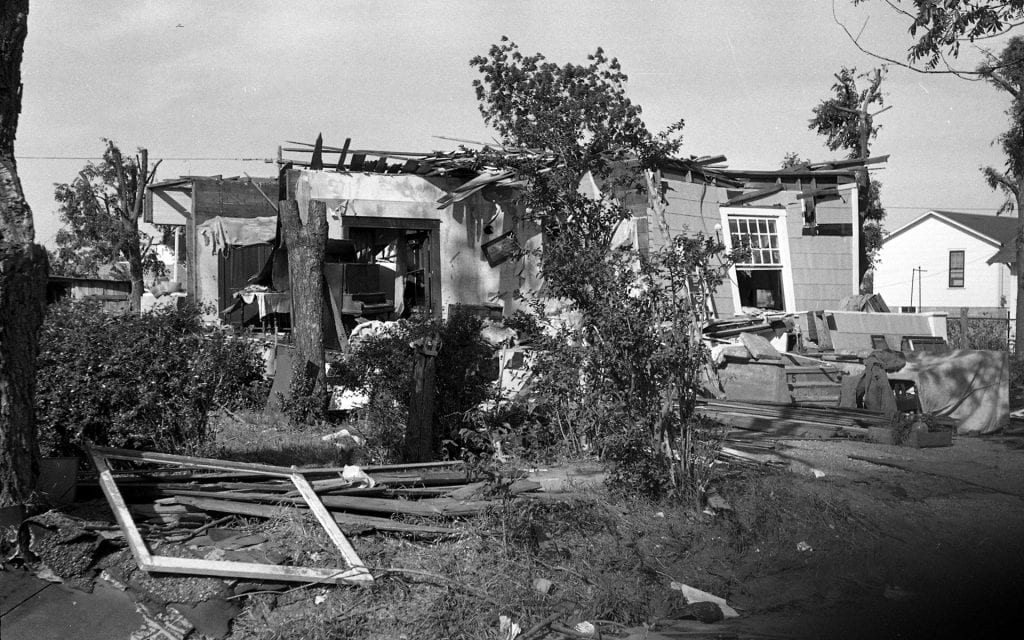
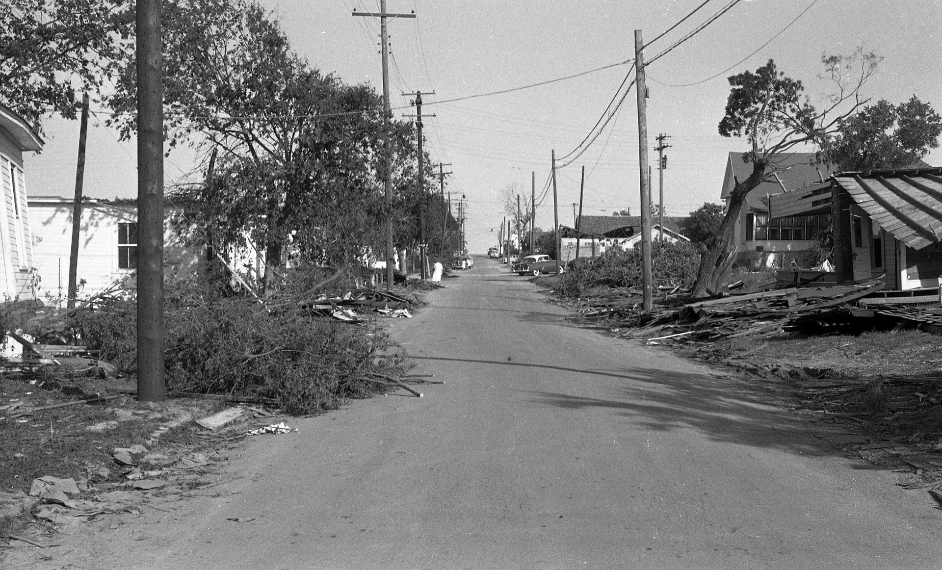
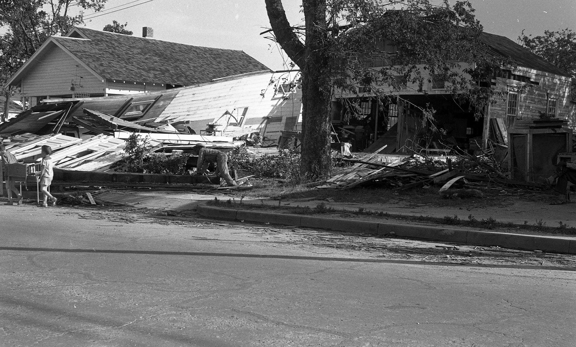
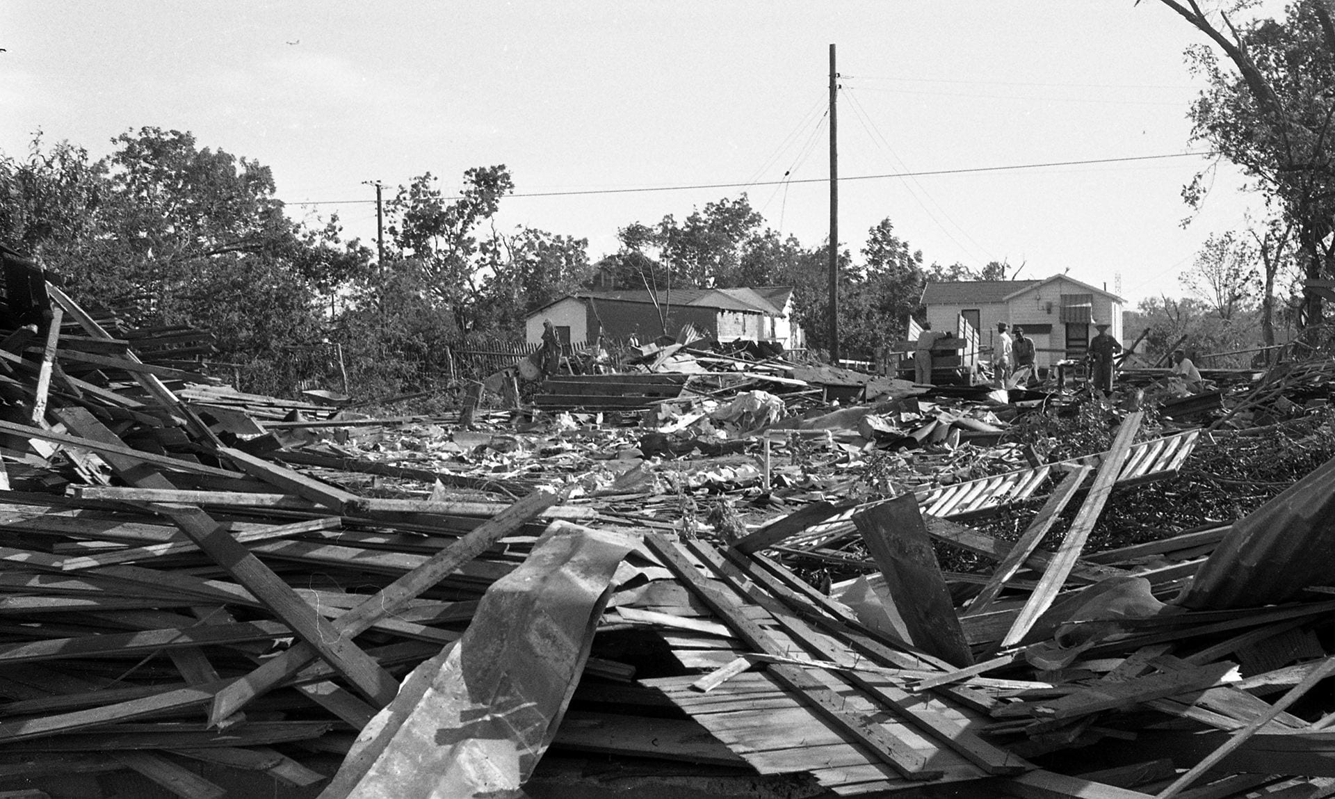
Unknown Residential Areas (likely East Waco)
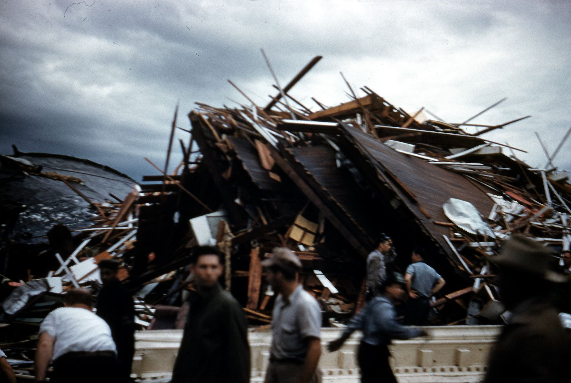
This gallery shows a collection of images taken in residential areas following the storm. Though their actual location is unknown, evidence suggests these houses were located in East Waco based on the general track of the storm as it exited downtown.

Digitized 8mm Film of Rescue and Recovery, from the audiovisual archives at The Texas Collection
The footage in the video below was digitized from original 8mm film found in the archives of The Texas Collection. It was originally shot by William Louis Trice, Cecil Johnson and Whayne Farmer, Jr. and digitized by specialists in the Riley Digitization Center at the Baylor University Libraries.
Thanks for sharing these pictures with comments on Waco’s history.
This is a tragic, but informative part of Waco’s history. The “Tornado Walk” brought the reality of this tragedy closer to home. Thank you to everyone who spent so much time to put this together.