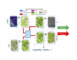
A paper has just been accepted to Environmetrics with first author and PhD student Nicolas Rodriguez-Jeangros receiving an Honorable Mention for the work by the American Statistical Association’s Section on Statistics and the Environment. In this work, we fuse multiple land cover (LC) products together to produce a single “super-product.”
Short Description: The type of land cover (LC) present on the Earth, such as open water, forest, or grasslands, drives many environmental processes and is thus important to track over time. In recent decades, multiple maps depicting LC have been produced by classifying images obtained from satellites orbiting the Earth. In these maps, each pixel is assigned a specific LC category, and the size of the pixel is referred to as the spatial resolution of the map. Despite vast improvements in satellite technologies, there is no LC map that has the spatial resolution and the frequency in time required for long-term environmental studies. Consequently, in this paper, the authors propose the Spatiotemporal Categorical Map Fusion (SCaMF) methodology to fuse multiple existing LC maps into a single map with any spatial and temporal resolution chosen by the end user. SCaMF is illustrated by fusing six LC maps over the Rocky Mountains. The fused map is generally able to reproduce known LC features even better than some of the individual LC maps, and as a byproduct of the method, the uncertainty in the fused map is also produced. Given the enormous size of the LC maps, the method is computationally intense, so experiments that justify some computing short-cuts are performed.

